
Hastings, Oklahoma facts for kids
Quick facts for kids
Hastings, Oklahoma
|
|
|---|---|

Hastings, Oklahoma
Location in Oklahoma

Hastings, Oklahoma
Location in the United States
|
|
| Country | United States |
| State | Oklahoma |
| County | Jefferson |
| Area | |
| • Total | 0.48 sq mi (1.25 km2) |
| • Land | 0.48 sq mi (1.25 km2) |
| • Water | 0.00 sq mi (0.00 km2) |
| Elevation | 997 ft (304 m) |
| Population
(2020)
|
|
| • Total | 104 |
| • Density | 215.77/sq mi (83.23/km2) |
| Time zone | UTC-6 (Central (CST)) |
| • Summer (DST) | UTC-5 (CDT) |
| ZIP code |
73548
|
| Area code(s) | 580 |
| FIPS code | 40-33000 |
| GNIS feature ID | 2412733 |
Hastings is a small town in Jefferson County, Oklahoma, United States. In 2020, about 104 people lived there. This was a bit less than the 143 people who lived there in 2010.
Contents
History of Hastings
Before Hastings was called Hastings, there was a community named Bayard. This area was part of the Kiowa, Comanche, and Apache Reservation. When the reservation opened for new settlers on August 6, 1901, things changed.
The postal department needed a new name for the post office because there was already a "Baird" post office in Indian Territory. Some local people suggested naming the town after their old hometown, Hastings, Nebraska. Postal officials liked this idea, and the name "Hastings" was chosen.
In 1902, a railroad line called the Enid and Anadarko built tracks right through Hastings. This helped the town grow. In 1907, about 560 people lived in Hastings, and by 1910, the population reached 727. However, since 1910, the number of people living in Hastings has slowly gone down.
Where is Hastings Located?
Hastings is in the northwestern part of Jefferson County. It is about 9 miles (14 km) northwest of a town called Waurika. You can find Hastings along Oklahoma State Highway 5. It is also about 5 miles (8 km) north of the Red River.
The United States Census Bureau says that the town covers a total area of about 1.24 square kilometers (0.48 sq mi). All of this area is land, with no water.
Population Changes Over Time
The number of people living in Hastings has changed quite a bit over the years. Here's a look at the population from different census counts:
| Historical population | |||
|---|---|---|---|
| Census | Pop. | %± | |
| 1910 | 727 | — | |
| 1920 | 629 | −13.5% | |
| 1930 | 379 | −39.7% | |
| 1940 | 352 | −7.1% | |
| 1950 | 285 | −19.0% | |
| 1960 | 200 | −29.8% | |
| 1970 | 184 | −8.0% | |
| 1980 | 246 | 33.7% | |
| 1990 | 164 | −33.3% | |
| 2000 | 155 | −5.5% | |
| 2010 | 143 | −7.7% | |
| 2020 | 104 | −27.3% | |
| U.S. Decennial Census | |||
In 2000, there were 155 people living in Hastings. These people lived in 72 households, and 50 of those were families. Most of the people living in Hastings were White (93.55%). There were also some African American and Native American residents.
About 16.7% of households had children under 18. Many households (61.1%) were married couples living together. About 25% of all households were people living alone. Many people living alone were 65 years old or older. The average household had about 2 people.
The median age in Hastings in 2000 was 53 years old. This means half the people were younger than 53, and half were older.
Famous People from Hastings
- John Green – He was a football player.
See also
 In Spanish: Hastings (Oklahoma) para niños
Images for kids
-
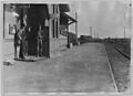
Hastings, Oklahoma (1919)

