
Hazel, Kentucky facts for kids
Quick facts for kids
Hazel, Kentucky
|
|
|---|---|

Hazel Kentucky Post Office
|
|

Location of Hazel in Calloway County, Kentucky.
|
|
| Country | United States |
| State | Kentucky |
| County | Calloway |
| Incorporated | 1911 |
| Area | |
| • Total | 0.35 sq mi (0.91 km2) |
| • Land | 0.35 sq mi (0.91 km2) |
| • Water | 0.00 sq mi (0.00 km2) |
| Elevation | 564 ft (172 m) |
| Population
(2020)
|
|
| • Total | 390 |
| • Density | 1,114.29/sq mi (430.17/km2) |
| Time zone | UTC-6 (Central (CST)) |
| • Summer (DST) | UTC-5 (CDT) |
| ZIP code |
42049
|
| Area code(s) | 270 & 364 |
| FIPS code | 21-35380 |
| GNIS feature ID | 0493943 |
Hazel is a small city in Calloway County, Kentucky, United States. It is a "home rule-class city," which means it has the power to manage its own local affairs. In 2010, about 410 people lived there.
Contents
Where is Hazel Located?
Hazel is found in the southern part of Calloway County. It is near the border between Tennessee and Kentucky. The city is north of Paris, Tennessee, and south of Murray, Kentucky.
The city covers a total area of about 0.96 square kilometers (0.37 square miles). All of this area is land.
A Look at Hazel's History
Hazel started as a stop on the Nashville, Chattanooga and St. Louis Railway in 1890. This was a railroad line that helped connect different towns. The first post office in Hazel opened in the same year.
People are not completely sure how Hazel got its name. It might have been named after the hazel shrubs that grew in the area. Another idea is that it was named after the daughter of a railroad conductor or the first postmaster.
The city officially became an incorporated city in 1911. This means it was formally recognized by the state government.
How Many People Live in Hazel?
| Historical population | |||
|---|---|---|---|
| Census | Pop. | %± | |
| 1910 | 395 | — | |
| 1920 | 415 | 5.1% | |
| 1930 | 359 | −13.5% | |
| 1940 | 396 | 10.3% | |
| 1950 | 444 | 12.1% | |
| 1960 | 342 | −23.0% | |
| 1970 | 424 | 24.0% | |
| 1980 | 465 | 9.7% | |
| 1990 | 460 | −1.1% | |
| 2000 | 440 | −4.3% | |
| 2010 | 410 | −6.8% | |
| 2020 | 390 | −4.9% | |
| U.S. Decennial Census | |||
In 2000, there were 440 people living in Hazel. These people made up 197 households. About 29.4% of these households had children under 18 living with them. The average age of people in Hazel was 39 years old.
What is Life Like in Hazel?
Hazel is known for its many antique shops. You can find these shops along Main Street. There are also other small shops and a cozy café.
Every fall, the town celebrates "Hazel Day." This special event is held in early October. It's a fun time for everyone in the community.
Famous People from Hazel
- O. L. Burton: This person grew up in Hazel. He later became a politician in Florida.
- Jackie DeShannon: She was born in Hazel. She became a famous singer and songwriter in the 1960s.
- Ella Florence Fondren: Born in Hazel, she became known as a philanthropist. A philanthropist is someone who gives money and time to help others.
Images for kids
-
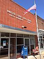
The post office in Hazel, Kentucky.
-

A map showing Hazel's location in Calloway County.
See also
 In Spanish: Hazel (Kentucky) para niños
