
Hempstead, Texas facts for kids
Quick facts for kids
Hempstead
|
|
|---|---|
| City of Hempstead, Texas | |

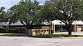
Hempstead City Hall
|
|
| Nickname(s):
Watermelon Capital of Texas
|
|

Location in the state of Texas
|
|
| Country | United States |
| State | Texas |
| County | Waller |
| Incorporated | Originally incorporated November 10, 1858, re-incorporated June 10, 1935 |
| Area | |
| • Total | 6.56 sq mi (16.99 km2) |
| • Land | 6.55 sq mi (16.97 km2) |
| • Water | 0.01 sq mi (0.03 km2) |
| Elevation | 227 ft (69.1 m) |
| Population
(2020)
|
|
| • Total | 5,430 |
| • Density | 1,275.38/sq mi (492.42/km2) |
| Time zone | UTC-6 (CST) |
| • Summer (DST) | UTC-5 (CDT) |
| ZIP code |
77445
|
| Area code(s) | 979 |
| FIPS code | 48-33200 |
| GNIS feature ID | 1337592 |
Hempstead is a city in Waller County, Texas, United States. It is also the county seat, meaning it's where the main government offices for the county are located. Hempstead is part of the larger Houston–The Woodlands–Sugar Land metropolitan area.
Contents
History of Hempstead
On December 29, 1856, two people named Richard Rodgers Peebles and James W. McDade started the Hempstead Town Company. Their goal was to sell land in a new community called Hempstead. This new town was planned to be the end point of the Houston and Texas Central Railway.
Peebles named the town after his brother-in-law, Dr. G. S. B. Hempstead. Peebles and his wife, Mary Ann Groce Peebles, gave 2,000 acres (about 8 km2) of land for the community. When the railway reached Hempstead on June 29, 1858, the town became an important place for moving goods between the Texas coast and the inner parts of the state. Hempstead officially became a city on November 10, 1858. Another railway, the Washington County Railroad, also helped the city grow.
Hempstead During the American Civil War
Military Camps and Hospitals
During the spring of 1861, the Confederate army set up a military post in Hempstead. Several training camps were built east of town near Clear Creek. Camp Hebert was one of the first camps and served as the main office for the Hempstead Post early in the war.
Another camp, Camp Groce CSA, was started in the spring of 1862 on the Liendo Plantation. It was a training camp for new Confederate soldiers. It was first called Camp Liendo, but its name was changed to Camp Groce to honor Leonard Waller Groce, who owned the plantation. Many Confederate soldiers were trained and equipped at Camps Groce and Hebert.
These camps were sometimes closed because soldiers got sick there. From 1861 to 1863, almost 200 Confederate soldiers became ill and passed away at these camps. Many were taken to the Post Hospital, which was in the Planter's Exchange Hotel in downtown Hempstead. Most of those who passed away at the hospital were buried on McDade Plantation, west of town.
Prison Camp for Union Soldiers
In June 1863, Camp Groce was reopened, but this time as a prison camp. It held Union soldiers who were captured in battles like the Battle of Galveston and the Battle of Sabine Pass. Union prisoners from the second Battle of Sabine Pass were also sent to Camp Groce. In 1863, 427 Union prisoners were held there, and 21 of them passed away. Most of them were buried northeast of the camp.
Elisabet Ney at Liendo Plantation
In 1873, a German-American sculptor named Elisabet Ney and her husband, Edmund Montgomery, bought the Liendo plantation. They spent time there and at their home in Austin for the next 20 years. Elisabet Ney was later buried at Liendo.
Hempstead in the 20th Century and Today
Hempstead became very well known for its watermelon crops. Until the 1940s, it was the biggest shipper of watermelons in the entire United States! People like Billy DiIorio, known as the Watermelon King, and Angelina DiIorio, the Watermelon Queen, lived in Hempstead. The town still celebrates its history with an annual Watermelon Festival every July.
In the early 1900s, Hempstead was sometimes called "Six Shooter Junction" because it had a reputation for being a bit wild and rough.
In recent years, Hempstead has grown because it's fairly close to Houston and is located along U.S. Highway 290. Today, the town's economy relies on county government, shipping, and a growing number of industries. The population has increased since 2010.
One notable resident of Hempstead was Lillie E. Drennan. In 1929, she became the first woman in Texas to get a commercial driver's license. She ran a successful trucking company called the Drennan Truck Line and had an excellent driving record. Her story was even featured in national newspapers and radio shows.
Geography and Location

Hempstead is located at 30°5′29″N 96°4′53″W / 30.09139°N 96.08139°W. The city has a total area of about 5 square miles (12.9 km2). Only a very small part of this area is covered by water.
The community is found where several major roads meet: U.S. Highway 290, Texas State Highway 6, and Texas State Highway 159. Hempstead is about 50 miles (80 km) northwest of downtown Houston. In 2010, the population was 5,770 people.
Highways Serving Hempstead
Hempstead is connected by several important highways:
 US 290
 SH 6
SH 6 SH 159
 FM 1488
Population and Demographics
| Historical population | |||
|---|---|---|---|
| Census | Pop. | %± | |
| 1880 | 1,612 | — | |
| 1890 | 1,671 | 3.7% | |
| 1940 | 1,674 | — | |
| 1950 | 1,395 | −16.7% | |
| 1960 | 1,505 | 7.9% | |
| 1970 | 1,891 | 25.6% | |
| 1980 | 3,456 | 82.8% | |
| 1990 | 3,551 | 2.7% | |
| 2000 | 4,691 | 32.1% | |
| 2010 | 5,770 | 23.0% | |
| 2020 | 5,430 | −5.9% | |
| U.S. Decennial Census | |||
Hempstead is a diverse city. As of the 2020 United States census, there were 5,430 people living in the city. There were 2,777 households and 1,734 families.
In 2010, the city had 5,770 people. The population density was about 1,040 people per square mile (400 per km2). The community is made up of different racial and ethnic groups. About 36.8% of the people were White (including 22.5% non-Hispanic/Latino), 38.9% were African American, and 37.4% were Hispanic or Latino.
Many households in Hempstead have children. In 2010, about 36.4% of households had children under 18 living with them. The average household had 2.81 people.
Economy
Until 2009, the Lawrence Marshall car dealership was the biggest employer in Hempstead. When it closed, the city had to rethink some of its plans for improving things like sewer systems and city parks. Today, the economy is supported by county government, shipping, and a growing industrial sector.
Education in Hempstead

The Hempstead Independent School District serves the City of Hempstead. Students attend Hempstead High School for public high school education.
All of Waller County, where Hempstead is located, is served by Blinn College. This college provides higher education opportunities.
The Hempstead Library is part of the Waller County Library System, offering books and resources to the community. There is also a private Christian school in Hempstead called Community Christian Academy, which teaches students from kindergarten through fifth grade.
Climate
Hempstead has a climate with hot and humid summers. The winters are generally mild to cool. This type of weather is known as a humid subtropical climate.
Notable People from Hempstead
Many interesting people have connections to Hempstead:
- Cynthia Bond (born 1961), an author and actress
- Kevin Carroll (born 1969), an American football player
- Norris Wright Cuney (1846–1898), a politician
- Alfred C. Finn (1883–1964), an architect
- Pamelya Herndon (born 1952), an attorney, accountant, and politician
- Johnny Holland (born 1965), an American football player and coach
- Madison Kilpatrick (1829–2010), a politician
- Edmund Montgomery (1835–1911), a physician and philosopher
- Pat Newnam (1880–1938), a baseball player
- Buster Pickens (1916–1964), a pianist
- Terrence Toliver (born 1988), an American football player
- Harvey Williams (born 1967), an American football player
Images for kids
-
Post Office
-
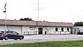
Waller County Sheriff's Office and County Jail


See also
 In Spanish: Hempstead (Texas) para niños
