Hernando, Mississippi facts for kids
Quick facts for kids
Hernando, Mississippi
|
|||
|---|---|---|---|

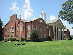
DeSoto County Courthouse in Hernando
|
|||
|
|||
| Motto(s):
"Hernando…… what?"
|
|||

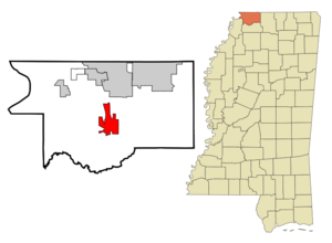
Location within DeSoto County and Mississippi
|
|||
| Country | United States | ||
| State | Mississippi | ||
| County | DeSoto | ||
| Founded | 1839 | ||
| Area | |||
| • Total | 25.39 sq mi (65.76 km2) | ||
| • Land | 25.30 sq mi (65.53 km2) | ||
| • Water | 0.09 sq mi (0.23 km2) | ||
| Elevation | 305 ft (93 m) | ||
| Population
(2020)
|
|||
| • Total | 17,138 | ||
| • Density | 677.36/sq mi (261.54/km2) | ||
| Time zone | UTC-6 (Central (CST)) | ||
| • Summer (DST) | UTC-5 (CDT) | ||
| ZIP Code |
38632
|
||
| Area code | 662 | ||
| FIPS code | 28-31780 | ||
| GNIS ID | 2404688 | ||
Hernando is a city in Mississippi, United States. It is the main city of DeSoto County. Hernando is located on the northwestern edge of Mississippi.
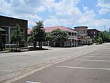
In 2020, about 17,138 people lived there. The city is just south of Memphis, Tennessee. Major roads like U.S. Route 51, I-55, and I-69 pass through Hernando. The historic county courthouse is in the city's downtown area.
Contents
History of Hernando
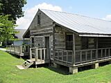
For a long time, the Chickasaw people lived in the area where Hernando is now. Later, French and Spanish explorers and settlers arrived. The French built homes similar to those found in other parts of their colonies, like the Illinois Country. An old French log house in Hernando reminds us of these early buildings.
In the 1830s, the United States government pressured the Chickasaw to give up their lands. Most of the tribe moved west of the Mississippi River to what was called Indian Territory. This was part of a larger event known as the Indian Removal Act.
The town was first named Jefferson by the new European American settlers. But in 1832, it was renamed Hernando. This name honors Hernando de Soto, a Spanish explorer. He was the first European to explore the Mississippi River.
In the early 1900s, many blues musicians came from Hernando. African Americans in this region had a strong musical background. Many grew up working on cotton farms. During the Great Migration, many blues musicians moved north. They took their music to cities like Chicago, helping to shape the culture there.
Geography and Climate
Hernando is in the middle of DeSoto County. To the north, it borders the city of Southaven. If you travel north on Interstate 55 or US 51, Memphis, Tennessee is about 25 miles away. Going south on the same roads, Senatobia is about 15 miles away.
The city of Hernando covers about 25.8 square miles (66.9 square kilometers). Most of this area is land, with a small part being water.
Local Climate
Hernando has a humid subtropical climate. This means it has hot, humid summers. Winters are usually mild to cool. You can see more details about the weather in the table below.
| Climate data for Hernando, Mississippi, 1991–2020 normals, extremes 1893–present | |||||||||||||
|---|---|---|---|---|---|---|---|---|---|---|---|---|---|
| Month | Jan | Feb | Mar | Apr | May | Jun | Jul | Aug | Sep | Oct | Nov | Dec | Year |
| Record high °F (°C) | 80 (27) |
83 (28) |
91 (33) |
97 (36) |
98 (37) |
104 (40) |
110 (43) |
112 (44) |
106 (41) |
99 (37) |
88 (31) |
81 (27) |
112 (44) |
| Mean maximum °F (°C) | 70.0 (21.1) |
73.9 (23.3) |
80.0 (26.7) |
86.3 (30.2) |
90.8 (32.7) |
95.5 (35.3) |
97.3 (36.3) |
98.2 (36.8) |
95.6 (35.3) |
88.7 (31.5) |
79.2 (26.2) |
70.9 (21.6) |
99.3 (37.4) |
| Mean daily maximum °F (°C) | 49.7 (9.8) |
53.9 (12.2) |
62.9 (17.2) |
72.4 (22.4) |
80.3 (26.8) |
87.5 (30.8) |
90.1 (32.3) |
90.3 (32.4) |
85.1 (29.5) |
74.0 (23.3) |
61.6 (16.4) |
52.0 (11.1) |
71.6 (22.0) |
| Daily mean °F (°C) | 40.0 (4.4) |
43.7 (6.5) |
52.0 (11.1) |
61.2 (16.2) |
69.9 (21.1) |
77.4 (25.2) |
80.4 (26.9) |
79.8 (26.6) |
73.7 (23.2) |
62.2 (16.8) |
50.7 (10.4) |
42.9 (6.1) |
61.2 (16.2) |
| Mean daily minimum °F (°C) | 30.2 (−1.0) |
33.5 (0.8) |
41.1 (5.1) |
50.1 (10.1) |
59.6 (15.3) |
67.2 (19.6) |
70.7 (21.5) |
69.3 (20.7) |
62.4 (16.9) |
50.4 (10.2) |
39.8 (4.3) |
33.8 (1.0) |
50.7 (10.4) |
| Mean minimum °F (°C) | 13.4 (−10.3) |
18.5 (−7.5) |
23.6 (−4.7) |
34.3 (1.3) |
46.1 (7.8) |
56.8 (13.8) |
62.6 (17.0) |
61.1 (16.2) |
48.3 (9.1) |
34.5 (1.4) |
24.5 (−4.2) |
19.4 (−7.0) |
11.4 (−11.4) |
| Record low °F (°C) | −12 (−24) |
−5 (−21) |
10 (−12) |
23 (−5) |
37 (3) |
47 (8) |
54 (12) |
49 (9) |
38 (3) |
24 (−4) |
7 (−14) |
−5 (−21) |
−12 (−24) |
| Average precipitation inches (mm) | 4.22 (107) |
5.04 (128) |
5.52 (140) |
6.25 (159) |
5.49 (139) |
4.80 (122) |
4.14 (105) |
3.40 (86) |
3.48 (88) |
4.11 (104) |
4.25 (108) |
5.83 (148) |
56.53 (1,436) |
| Average snowfall inches (cm) | 0.9 (2.3) |
0.7 (1.8) |
0.1 (0.25) |
0.0 (0.0) |
0.0 (0.0) |
0.0 (0.0) |
0.0 (0.0) |
0.0 (0.0) |
0.0 (0.0) |
0.0 (0.0) |
0.1 (0.25) |
0.1 (0.25) |
1.9 (4.8) |
| Average precipitation days (≥ 0.01 in) | 10.1 | 9.7 | 11.1 | 9.4 | 10.5 | 9.6 | 9.1 | 7.2 | 6.4 | 7.3 | 8.8 | 10.3 | 109.5 |
| Average snowy days (≥ 0.1 in) | 0.5 | 0.4 | 0.1 | 0.0 | 0.0 | 0.0 | 0.0 | 0.0 | 0.0 | 0.0 | 0.0 | 0.2 | 1.2 |
| Source 1: NOAA | |||||||||||||
| Source 2: National Weather Service | |||||||||||||
Population Data
Here's how Hernando's population has grown over the years:
| Historical population | |||
|---|---|---|---|
| Census | Pop. | %± | |
| 1870 | 730 | — | |
| 1880 | 583 | −20.1% | |
| 1890 | 602 | 3.3% | |
| 1900 | 563 | −6.5% | |
| 1910 | 600 | 6.6% | |
| 1920 | 796 | 32.7% | |
| 1930 | 938 | 17.8% | |
| 1940 | 1,072 | 14.3% | |
| 1950 | 1,206 | 12.5% | |
| 1960 | 1,898 | 57.4% | |
| 1970 | 2,499 | 31.7% | |
| 1980 | 2,969 | 18.8% | |
| 1990 | 3,125 | 5.3% | |
| 2000 | 6,812 | 118.0% | |
| 2010 | 14,090 | 106.8% | |
| 2020 | 17,138 | 21.6% | |
| U.S. Decennial Census | |||
2020 Census Information
The 2020 United States Census showed that 17,138 people lived in Hernando. There were 5,770 households and 4,237 families in the city.
The table below shows the different racial groups living in Hernando according to the 2020 census:
| Race | Num. | Perc. |
|---|---|---|
| White | 13,193 | 76.98% |
| Black or African American | 2,029 | 11.84% |
| Native American | 22 | 0.13% |
| Asian | 223 | 1.3% |
| Pacific Islander | 9 | 0.05% |
| Other/Mixed | 641 | 3.74% |
| Hispanic or Latino | 1,021 | 5.96% |
Education
Hernando has 5 public schools. These schools are part of the DeSoto County School District.
Gallery
Media
- DeSoto Times-Tribune is a local newspaper.
Notable People
Many interesting people have connections to Hernando:
- Garfield Akers, a blues musician
- DeAundre Alford, a cornerback for the Atlanta Falcons football team
- George "Mojo" Buford, a blues musician
- Louis Bullard, a former professional football player
- Paul Burlison, a musician and member of The Rock and Roll Trio
- Melissa Cookston, a chef and 7-time World Barbecue Champion
- Kevin Dockery, a former professional football player
- Nathan Bedford Forrest, a Confederate general during the Civil War
- Marshall Grant, a former bass player for Johnny Cash
- Jim Jackson, a blues musician
- Felix LaBauve (1809–1879), an early French-born American settler and community leader
- James Oliver, the first African-American to graduate from UMMC
- Gary Parrish, a sports writer and reporter for the CBS Sports Network
- Austin Riley, a 3rd baseman for the Atlanta Braves baseball team
- Ricky Robertson, a track and field high jumper and 2016 Olympian
- Deljuan Robinson, a former professional football player
- Bradley Sowell, a former professional football player
- Garrison Starr, a singer/songwriter
- Frank Stokes, a blues musician
- Robert Wilkins, a blues musician
See also
 In Spanish: Hernando (Misisipi) para niños


