High Rock Range facts for kids
Quick facts for kids High Rock Range |
|
|---|---|

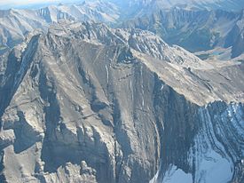
Mount Rae from the north, Sept. 2006
|
|
| Highest point | |
| Peak | Mount Rae |
| Elevation | 3,218 m (10,558 ft) |
| Dimensions | |
| Length | 117 km (73 mi) N-S |
| Width | 37 km (23 mi) E-W |
| Area | 2,172 km2 (839 sq mi) |
| Geography | |
| Country | Canada |
| Parent range | Canadian Rockies |
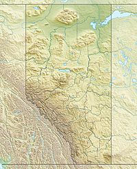
The High Rock Range is a cool group of mountain ranges in the Canadian Rockies. You can find it in southwestern Alberta and southeastern British Columbia, Canada.
This range is part of the Southern Continental Ranges. It sits right on the Continental Divide. This means that water on one side flows to the Pacific Ocean, and water on the other side flows to the Atlantic or Arctic Oceans! It's located north of the Crowsnest Pass and south of the Highwood Pass. Part of this mountain range is also inside Kananaskis Country, a popular area for outdoor fun.
The Misty Range and Greenhills Range are smaller parts of the High Rock Range.
The High Rock Range covers a large area, about 2,172 square kilometers (838 square miles). It stretches for about 117 kilometers (73 miles) from north to south. It's also about 37 kilometers (23 miles) wide from east to west.
Tallest Mountains in the Range
The High Rock Range is home to many impressive peaks. The highest point in this range is Mount Rae. It stands tall at 3,218 meters (10,558 feet).
Here are some of the other notable mountains in the High Rock Range:
- Mount Rae - 3,218 meters (10,558 feet)
- Mist Mountain - 3,140 meters (10,302 feet)
- Tornado Mountain - 3,099 meters (10,167 feet)
- Courcelette Peak - 3,044 meters (9,987 feet)
- Mount Lyall - 2,951 meters (9,682 feet)
- Beehive Mountain - 2,895 meters (9,498 feet)
- Mount Armstrong - 2,793 meters (9,163 feet)
- Crowsnest Mountain - 2,785 meters (9,137 feet)
- Mount Muir - 2,758 meters (9,049 feet)
- Allison Peak - 2,646 meters (8,681 feet)
 | Madam C. J. Walker |
 | Janet Emerson Bashen |
 | Annie Turnbo Malone |
 | Maggie L. Walker |


