Mist Mountain facts for kids
Quick facts for kids Mist Mountain |
|
|---|---|

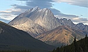
Mist Mountain from the south
|
|
| Highest point | |
| Elevation | 3,140 m (10,300 ft) |
| Prominence | 487 m (1,598 ft) |
| Geography | |
| Location | Alberta, Canada |
| Parent range | Misty Range |
| Topo map | NTS 82J/10 |
| Climbing | |
| First ascent | 1946, Donald King, Alan Blayney, Len Blayney, York Blayney |
| Easiest route | Hike, but avoid 'nameless ridge' |
Mist Mountain is a tall mountain in the Canadian Rockies in Alberta, Canada. You can find it right next to Highway 40.
This mountain stands at about 3,140 meters (10,300 feet) high. It's easy to spot from Highway 40 and the Sheep River area.
A person named George M. Dawson gave Mist Mountain its name way back in 1884.
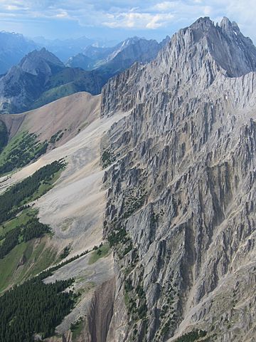
Mist Mountain is made of sedimentary rock. This type of rock forms from layers of sand, mud, and tiny bits of plants and animals over millions of years. During a time called the Laramide orogeny, huge forces pushed these rocks up. This caused older rocks to slide over younger rocks, creating the mountain shapes we see today.
Contents
Climate and Weather at Mist Mountain
Understanding the Climate
Mist Mountain is located in a subarctic climate zone. This means it has very cold and snowy winters. The summers are usually mild, not too hot.
Temperature and Best Times to Visit
In winter, temperatures can drop below −20 °C (that's −4 °F). With the wind, it can feel even colder, sometimes below −30 °C (−22 °F). If you want to climb Mist Mountain, the best time to go is from June through September. The weather is much nicer then.
Water Flow from the Mountain
All the rain and melting snow that falls on Mist Mountain eventually flows down its sides. This water, called runoff, goes into smaller streams. These streams then join up with the Highwood River.
 | Madam C. J. Walker |
 | Janet Emerson Bashen |
 | Annie Turnbo Malone |
 | Maggie L. Walker |


