Hillsborough (CDP), New Hampshire facts for kids
Quick facts for kids
Hillsborough, New Hampshire
|
|
|---|---|

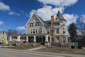
Gov. John Butler Smith House
|
|
| Country | United States |
| State | New Hampshire |
| County | Hillsborough |
| Town | Hillsborough |
| Area | |
| • Total | 1.95 sq mi (5.04 km2) |
| • Land | 1.95 sq mi (5.04 km2) |
| • Water | 0.00 sq mi (0.00 km2) |
| Elevation | 640 ft (200 m) |
| Population
(2020)
|
|
| • Total | 2,156 |
| • Density | 1,107.91/sq mi (427.75/km2) |
| Time zone | UTC-5 (Eastern (EST)) |
| • Summer (DST) | UTC-4 (EDT) |
| ZIP code |
03244
|
| Area code(s) | 603 |
| FIPS code | 33-36020 |
| GNIS feature ID | 2378071 |
Hillsborough (sometimes spelled Hillsboro) is a special kind of community called a census-designated place (CDP). It's the main village within the larger town of Hillsborough in Hillsborough County, New Hampshire, United States. A CDP is like a town or village that the government counts for population, but it doesn't have its own separate local government.
In 2020, about 2,156 people lived in the Hillsborough CDP. The whole town of Hillsborough had a population of 5,939 people.
Contents
Where is Hillsborough Located?
Hillsborough CDP is in the southeastern part of the town of Hillsborough. It sits right next to the Contoocook River. The river forms some of its eastern and southern borders.
Nearby Roads and Cities
Important roads like Route 202 and Route 9 pass through Hillsborough. These roads can take you to other cities.
- You can travel east about 22 miles (35 km) to Concord, which is the capital city of New Hampshire.
- If you go south on Route 202, you'll reach Peterborough in about 20 miles (32 km).
- Route 9 goes southwest for about 28 miles (45 km) to Keene.
- New Hampshire Route 149 goes through the center of Hillsborough. It leads southeast about 12 miles (19 km) to Weare.
How Big is Hillsborough?
The Hillsborough CDP covers a total area of about 5.0 square kilometers (1.9 square miles). All of this area is land, meaning there are no large lakes or rivers within the CDP's official boundaries.
Who Lives in Hillsborough?
The number of people living in Hillsborough has changed over the years. Here's a quick look at the population counts from different years:
| Historical population | |||
|---|---|---|---|
| Census | Pop. | %± | |
| 1950 | 1,670 | — | |
| 1960 | 1,645 | −1.5% | |
| 1970 | 1,784 | 8.4% | |
| 1980 | 1,797 | 0.7% | |
| 1990 | 1,826 | 1.6% | |
| 2000 | 1,842 | 0.9% | |
| 2010 | 1,976 | 7.3% | |
| 2020 | 2,156 | 9.1% | |
| U.S. Decennial Census | |||
Population Details from 2010
According to the 2010 census, there were 1,976 people living in Hillsborough. These people lived in 823 different homes. About 492 of these homes were families.
Most of the people living in Hillsborough in 2010 were white (about 95%). A small number of people were from other racial backgrounds, including African American, Native American, and Asian. About 1.7% of the population identified as Hispanic or Latino.
Households and Families
- About 34% of homes had children under 18 living there.
- Around 36% of homes were families with married couples.
- About 17% of homes had a female head of household with no husband present.
- Many homes (about 40%) were not families, meaning they might be single people or roommates.
- Around 31% of all homes were people living alone. About 11% of these were people aged 65 or older.
The average number of people in each home was about 2.4. For families, the average was 3 people.
Age Groups in Hillsborough
The population of Hillsborough in 2010 included people of all ages:
- About 25.5% of residents were under 18 years old.
- About 11% were young adults, aged 18 to 24.
- Around 25% were adults aged 25 to 44.
- Another 26% were adults aged 45 to 64.
- About 12% were 65 years old or older.
The average age of people in Hillsborough was 35 years old. For every 100 females, there were about 94 males.
Income Information
From 2011 to 2015, the average yearly income for a household in Hillsborough was estimated to be about $41,750. Families generally earned more, with an average income of about $75,526.
See also
 In Spanish: Hillsborough (condado de Hillsborough) para niños


