Holloways Beach, Queensland facts for kids
Quick facts for kids Holloways BeachCairns, Queensland |
|||||||||||||||
|---|---|---|---|---|---|---|---|---|---|---|---|---|---|---|---|

Holloways Beach
|
|||||||||||||||
| Population | 2,398 (2021 census) | ||||||||||||||
| • Density | 303.5/km2 (786/sq mi) | ||||||||||||||
| Postcode(s) | 4878 | ||||||||||||||
| Area | 7.9 km2 (3.1 sq mi) | ||||||||||||||
| Time zone | AEST (UTC+10:00) | ||||||||||||||
| Location |
|
||||||||||||||
| LGA(s) | Cairns Region | ||||||||||||||
| State electorate(s) | Barron River | ||||||||||||||
| Federal Division(s) | Leichhardt | ||||||||||||||
|
|||||||||||||||
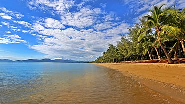
Holloways Beach is a lovely coastal suburb in Cairns, Queensland, Australia. In 2021, about 2,398 people lived there. It's located about 10 kilometers north of Cairns, nestled between Machans Beach and Yorkeys Knob.
Because it's close to Cairns International Airport, you might hear some planes. This can sometimes make homes a bit more affordable, though houses right on the waterfront are usually quite expensive. A local journalist once joked that the beach itself tries to escape because of how much work is done to keep the sand in place! He also mentioned a great fish burger and warned about mosquitoes.
Contents
Exploring Holloways Beach
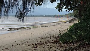
Holloways Beach is bordered by two creeks: Barr Creek to the southeast and Richter Creek to the northwest. The Captain Cook Highway forms its southwestern edge. On the other side of the highway, there's a sand quarry. The northeastern side is the beautiful beach itself, which is about 1.8 kilometers long.
About halfway along the beach, there's a special swimming area protected from stingers. These are also known as box jellyfish and can be a danger in the first half of the year.
Protecting the Beach
The beach here often loses sand due to erosion. To help save it, millions of dollars have been spent since 2020. This includes building two 30-meter rock walls called groynes. More money is also spent to bring in new sand, a process called "sand nourishment."
Most of the land near the beach is used for homes, while further west, it's mostly farmland.
A Glimpse into History
Holloways Beach is located on the traditional lands of the Djabugay (Tjapukai) Aboriginal people.
The area is named after Richard Holloway, who started farming here in 1926. It was officially named Holloway in 1951, then Holloway Beach in 1971, and finally Holloways Beach in 1981. In 2002, it became an official suburb of Cairns.
A school was planned for the area in 1951, but instead, a bus service took students to schools in Cairns. Later, in 1954, an old school building from Woree was moved here. Holloway's Beach State School opened on May 23, 1955, but it closed in 1966.
Learning and Education
Today, children living in Holloways Beach usually go to Machans Beach State School or other schools further away. The suburb is also in the area for Cairns High School.
There's a special place called the Holloways Beach Environmental Education Centre at 46 Poinsettia Street (16°49′39″S 145°44′02″E / 16.8274°S 145.7339°E). It's a great spot for learning about the environment.
Local Amenities
The beach has a lifeguard for most of the year, keeping swimmers safe. You'll find several places to eat, including two coffee shops (one right on the beach!), a pizza shop, and a bottle shop. There's also a convenience store and a laundromat.
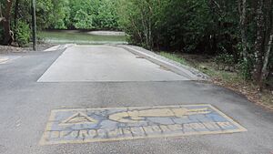
If you like boating, there's a boat ramp into Richters Creek at Acacia Street. It's managed by the Cairns Regional Council. Just remember to look out for warning signs about crocodiles near the boat ramp!
The Holloways Beach SES Group, which helps people during emergencies, meets at the Syd and Jane Granville Memorial Park.
 | Sharif Bey |
 | Hale Woodruff |
 | Richmond Barthé |
 | Purvis Young |


