Machans Beach, Queensland facts for kids
Quick facts for kids Machans BeachCairns, Queensland |
|||||||||||||||
|---|---|---|---|---|---|---|---|---|---|---|---|---|---|---|---|
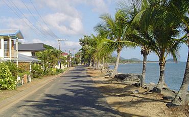
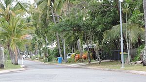
Esplanade 2005
|
|||||||||||||||
| Population | 943 (2021 census) | ||||||||||||||
| • Density | 132.8/km2 (344/sq mi) | ||||||||||||||
| Established | 1885 | ||||||||||||||
| Postcode(s) | 4878 | ||||||||||||||
| Area | 7.1 km2 (2.7 sq mi) | ||||||||||||||
| Time zone | AEST (UTC+10:00) | ||||||||||||||
| Location |
|
||||||||||||||
| LGA(s) | Cairns Region | ||||||||||||||
| State electorate(s) | Barron River | ||||||||||||||
| Federal Division(s) | Leichhardt | ||||||||||||||
|
|||||||||||||||
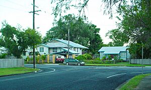
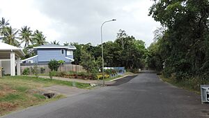
Machans Beach is a lovely beach and coastal area near Cairns in Queensland, Australia. It's a suburb of the Cairns Region. In 2021, about 943 people lived here.
Machans Beach is close to Cairns International Airport. This means you might hear planes flying overhead. Because of the airport, house prices here are often a bit lower than other places. However, homes right on the waterfront can be very expensive!
Exploring Machans Beach
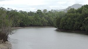
Machans Beach is bordered by water on two sides. The Barron River is to the south, and Barr Creek is to the north. The beautiful Coral Sea is to the east, and the Captain Cook Highway is to the west.
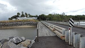
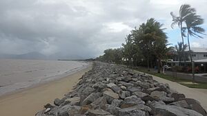
The land in Machans Beach is mostly flat and sits just above sea level. Most homes are built near the coast. The northern part of the coastline has a rocky sea wall. But the southern part has a sandy beach. These two parts are separated by Redden Creek. This creek flows from the Barron River and creates a special area called Redden Island.
You can get to Redden Island by crossing the Gundy Anton Bridge. Redden Island is a very important place for birds. Over 200 types of birds have been seen there! This includes rare and endangered species like the eastern curlew and the great knot. Many of these birds are migratory. This means they travel huge distances, up to 25,000 kilometers, each year. They fly between Australia and Asia, sometimes even as far as Siberia and Japan!
Most of the land in Machans Beach is used for farming. Sugarcane is the main crop grown here.
A Look Back in Time
The Yirrganydji people (also known as Tjapukai) were the first people to live in this area. They were skilled fishers. They used dugout canoes to fish in the sea. From their canoes, they would use spears to catch smaller fish. They used harpoons for larger sea creatures like dugong and turtles.
In calm creeks, the Yirrganydji people built special fish traps. These traps were made from lawyer vine and bushes. Women would splash the water to guide fish into the traps. Then, men would hold the trap tight and spear the fish. An old story says that if a sea snake was caught, it had to be set free. If not, huge storms would come!
The area was first surveyed in 1885. But people didn't start living there permanently until the 1920s. Machans Beach is named after Richard Morton Machan. He was one of the first settlers to buy land here in the 1920s. Richard Machan used a Model T Ford to help people travel around. He even built a jetty to encourage tourist boats from Cairns to visit nearby Barron Beach.
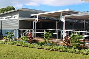
Machans Beach State School opened its doors on February 4, 1952.
In 1961, a man named Gundy Anton gave some of his land. This land was used to build a bridge across Redden Creek to Redden Island. In 2006, the local community suggested renaming the bridge. It was called the Redden Island Bridge before. They wanted to call it the Gundy Anton Bridge. This was to honor Gundy Anton for his land donation and all the help he gave the community over the years. The council agreed to this change.
Machans Beach officially became a suburb in 2002. Before that, it was known as a locality.
The coastline here can be affected by storms and floods. These natural events have even changed the path of the Barron River over time. From 2014 to 2015, the old sea wall along the northern coast was rebuilt. A new causeway was also built further out to sea. This project cost a lot of money, about $16.8 million. It helps protect the homes along the coast from severe storms. One thing about the sea wall is that it stops a sandy beach from forming in that area.
Learning in Machans Beach
Machans Beach State School is a primary school for students from Prep to Year 6. It's located at 61 Machan Street. In 2018, about 116 students attended the school.
There are no high schools directly in Machans Beach. The closest government high school is Cairns State High School. It's located in Cairns North, which is to the south.
 | Dorothy Vaughan |
 | Charles Henry Turner |
 | Hildrus Poindexter |
 | Henry Cecil McBay |


