Honorine Lake facts for kids
Quick facts for kids Honorine Lake |
|
|---|---|
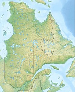
| Location | Lac-Jacques-Cartier (TNO), La Côte-de-Beaupré Regional County Municipality, Capitale-Nationale, Quebec, Canada |
| Coordinates | 47°41′30″N 71°19′56″W / 47.69167°N 71.332221°W |
| Lake type | Natural |
| Primary inflows | (clockwise from the mouth) Ruisseaux riverains et décharge des lacs Bert et Mongeau |
| Primary outflows | Launière River |
| Basin countries | Canada |
| Max. length | 2.8 km (1.7 mi) |
| Max. width | 0.7 km (0.43 mi) |
| Surface elevation | 844 m (2,769 ft) |
Honorine Lake is a beautiful freshwater lake in Quebec, Canada. It's located in the Lac-Jacques-Cartier area. This area is part of the La Côte-de-Beaupré Regional County Municipality. The lake is an important part of the Launière River and Jacques-Cartier River systems.
You can reach the area around Honorine Lake using Route 175. This main road runs to the east of the lake. There are also smaller forest roads nearby. These roads are used for logging and for people visiting for fun.
Logging is the main activity in this area. Tourism and recreation come in second. Honorine Lake usually freezes over from early December to late March. It's generally safe to walk or play on the ice from mid-December to mid-March.
Contents
Where is Honorine Lake?
Honorine Lake is surrounded by many rivers and streams. These are called hydrographic slopes. They show how water flows into and out of the lake.
Rivers and Streams Nearby
- North side: Rivière aux Écorces North-East, Hell stream, Pies stream, Noir stream, Pikauba River.
- East side: Hell stream, Pikauba River, Jacques-Cartier Lake, Jacques-Cartier River.
- South side: Launière River, Launière lake, Frazie lake, Cavée River, Jacques-Cartier North-West River.
- West side: Franchère Lake, Gravel brook, Dei brook, Rivière aux Écorces North-East, Kane brook.
Lake Size and Location
Honorine Lake is about 2.8 kilometres (1.7 mi) long and 0.7 kilometres (0.43 mi) wide. It sits at an elevation of 844 metres (2,769 ft) above sea level. The lake gets its water from nearby streams. It also gets water from lakes Berth and Mongeau, which are to the northeast. Another stream from the southeast also feeds the lake.
Mountains surround Honorine Lake on its east and south sides. Some of these mountain peaks are quite tall. One peak to the northeast reaches 960 metres (3,150 ft). Another to the southwest is 1,001 metres (3,284 ft) high.
The water from Honorine Lake flows out from its northwest side. This outflow is the start of the Launière River.
Distances from the Lake's Outlet
The outlet of Honorine Lake is located:
- 3.3 kilometres (2.1 mi) southeast of Jacqueline Lake (Rivière aux Écorces North-East).
- 6.5 kilometres (4.0 mi) southwest of the Pikauba River.
- 7.0 kilometres (4.3 mi) northwest of the dam at Lake Rieutard. Lake Rieutard is where the Clavée River begins.
- 7.9 kilometres (4.9 mi) east of Franchère Lake.
- 9.6 kilometres (6.0 mi) west of Route 175.
- 11.4 kilometres (7.1 mi) northwest of Jacques-Cartier Lake.
- 33.8 kilometres (21.0 mi) north of where the Launière River meets the Jacques-Cartier River.
From Honorine Lake, the water flows into the Launière River. This river then flows south for many kilometers. After that, the water joins the Jacques-Cartier River. The Jacques-Cartier River also flows south. Finally, it empties into the mighty Saint Lawrence River.
Name of the Lake
The name "Honorine" comes from a French first name.
The official name "Lac Honorine" was made formal on December 5, 1968. This was done by the Commission de toponymie du Québec. This commission is in charge of naming places in Quebec.
Related articles
- La Côte-de-Beaupré Regional County Municipality
- Lac-Jacques-Cartier, an unorganized territory (TNO)
- Launière River
- Jacques-Cartier River
- St. Lawrence River
- List of lakes of Canada
 | Selma Burke |
 | Pauline Powell Burns |
 | Frederick J. Brown |
 | Robert Blackburn |


