Houston Heights facts for kids
Quick facts for kids
Houston Heights, Texas
|
|
|---|---|
|
Neighborhood of Houston
|
|
| Country | United States |
| State | Texas |
| County | Harris |
| Elevation | 59 ft (18 m) |
| Time zone | UTC-6 (Central (CST)) |
| • Summer (DST) | UTC-5 (CDT) |
| ZIP code |
77008
|
| Area code(s) | 281, 713, 832, 346, 936 |
| GNIS feature ID | 1374161 |
Houston Heights (often called "The Heights") is a community in northwest-central Houston, Texas, United States. While "The Heights" can sometimes refer to a larger group of neighborhoods, Houston Heights has its own unique past, different from nearby areas like Norhill and Woodland Heights.
Contents
- History of Houston Heights
- Cityscape of Houston Heights
- Demographics of Houston Heights
- Transportation in Houston Heights
- Culture in Houston Heights
- Media in Houston Heights
- Economy in Houston Heights
- Education in Houston Heights
- Parks and Recreation in Houston Heights
- Religion in Houston Heights
- Community Information
- Climate in Houston Heights
- Notable Residents
- See also
History of Houston Heights
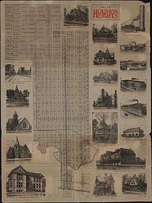
In 1891, a millionaire named Oscar Martin Carter and other investors started a company. They bought 1,756 acres (7.11 km2) of land. They also built important things like streets, parks, schools, and utilities, which cost $500,000.
When Houston Heights was first created, it was a "streetcar suburb." This means it was a town outside a big city, and people could travel to the city using streetcars. People who didn't want to live in the busy city moved there. Houston Heights was its own town until the City of Houston took it over in 1919.
After World War II, more factories and businesses moved into Houston Heights. For a while, the area looked a bit run-down. However, in the 1970s, the Houston Heights was seen as a lower-income part of the city.
From 1980 to 1990, the number of people living in Houston Heights went down. In 1973, the Houston Heights Association was started to help the community.
Since the 1990s, the Heights has been changing a lot. This process is called gentrification. It means that younger people with good jobs, especially those working in Downtown Houston, have been moving to the area. They buy and fix up old historic homes. Sometimes, they even tear down old houses to build new, fancy ones. Because of this, new shops and restaurants have opened, making the area look more modern and lively.
The old fire station at 12th Street and Yale Street was built in 1914. It used to be Houston Heights' city hall, jail, and fire station. After Houston took over, it was a city fire station until 1995. The Houston Heights Association then leased the building and fixed it up.
In 2013, CNN Money magazine ranked Houston Heights as one of the top 10 big city neighborhoods.
Cityscape of Houston Heights
The Houston Heights is one of the first planned communities in Texas. It is located about 4 miles (6.4 km) northwest of Downtown Houston. A National Geographic article said that walking through the Heights, with its wide, tree-lined streets and homes from the early 1900s, feels like being in a small town.
In 2011, John Nova Lomax described the Heights as "Houston's own mini-Austin" with many relaxed restaurants and beer gardens. The Houston Heights Association says the area is bordered by Interstate 10 to the south, North Shepherd Drive to the west, Interstate 610 to the north, and North Main and Studewood Streets to the east.
Some neighborhoods inside Houston Heights include Shady Acres in the northwest, Greater Heights in the center, and Woodland Heights in the southeast.
From 2002 to 2003, the prices of single-family houses in the Heights went up by 8.7 percent. Real estate agents say that most houses costing less than $200,000 need a lot of work. Buying a house in Houston Heights is becoming expensive.
Demographics of Houston Heights
In 2010, a study called "Houston Heights" said the area had a "diverse population." In the same year, National Geographic mentioned that Houston Heights was home to the most professional artists in Texas.
Since 2000, the Houston Heights has seen a lot of gentrification, which has changed who lives there. In 2000, the average household income was $41,576. By 2015, it almost doubled to $80,048. Also, 42% of households now earn over $100,000 a year. During this time, the average home value also increased from $118,758 in 2000 to $315,793 in 2015.
The ethnic makeup of the area also changed. Between 2000 and 2015, the Hispanic population went down from 53% to 34%. At the same time, the Non-Hispanic White population increased from 42% to 58%.
In 2015, the population of Super Neighborhood #15 Greater Heights, which includes Houston Heights and other nearby areas, was 41,362 people.
Racial Breakdown
| Race | Greater Heights | City of Houston |
|---|---|---|
| White (Non Hispanic) | 58% | 26% |
| Hispanic | 34% | 44% |
| Black (Non Hispanic) | 3% | 22% |
| Asian (Non Hispanic) | 4% | 7% |
| Others (Non Hispanic) | 2% | 1% |
Age Breakdown
This table shows the age groups in Super Neighborhood #15 Greater Heights.
| Age Group | Greater Heights | City of Houston |
|---|---|---|
| Under 5 Years | 7% | 8% |
| 5–17 Years | 10% | 17% |
| 18–65 Years | 73% | 65% |
| 65 and Over | 10% | 10% |
Transportation in Houston Heights
Bike Trails: The MKT Trail is a special path built on an old railroad line. It is 4.62 miles (7.44 km) long and is made of concrete. It's 10 feet (3.0 m) wide and can be used for walking and biking.
The trail runs from 26th Street to 7th Street along Nicholson. Then it goes from Shepherd along 7th Street to Spring Street, crosses White Oak Bayou, and goes under I-45. There, it connects to another trail called the Heritage Corridor West Trail. This trail leads to the University of Houston and other bike paths downtown.
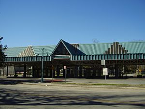
The Metropolitan Transit Authority of Harris County, Texas (METRO) used to run the Heights Transit Center. In 2018, the city bought the land from METRO. It is now a park called Sunset Heights Park.
Culture in Houston Heights
A National Geographic Traveler article said that Houston Heights "keeps a unique sense of individuality." It also said the area "is great for people who love food, architecture, and creative things."
Doug's Barbershop on 11th Street was shown in the 1998 movie Rushmore, which was directed by Wes Anderson. Doug's has also been in many TV shows and ads because of its classic barbershop look.
Media in Houston Heights
The Houston Chronicle is the main newspaper for the whole city.
The main office of Houstonia magazine is located in Houston Heights.
The Suburbanite was the first newspaper ever started in the Heights. The Leader is a local community newspaper. As of 2016, Sharon Lauder publishes a monthly newspaper called The Heights Tribune, which started in 1986. Businesses in the area receive copies of this paper.
Economy in Houston Heights
Fiesta Mart used to have a store in the Heights. H-E-B bought the old Fiesta location in 2015. H-E-B said it would build a new store there if people voted to remove a 1912 rule that stopped grocery stores from selling beer and wine. The rule was removed in a 2016 vote, and H-E-B started building in October 2017.
Education in Houston Heights
Colleges and Universities
Houston Community College offers college services to the community.
The Gulf Coast Bible College used to be in Houston Heights. It tried to create its own campus by buying and tearing down houses. In 1984, the college announced it was moving to Oklahoma City, Oklahoma, and it did so in June 1985.
Primary and Secondary Schools
The Houston Heights is served by the Houston Independent School District (HISD). It is in Trustee District I. HISD's Central Region offices were once in the former Holden Elementary building in Houston Heights.
Elementary schools that serve parts of Houston Heights include Harvard, Helms Community Learning Center, Field, Love, and Sinclair. Helms has a program where students learn in both Spanish and English. Field Elementary is nearby in Pinelawn. Love Elementary is next to the Heights.
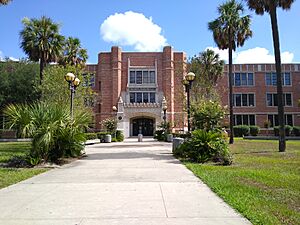
Middle schools that serve parts of Houston Heights include Hamilton and Hogg. Hamilton is in the Heights, while Hogg is in nearby Norhill. High schools that serve parts of Houston Heights are Heights High School (formerly John H. Reagan High School) and Waltrip High School. The Arabic Language Immersion School, a special magnet elementary school, opened in the former Holden Elementary School building in 2015.
Two state charter schools are in the Heights: Houston Heights Learning Academy and Houston Heights High School. Three private schools are also in Houston Heights: The New School in the Heights (K-9), Immanuel Lutheran Church and School (K-8), and Houston Outdoor Learning Academy (6-12).
Trinity Classical School has an elementary campus in the Heights.
As of 2019, the British International School of Houston in Greater Katy offers a school bus service to Houston Heights.
History of Schools
The first elementary school in Houston Heights was Cooley Elementary School, which opened in 1894. Harvard Elementary School opened in 1898.
An elementary school for Black children, which became Eighth Avenue Elementary, opened in 1911. In 1914, a businessman gave land for a new elementary school, which became Love Elementary School. Helms Elementary School was built in 1918 and opened in 1921.
Houston Heights Senior High School opened in 1919. Harvard became part of Houston ISD in 1921. In 1925, Heights High School became Hamilton High School. In 1926, Love got a new campus, Hogg opened, and Reagan opened. Hamilton then became a junior high school. Field opened in 1929. Sinclair and Waltrip opened in 1959.
Cooley Elementary closed in 1980. Holden Elementary School closed in 2004, and its students were sent to Sinclair and Helms. Eighth Avenue also closed in 2004, and its students went to Love Elementary.
The former Holden Elementary building was used for Energy Institute High School for one school year (2013-2014) and later became the Arabic Immersion Magnet School.
In 2015, Field Elementary applied to have a special program for theater and media arts. In 2016, people in the Love Elementary area suggested adding a magnet program to Love Elementary. This would help the school attract more students and get more financial support from the community.
Public Libraries
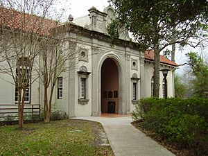
The Heights Neighborhood Library of the Houston Public Library (HPL) is located at 1302 Heights Boulevard. It has a pink, old-style Italian Renaissance look with arches in its doors and windows. The library has been renovated and now has over 14,000 sq ft (1,300 m2) of space.
The first library in the Heights area was the Baptist Temple Library, which opened in 1909. This collection later moved to Heights Senior High School in 1918. The land for the current library was bought in the mid-1920s. The current building opened in 1925 and was officially dedicated on March 18, 1926.
Parks and Recreation in Houston Heights
The City of Houston manages parks in and around Houston Heights. The Heights Boulevard Park is located along Heights Boulevard. Milroy Park and Community Center has a playground and lighted tennis courts. Milroy Park used to be the site of the original Heights High School.
Love Park and Community Center are next to Houston Heights. Love Park has an outdoor basketball court, a 0.2-mile (0.32 km) trail for walking and biking, a playground, a lighted sports field, and a swimming pool. Love Community Center has an indoor gym, meeting rooms, and a weight room. The Houston Heights World War II Memorial is also located in the Heights.
The MKT/SP Heights Trail runs along the southern edge of the neighborhood for about 4.6 miles (7.4 km). It is used by both walkers and bikers.
The Heights is also where Houston's White Linen Night is held every year in late July or early August.
Religion in Houston Heights
Churches in Houston Heights include:
- All Saints Catholic Church (Roman Catholic Archdiocese of Galveston-Houston)
- Heights Christian Church
- Baptist Temple in the Heights
The archdiocese also runs St. Anne De Beaupre Church in Sunset Heights Extension No. 2, which is near Houston Heights. It was the third Black church in Houston and opened in 1938.
Community Information
The Houston Heights Association was started in 1973 by people living and working in the area. They wanted to work together to keep the community nice and protect its historic look.
The association owns several properties, including Marmion Park. This park is where the Cooley mansion, one of the first houses in Houston Heights, used to stand. The house was torn down in 1965. The Houston Heights Association bought the land in 1979 to build Marmion Park. It was named after J. B. Marmion, who was the last mayor of Houston Heights.
The Houston Heights Woman's Club was founded in 1900. They built their own club building in 1912, which is still used today. Members of the club were active in the movement for women's right to vote. Later, during both World Wars, they let the Red Cross use their building. Today, the club helps improve the Heights neighborhood, especially by helping children and older people.
Climate in Houston Heights
The climate in Houston Heights has hot, humid summers and generally mild to cool winters. According to the Köppen Climate Classification system, Houston Heights has a humid subtropical climate, which is called "Cfa" on climate maps.
Notable Residents
- Dan Rather - American news anchor
- Martha Wong - Politician
- T.C. Jester - Pastor at Baptist Temple Church
- John Ross Palmer - American Artist
See also
 In Spanish: Houston Heights para niños


