Huatabampo facts for kids
Quick facts for kids
Huatabampo
|
||
|---|---|---|
|
||
| Nickname(s):
Tierra de generales
|
||
| Country | ||
| State | Sonora | |
| Municipality | Huatabampo | |
| Population
(2005)
|
||
| • Total | 76,296 | |
| • Demonym | Huatabampense | |
| Time zone | UTC-7 (Pacific (US Mountain)) | |
| • Summer (DST) | UTC-7 (No DST) | |
| Postal code |
85900-
|
|
| Area code(s) | 647 | |
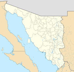
Huatabampo (pronounced wata-BAM-po) is a city in the state of Sonora, located in northwestern Mexico. It sits right on the Gulf of California, close to where the Mayo River meets the sea.
The city is about 34 kilometers (21 miles) southwest of Navojoa. You can reach it using Sonora State Highway 56 and 149. Huatabampo is famous for being the home and burial place of Álvaro Obregón. He was a very successful chickpea farmer before becoming a key leader in the Mexican Revolution.
Contents
About Huatabampo's Name
Origin of the Name
The name Huatabampo comes from the local Mayo language. "Huata" means "Willow," and "Bampo" means "Water." So, the name means "Willow in or near the Water."
Land of Generals
Huatabampo is also known as "Tierra de Generales," which means "Land of Generals." This nickname came about because several important generals from the Mexican Revolution (1910–1917) were from this town.
Álvaro Obregón: A Key General
One of the most famous generals was Álvaro Obregón (1880–1928). He was born nearby but lived in Huatabampo for many years. He was the only general who was never defeated in the war.
After the war, he became the President of the Mexican Republic (1920–1924). He helped Mexico start to rebuild after the fighting. Sadly, he was assassinated in 1928 after being elected for a second term. He is buried in the old cemetery in Huatabampo.
Other Important Generals
Other generals from the area include General José Tiburcio Otero Toledo (1834–1900). He was a well-known military leader and even a governor of Sonora. General Ignacio Otero Pablos (1896–1970) also came from here. He served as an Ambassador to other countries.
People and Population
In 2005, Huatabampo had a total population of 74,533 people. About 29,789 of these people lived in the main city area. Other towns in the municipality include Ejido la Unión, Yavaros, and Las Bocas.
The average income per person in the municipality was $5,984 in 2005. The Human Development Index (HDI) was 0.8002. The HDI is a way to measure how well people are living, looking at things like health, education, and income.
Huatabampo's Economy
Farming and Ranching
Huatabampo is a big farming area. Farmers here grow many crops, including chickpeas, various fruits, vegetables, and cereals. Raising cattle and pigs is also a very important part of the economy.
Fishing Industry
With about 120 kilometers (75 miles) of coastline, fishing is a huge part of Huatabampo's economy. More than 3,000 people work as fishermen. There are many large fishing boats and almost 1,000 smaller ones. Raising shrimp in special farms has also become a major business recently.
Food Processing
In 2000, there were 8 factories that processed seafood like sardines, crab, and shrimp. These factories also produce fish oil and fish flour, which are important products.
Things to Do in Huatabampo
Huatabampo attracts many visitors, especially from the United States. People come to enjoy its beautiful beaches and relaxing spas.
You can also visit the Museum of Álvaro Obregón. It is located in the house where the famous general and president lived. His tomb is in the Old Cemetery, which you can also visit.
Notable People from Huatabampo
- Álvaro Obregón
- General Ignacio Otero Pablos
- José Tiburcio Otero Toledo
- José Luis Ramírez
- Fernando Salas
- Baldomero "Mel" Almada
- Mario Almada
- Fernando Almada
- Daniel Duarte
See also
 In Spanish: Huatabampo para niños
 | Valerie Thomas |
 | Frederick McKinley Jones |
 | George Edward Alcorn Jr. |
 | Thomas Mensah |


