Hundred of Yatala facts for kids
Quick facts for kids YatalaSouth Australia |
|||||||||||||||
|---|---|---|---|---|---|---|---|---|---|---|---|---|---|---|---|

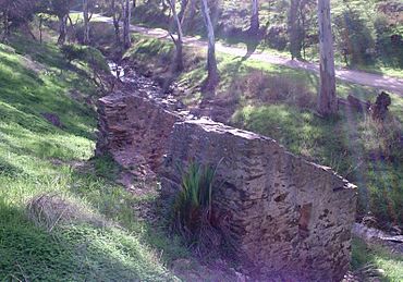
The Dry Creek watercourse in the suburb of Walkley Heights
|
|||||||||||||||
| Established | 29 October 1846 | ||||||||||||||
| County | Adelaide | ||||||||||||||
|
|||||||||||||||
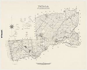
The Hundred of Yatala is a special kind of land division in South Australia. It covers a large part of the Adelaide city area. This area is mostly north of the River Torrens. It is one of eleven "hundreds" in the County of Adelaide.
This land division stretches from the Torrens River in the south. It goes all the way to the Little Para River in the north. It also reaches from the coast in the west to the Adelaide foothills in the east. The Dry Creek runs through the middle of it. Governor Frederick Robe named this area in 1846. The name "Yatala" likely comes from a local Aboriginal word.
What Does "Yatala" Mean?
Experts in Australian languages believe the name "Yatala" comes from "yartala." This is a word from the Kaurna language. It probably means "water running by the side of a river." It could also mean "inundation" or "cascade." This refers to how the flat land near Dry Creek would flood after heavy rain. It would become a very swampy area.
The word "yartala" was used by early European settlers. They used it to name different things. For example, a government ship built in 1865 was called the Yatala.
The name "Yatala" was used for places by settlers as early as 1836. At first, it referred to the River Torrens. The Kaurna people called the flooded river "Yertala." Later, the name was used for the land north of the Torrens. This land stretched from Port Adelaide on the coast to the foothills at Tea Tree Gully. Because of this history, "Yatala" was a good choice for the land division in 1846.
 | Roy Wilkins |
 | John Lewis |
 | Linda Carol Brown |


