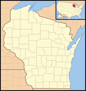
Map of the Ice Age National Scientific Reserve
Hover over locations to see the park name; click to visit the park's page.
The Ice Age National Scientific Reserve is a special group of nine places in Wisconsin. These places are part of the National Park System in the United States. They help protect and show off amazing landforms left behind by huge sheets of ice. These ice sheets covered much of North America a long time ago.
The U.S. Congress decided to create this reserve in 1964. They wanted to protect these important scientific and beautiful areas. The reserve officially started in 1971. Today, it covers about 32,500 acres (13,152 hectares) of land. The cool landforms you see here were made during the Wisconsin glaciation. This was the most recent time glaciers covered the area. It happened between 110,000 and 10,000 years ago.
The nine parts of the reserve are mostly Wisconsin state parks or other protected lands. The Wisconsin Department of Natural Resources manages them. Some areas are not yet fully ready for visitors. They might only have a few trails and no signs to explain things. Plans were being made in 2012 to develop the Cross Plains unit. Parts of the reserve are connected by the Ice Age National Scenic Trail. But the reserve itself is a separate place. If a unit charges a fee to enter, federal park passes can be used there.
Exploring the Reserve's Units
The Ice Age National Scientific Reserve has nine different units. Each unit shows off unique features left by the glaciers. You can learn about different landforms and enjoy outdoor activities.
| Unit Name |
Location |
Cool Glacial Features |
Fun Things to Do |
| Campbellsport Drumlins State Park |
Campbellsport |
Drumlins (long, oval hills shaped by glaciers) |
Scenic drive |
| Chippewa Moraine State Recreation Area |
New Auburn |
Kettle lakes (lakes formed by melting ice blocks), ponds, and bumpy land from stagnant ice |
Interpretive center, camping, hiking trails |
| Cross Plains State Park |
Cross Plains |
Land that glaciers didn't cover (Driftless Zone), old glacial lakes, and a deep gorge |
Hiking trails |
| Devil's Lake State Park |
Baraboo |
A large kettle lake and a terminal moraine (a ridge of rock and dirt left by a glacier) |
Interpretive center, camping, non-motorized boating, hiking, swimming, picnicking |
| Horicon Marsh State Wildlife Area |
Horicon |
An old glacial lake that is now a marsh, and a drumlin |
Interpretive center, watching wildlife, trails, boating, picnicking |
| Interstate State Park |
St. Croix Falls |
The Dalles of the St. Croix River (a narrow river valley), and glacial potholes (round holes in rock made by swirling water) |
Interpretive center, camping, non-motorized boating, hiking, swimming, picnicking, fishing |
| Kettle Moraine State Forest, Northern Unit |
Glenbeulah and Kewaskum |
A Kettle Moraine (a ridge of hills and hollows), kames (steep hills of sand and gravel), eskers (long, winding ridges), and kettle lakes |
Interpretive center, camping, boating, hiking, swimming, picnicking |
| Mill Bluff State Park |
Camp Douglas |
Old islands and the bottom of Glacial Lake Wisconsin |
Camping, hiking trails, swimming, picnicking |
| Two Creeks Buried Forest State Natural Area |
Two Creeks |
An exposed layer of earth with old plant remains (a buried forest) |
Not yet developed for visitors |


