
Ideraway facts for kids
Quick facts for kids IderawayQueensland |
|||||||||||||||
|---|---|---|---|---|---|---|---|---|---|---|---|---|---|---|---|

Citrus orchard, 2014
|
|||||||||||||||

Ideraway
Location in Queensland
|
|||||||||||||||
| Population | 31 (2021 census) | ||||||||||||||
| • Density | 0.873/km2 (2.26/sq mi) | ||||||||||||||
| Postcode(s) | 4625 | ||||||||||||||
| Area | 35.5 km2 (13.7 sq mi) | ||||||||||||||
| Time zone | AEST (UTC+10:00) | ||||||||||||||
| Location |
|
||||||||||||||
| LGA(s) | North Burnett Region | ||||||||||||||
| State electorate(s) | Callide | ||||||||||||||
| Federal Division(s) | Flynn | ||||||||||||||
|
|||||||||||||||
Ideraway is a small country town in the North Burnett Region, Queensland, Australia. It is also a locality, which is like a local area. In 2021, only 31 people lived in Ideraway.
Contents
Ideraway's Location and Land Use

The Burnett River flows along Ideraway's south-east side. Reid Creek forms its western border. The Burnett Highway road also goes through the area.
Most houses are in the town itself, which is in the south-east part of the locality. People mostly use the land for grazing animals like cattle in the south. In the north, they grow crops.
A Look Back at Ideraway's History
How Ideraway Got Its Name
The name Ideraway comes from a large sheep farm. This farm was leased by James Blair Reid starting in 1848. Over ten years, he gathered six smaller sheep stations to create the Ideraway farm. These stations had names like Tanjour and Binjour. Later, in 1869, two parts of the farm were sold off. They became a cattle property called Mungy.
Early Life and Changes
In the 1850s and 1860s, there were some conflicts between settlers and First Nations people in the area. In the early 1870s, some children from Ideraway Station were baptised into the Anglican church. These children had Chinese fathers and First Nations mothers. The original Ideraway Homestead building has been moved. You can now see it at the Gayndah Museum.
Land for Farming
In 1905, the Queensland Government bought the Ideraway land. They wanted to divide it into smaller farms for people to settle on. This was different from earlier ideas where people tried to farm together. This new plan allowed individuals to choose their own land. However, this farming plan did not work out very well in the end.
Battling Prickly Pear
Around that time, the area became covered in a plant called prickly pear. This plant was a big problem for farmers. Before a special moth was brought in to eat the prickly pear, people used poison to kill it. A local inventor, P. H. Gerhardt, even created a special tool called the Gerhardt Injector to put the poison into the plants.
In 1926, the cactoblastis cactorum moth was released. This moth helped control the prickly pear. After the moth arrived, butter production in the nearby Gayndah area grew a lot. Cream from Ideraway was sent to butter factories. The area became well-known for its butter in the 1930s.
Trains and Schools
The Mungar Junction to Monto railway line opened in 1907. Ideraway had its own railway station. Over the years, fewer trains ran as more people used roads. In 2017, the train tracks were removed, and the station was closed.
Ideraway State School opened in 1909. It closed around 1952. The Ideraway Post Office also opened in 1909 but closed in 1957.
Who Lives in Ideraway?
In 2011, there were 225 people living in Ideraway. By 2016, the population was 38 people. In 2021, the number of people living in Ideraway was 31.
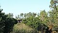
Important Old Bridges
,_from_N_bank.jpg)
Ideraway Creek has some special old bridges that are important to history. These include:
These bridges are part of a group of 12 railway bridges on the Mungar Junction to Monto railway line. They are considered the best example of historic railway bridges in Australia.
Farms and Homes
There are several homesteads, which are main farmhouses, in the Ideraway area:
- Banapan
- Burnett View
- Dentara
- Ideraway
- Yenda
Learning in Ideraway
There are no schools directly in Ideraway. Kids living here usually go to school in the nearby town of Gayndah. Gayndah State School is for primary students. Burnett State College in Gayndah is for high school students.
Images for kids
-
Citrus orchard, 2014
