
Image: Ottawarivermap
No higher resolution available.
Ottawarivermap.png (500 × 500 pixels, file size: 146 KB, MIME type: image/png)
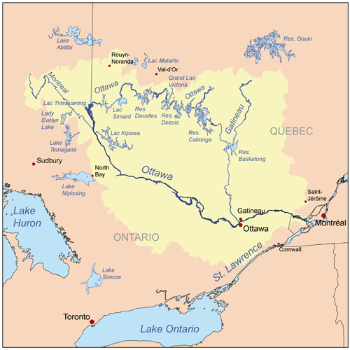
Description: This is a map of the Ottawa River drainage basin, created based on USGS and Digital Chart of the World data. [1] used as reference.
Title: Ottawarivermap
Credit: Own work
Author: Kmusser
Usage Terms: Creative Commons Attribution-Share Alike 2.5
License: CC BY-SA 2.5
License Link: http://creativecommons.org/licenses/by-sa/2.5
Attribution Required?: Yes
Image usage
The following 13 pages link to this image:
- Bazin River
- Blondeau River (Fraser River tributary)
- Canadian canoe routes
- Douville River
- Gatineau River
- Gosselin River (Fortier River tributary)
- La Pêche River
- Ottawa River
- Ottawa River drainage basin
- Rivière à l'Ours (Témiscamingue)
- Rivière à la Loutre (Témiscamingue)
- Saint-Cyr River (Ottawa River tributary)
- Tamarac River (Gatineau River tributary)

All content from Kiddle encyclopedia articles (including the article images and facts) can be freely used under Attribution-ShareAlike license, unless stated otherwise.