Interbay, Seattle facts for kids
Quick facts for kids
Interbay
|
|
|---|---|
|
Seattle Neighborhood
|
|
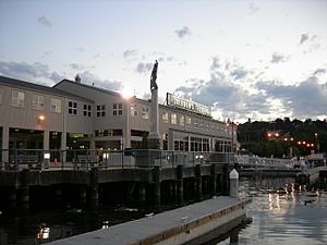
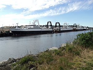
The Fishermen's Terminal marina on Salmon Bay, at the north end of Interbay
|
|
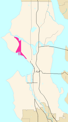
Map of Interbay's location in Seattle
|
|
| Area | |
| • Total | 3.58 km2 (1.382 sq mi) |
| Population | |
| • Total | 4,546 |
| • Density | 1,270/km2 (3,289/sq mi) |
Interbay is a neighborhood in Seattle, Washington. It sits in a valley between two hills: Queen Anne Hill to the east and Magnolia to the west. The area also includes land that was once part of Smith Cove and Salmon Bay.
To the north, Interbay is bordered by Salmon Bay, which is part of the Lake Washington Ship Canal. Across the canal is the neighborhood of Ballard. The Ballard Bridge connects Interbay to Ballard. To the south, Interbay reaches Smith Cove, an inlet of Elliott Bay. The neighborhood's eastern edge is along 15th Avenue W. and Elliott Avenue W., while the BNSF Railway forms its western border.
A large part of Interbay is taken up by BNSF Railway's Balmer Yard, which is a big train yard. Interbay is also home to Fishermen's Terminal on Salmon Bay, where fishing boats dock. The Port of Seattle has Piers 86, 90, and 91 here, which are important for shipping. The main roads in Interbay are Elliott Avenue W. and 15th Avenue W.
Contents
History of Interbay
The valley where Interbay is located was formed by glaciers a very long time ago, about 14,000 to 17,000 years ago. There's also a thin layer of sand that might be from a tsunami that happened after an earthquake about 1,000 years ago.
Early Days and Native People
Interbay is in the traditional lands of the Duwamish people. Even though early explorers didn't record specific villages in this area, there are Native American names for places near Smith Cove and Salmon Bay.
In 1852, a group of settlers known as the Denny Party explored Interbay. They saw its potential but decided to settle further south, which became the city of Seattle.
Henry A. Smith and Boulevard
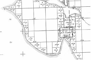
Most of Interbay eventually became owned by a doctor and poet named Henry A. Smith. Smith's Cove is named after him. Henry Smith and his family started with a land claim near Salmon Bay and bought more land, stretching all the way south to Smith Cove. They bought land when many others were selling during a time of conflict in 1855–56.
Smith created a small settlement called Boulevard in the middle of Interbay. He farmed, practiced medicine, and wrote. He is known for a version of a famous Chief Seattle speech, though there are questions about how accurate the translation was.
Railroads and Growth
In 1884, the Seattle, Lake Shore and Eastern Railway bought most of Smith's land in Interbay. They built a railway line through the area. A train stop on Grand Boulevard (now West Dravus Street) helped the area grow with businesses and homes for workers.
In 1891, Seattle officially added Magnolia and Interbay, including Boulevard, to the city. By 1894, the post office changed the name from "Boulevard" to "Interbay," which is still used today.
The railway line eventually became part of the Great Northern Railway. This company built a large port at Smith Cove. In 1896, a Japanese shipping company, Nippon Yusen Kaisha, started the first regular steamship service between Asia and North America, using Smith Cove as its American port.
Building the Ship Canal
Between 1911 and 1916, the Lake Washington Ship Canal was built along Salmon Bay. During this project, about 150 acres of Smith Cove's muddy shores were filled in with dirt from the canal digging. The Port of Seattle built Fishermen's Terminal on Salmon Bay and bought the Great Northern docks at Smith Cove. They built new piers, Piers 90 and 91, for coal and lumber. These developments at both ends of Interbay made the area more industrial.
This growth in shipping led to many companies setting up in Interbay, like a rope factory, a paint company, and a vinegar maker. People from many different countries, including Finland, Poland, Russia, Germany, Austria, and Scotland, came to live and work in the neighborhood.
The trade with Asia from Smith Cove stopped in 1934. This was due to a major workers' strike called the 1934 West Coast waterfront strike, which caused the trade to move to the Port of Los Angeles. During the Great Depression, Interbay was also home to one of Seattle's "Hoovervilles," which were shantytowns where people lived who had lost their homes.
From 1941 to the early 1970s, Smith Cove was used by the United States Navy as a supply depot. After that, it went back to being a civilian port.
Bridges in Interbay
The southern part of Interbay was originally flat, muddy areas called tideflats. The neighborhood was also divided by many north-south railway lines. Because of this, many bridges and raised roads (trestles) were built to cross the area from east to west.
One of the first crossings was at Grand Boulevard (now West Dravus Street). Around 1900, there was both a road and a trestle for a trolley line. The first bridge across Smith Cove at Garfield Street (where the current Magnolia Bridge is) was built between 1910 and 1912. Other trestles, like the 23rd Avenue West trestle, also extended into Magnolia.
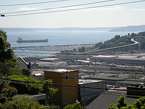
Today, besides the Magnolia Bridge and the West Dravus trestle, Interbay also has a flyover (a raised road) from Nickerson Street. This is near Salmon Bay and the Fishermen's Terminal, close to the south end of the Ballard Bridge.
Interbay Today
Interbay is still a busy place today. It has the BNSF Railway's Balmer Yard and train maintenance shops. The Port of Seattle's Fishermen's Terminal and Piers 86, 90, and 91 are also still very active.
The neighborhood is also home to a Washington Army National Guard armory, Interbay Stadium (a sports venue), the Interbay P-Patch (a large community garden), and the Interbay Golf Course. Five old houses from the late 1800s near Smith Cove are protected as a city landmark.
Along 15th Avenue West, you'll find various businesses, including light industrial companies, warehouses, and shops. There are also some offices and homes. The small shopping and dining area at West Dravus Street, which was once Grand Boulevard, is still there. Just north of Dravus, you can find the Quest Church and the Q Café, which is a non-religious community cafe.
A path for bikes and walkers comes north from the Central Waterfront through Myrtle Edwards Park. It continues through the pier areas around Smith Cove and runs next to the railway tracks through Interbay. In 2015, Expedia, Inc. bought a large building along Elliot Avenue and moved its main office there in 2018.
 | Charles R. Drew |
 | Benjamin Banneker |
 | Jane C. Wright |
 | Roger Arliner Young |


