Smith Cove (Seattle) facts for kids
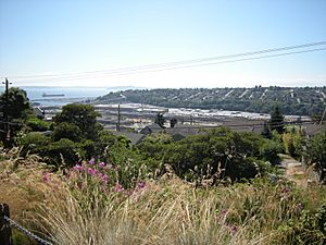
Smith Cove is a part of Elliott Bay in Seattle, Washington. It's located north of downtown Seattle, next to an area called Interbay. It's a very important place because it's home to the Port of Seattle's Piers 90 and 91, which are big docks for ships. There's also a marina there for boats.
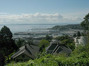
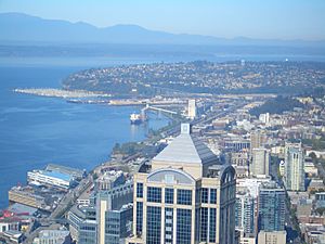
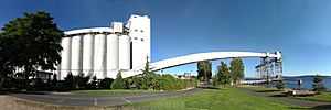
The cove was named after Dr. Henry A. Smith, who was one of the first white settlers in Seattle in 1853. At one point, Smith Cove was considered to be the main center of the growing city. The cove used to be much larger, with wide, flat areas called "tide flats" that stretched far north. In 1892, a man named James J. Hill bought a lot of these tide flats. He had them filled in with dirt to build a big train terminal for the Great Northern Railway. This terminal had train tracks, buildings for trains, grain storage, and warehouses. It also had piers for large ocean ships. Today, you can still see train yards belonging to the BNSF Railway. Other places built on this filled-in land include the Interbay Golf Center and the Washington Army National Guard Armory.
Contents
A Look Back: Smith Cove's History
Early Days and Native People
Even though Smith Cove was traditionally part of the Duwamish people's land, early studies didn't find specific Native American villages right at the cove. However, there were native names for places nearby. For example, the mouth of a creek flowing into the cove was called Silaqwotsid, meaning "talking."
Early European-American settlers saw that Smith Cove had potential for development. They farmed on the flat lands and built homes on the nearby hills. One of these settlers was Henry A. Smith, a doctor and poet, who the cove is named after. He and his family bought a lot of land in the area that is now Interbay. They bought land especially during the 1855–56 Indian War when many others were selling. Smith started a small settlement called Boulevard between Smith Cove and Salmon Bay.
In 1884, the Seattle, Lake Shore and Eastern Railway bought most of the land the Smith family owned. But it was James J. Hill and his Great Northern Railway who really developed Smith Cove. In 1892, the Great Northern bought 600 acres (2.4 km²) at Smith Cove. They built Piers 38 and 39, which were the end point for their cross-country railway.
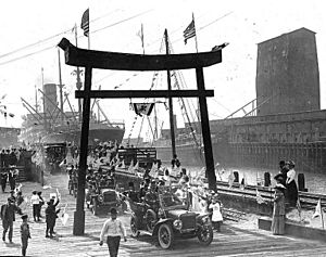
In 1896, a Japanese shipping company, Nippon Yusen Kaisha, started the first regular steamship service between Asia and North America using these piers. This led to important trade, with lumber being sent out and silk and tea being brought in. This trade continued until 1934.
Growing Up: 1900 to 1933
Between 1911 and 1916, when the Lake Washington Ship Canal was being built, about 150 acres (0.6 km²) of the Smith Cove tidelands were filled in with dirt from the dredging. The new Port of Seattle, which started in 1911, bought the docks and some land at Smith Cove from the Great Northern Railway.
At Smith Cove, the Port of Seattle built two new piers for coal and lumber, called Pier 40 and Pier 41. Pier 41 was the biggest pier on the Pacific Coast at the time. These new developments made the area around Smith Cove much more industrial.
Around this time, Queen Anne Hill and Magnolia were connected by bridges that crossed over the train tracks in Interbay. In 1930, a concrete bridge was built. It was improved later and in 1960, it was renamed the Magnolia Bridge.
The Maritime Strike of 1934
In 1934, during a big strike by dockworkers, there were many clashes between the striking workers, police, and people who crossed the picket lines. These events were called "The Battle of Smith Cove." The striking workers, with help from truck drivers, almost completely stopped all train and truck traffic in and out of the cove.
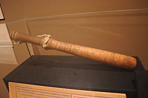
On July 20, 1934, the mayor of Seattle, Charles L. Smith, led police in an attack on 2,000 striking dockworkers. The police used tear gas and clubs. The strike ended on July 25. After this, Seattle lost a lot of its shipping business to the Port of Los Angeles.
Starting in 1939, when World War II began in Europe, the shipbuilding industry in the Puget Sound area grew a lot. Military activity also increased. In 1941, the United States Navy took over the Smith Cove piers. They eventually paid the Port of Seattle more than $3 million for them. The Navy then bought more land around the piers and built a large supply depot and a receiving station.
During and after the war, these Navy facilities at Smith Cove helped support naval operations in the Pacific and Alaska. Warships, ships carrying people, and cargo ships came and went. The facilities included many barracks for service members, dining halls, recreation areas, a swimming pool, and a hospital.
Even after World War II, the Naval Supply Depot continued to serve the Navy and other military branches through the Korean War and into the Vietnam War. However, a new Naval Supply Center was built in Bremerton, across Puget Sound. The Navy announced the closure of its Smith Cove facility in March 1970. The Port of Seattle quickly leased some of the facilities. In 1974, the Port bought 198 acres (0.8 km²) of the Supply Depot property, including the piers, for $10.3 million.
The Navy kept some presence on the former Smith Cove tideflats until at least 1977. Today, one military facility remains near the north end of the former tideflats: the Washington Army National Guard Armory.
Smith Cove Today: Since the 1970s
Once the Port of Seattle took back control, the Smith Cove facility was used as a transfer point for building the Alaska Pipeline. A company called Chempro took over the Navy's oil processing facilities.
Again, trade with Asia became very important. For many years, the most common imports were Datsun (later Nissan) cars. Nissan had a shipping and distribution center at Smith Cove from 1974 until 2001. Today, a part of that area is used for school bus maintenance. The most common exports from Smith Cove were seafood. There are several cold storage facilities on the former tideflats that help with the seafood trade.
The Fourteenth Avenue West Group
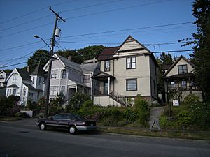
The Fourteenth Avenue West Group is a collection of five houses built in the late 1800s. They are now a bit further from the cove because of the filled-in land. These houses were originally part of a settlement of people from Slavic countries and Finland who lived near the cove. In 1979, these houses were recognized as city landmarks.
One of these houses, the Gilman house, was bought by Sharon Frances Young (later Southard) in 1970. She and her husband, Robert Laurie Southard, owned the house until 1980. During that time, they restored the Gilman house, bringing it back to its original look.
|
 | Claudette Colvin |
 | Myrlie Evers-Williams |
 | Alberta Odell Jones |


