Iron Range, Queensland facts for kids
Quick facts for kids Iron RangeQueensland |
|||||||||||||||
|---|---|---|---|---|---|---|---|---|---|---|---|---|---|---|---|

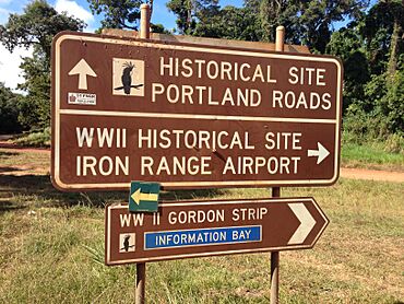
Road sign at the junction of Lockhart River Road and Portland Road, 2014
|
|||||||||||||||
| Population | 30 (2021 census) | ||||||||||||||
| • Density | 0.041/km2 (0.11/sq mi) | ||||||||||||||
| Area | 738.5 km2 (285.1 sq mi) | ||||||||||||||
| Time zone | AEST (UTC+10:00) | ||||||||||||||
| Location |
|
||||||||||||||
| LGA(s) | Shire of Cook | ||||||||||||||
| State electorate(s) | Cook | ||||||||||||||
| Federal Division(s) | Leichhardt | ||||||||||||||
|
|||||||||||||||
Iron Range is a small coastal area in Queensland, Australia. It is part of the Shire of Cook. The little town of Portland Road is also located here. In 2021, only 30 people lived in Iron Range.
Contents
What is Iron Range Like?
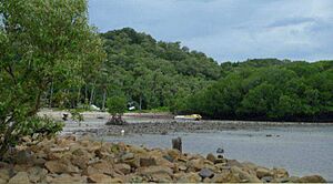
Iron Range is found on the north-east coast of the Cape York Peninsula. Weymouth Bay is a large bay off its north-eastern coast. The town of Portland Road sits on a headland in the north-east.
Most of Iron Range is covered by the Kutini-Payamu National Park. This park used to be called the Iron Range National Park. The area also has two important headlands:
- Cape Griffith
- Cape Weymouth
Mountains and Hills in Iron Range
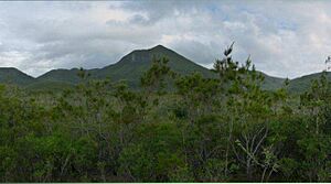
Iron Range has many mountains and hills. Some of the notable ones include:
- Aylen Hills
- Barrett Hill, which is 233 metres (764 feet) high.
- Black Hill
- Briar Hill, which is 134 metres (440 feet) high.
- Ham Hill, which is 115 metres (377 feet) high.
- Joyce Hill, which is 150 metres (492 feet) high.
- Lambert Hill, which is 60 metres (197 feet) high.
- Lamond Hill, which is 191 metres (627 feet) high.
- Mount Dobson, which is 461 metres (1,512 feet) high.
- Mount Tozer, the tallest at 543 metres (1,781 feet) high.
- North Pap, which is 466 metres (1,529 feet) high.
- Ogilvie Hill, which is 118 metres (387 feet) high.
- Philip Hill, which is 150 metres (492 feet) high.
- Red Hill
- Robyn Hill
- Simpson Hill, which is 106 metres (348 feet) high.
- South Pap, which is 410 metres (1,345 feet) high.
- Tattam Hill, which is 70 metres (230 feet) high.
A Look at Iron Range's Past
The town of Portland Road is named after the harbour there. This harbour first appeared on a British map in 1897.
Gold Mining History
In 1934, a man named Jack Gordon started looking for gold in the Iron Range area. He found a gold trail and discovered what became known as the Iron Range Reef.
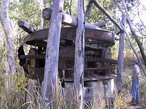
Within two years, many people were working in the area. By November 1936, a special machine called a Huntington mill was set up to process the gold. Other crushing machines were also installed. In 1938, a cyanide plant was added, and 29 men were working at the mine.
Remembering Edmund Kennedy
On November 11, 1948, a monument was built at Portland Road. It honours explorer Edmund Kennedy and his difficult trip to explore Cape York Peninsula in 1848. The monument is near a spring where his team found water.
How Iron Range Got Its Name
On April 11, 2014, the area known as Lockhart was divided. It became two new places: Iron Range and Lockhart River. Iron Range got its name from the Iron Range National Park, which is now called Kutini-Payamu National Park.
Who Lives in Iron Range?
In 2016, Iron Range had a population of 14 people. By 2021, the population had grown to 30 people.
Important Historical Sites
Iron Range has some places that are protected for their history. One of these is Gordon's Mine and Mill.
Learning in Iron Range
There are no schools directly in Iron Range. The closest government school is Lockhart River State School. It is in the nearby area of Lockhart River and offers both primary and secondary education.
 | James Van Der Zee |
 | Alma Thomas |
 | Ellis Wilson |
 | Margaret Taylor-Burroughs |


