Isla Vista, California facts for kids
Quick facts for kids
Isla Vista, California
|
|
|---|---|
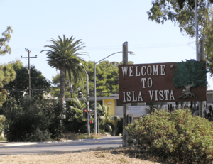
A welcome sign in Isla Vista
|
|
| Nickname(s):
I.V.
|
|
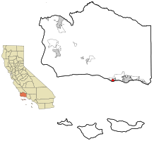
Location in Santa Barbara County and the state of California
|
|
| Country | United States |
| State | California |
| County | Santa Barbara |
| Area | |
| • Total | 1.86 sq mi (4.833 km2) |
| • Land | 1.849 sq mi (4.789 km2) |
| • Water | 0.017 sq mi (0.045 km2) 0.93% |
| Elevation | 46 ft (14 m) |
| Population
(2020)
|
|
| • Total | 15,500 |
| • Density | 8,330/sq mi (3,207/km2) |
| Time zone | UTC-8 (PST) |
| • Summer (DST) | UTC-7 (PDT) |
| ZIP code |
93117
|
| Area code(s) | 805 |
| FIPS code | 06-36868 |
| GNIS feature ID | 1702880 |
Isla Vista (pronounced EYE-lə VISS-tə) is a small community in Santa Barbara County, California. It is not an official city, but a place where many people live. In 2020, about 15,500 people lived here. Most of the people living in Isla Vista are college students. They attend the University of California, Santa Barbara (UCSB) or Santa Barbara City College.
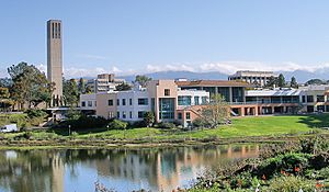
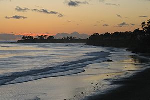
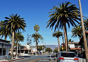
Isla Vista is right next to the beach. It sits on a flat area about 46 feet (14 meters) above the ocean. A bluff separates the community from the sand.
The weather in Isla Vista is like a Mediterranean climate, with mild, wet winters and warm, dry summers. It usually gets a bit less rain than nearby Santa Barbara. Isla Vista is located on the coast of Santa Barbara County, facing south. You can see the Channel Islands from here.
Some homes are built very close to the edge of the bluffs. These bluffs can wear away over time, especially during heavy rains. This means some buildings are at risk.
Isla Vista is known for having many students living in a small area. Since it's not a city, it gets money for projects from the county. The community is surrounded on three sides by university land. Isla Vista also has a student housing cooperative and a food cooperative.
Contents
History of Isla Vista
Early Times and Land Ownership
The first people to live in the Isla Vista area were the Chumash. They called this land Anisq'oyo' and had villages nearby. Later, the Chumash moved to the Santa Barbara Mission.
In 1842, the land became part of a Mexican land grant called Rancho Dos Pueblos. A man named Nicolas A. Den owned it. His son, Alfonso Den, inherited the land. In 1915, John and Pauline Ilharreguy bought part of Alfonso Den's land. In 1925, they divided this land into smaller plots and named it Isla Vista. They also named some of the streets, like Del Playa and Sabado Tarde.
Two other areas, Ocean Terrace and Orilla Del Mar, were also divided into plots in 1926. Today, all three of these areas together are known as Isla Vista. The streets in Isla Vista are narrow because of how they were planned in the 1920s. Back then, there were no plans for water, electricity, or sewage.
People hoped to find oil in Isla Vista, but not much was found. The nearby Ellwood Oil Field was much more successful. For many years, only a few vacation homes were built in Isla Vista. It was hard to live there because fresh water had to be brought in by trucks.
World War II and the University
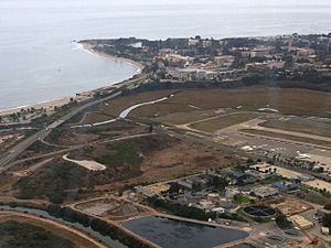
During World War II, in 1942, a Japanese submarine attacked an oil field near Isla Vista. Because of this, the United States Marine Corps took over land next to Isla Vista. They built Marine Corps Air Station Santa Barbara, an important training base for pilots. To build the air base, they filled in parts of the Goleta Slough. This was once a large water area.
After the war, the air base was no longer needed. The airport land went to the City of Santa Barbara. The land with barracks (military housing) was given to the University of California in 1948. This became the new campus for the University of California, Santa Barbara (UCSB).
UCSB moved to its new campus in 1954. At first, the university was planned to be small. People thought Isla Vista would become a mix of family homes and apartments for staff. In the early 1950s, water became available from a reservoir in the mountains.
Growth of the University and Isla Vista
By the late 1950s, many more students wanted to go to the University of California. UCSB was planned to become a much larger university. This meant more housing was needed for students.
Developers started building large apartment complexes in Isla Vista. They built many apartments quickly to meet the demand. This made Isla Vista a very dense area, with many people living close together.
By 1967, Isla Vista had many apartments and a commercial area with shops and offices. It also became a popular place for young people and the counterculture movement. The famous writer Richard Brautigan read from his book Trout Fishing in America in Isla Vista in 1967.
In the 1970s, local residents tried to make Isla Vista an official city, but these efforts did not succeed. However, many new organizations were created. These included the Isla Vista Recreation and Park District and the Isla Vista Food Cooperative. The company Kinko's was also started in Isla Vista in 1970.
Over time, Isla Vista became more and more focused on students. As UCSB grew, more students moved to Isla Vista. This led to many non-student residents moving out.
Isla Vista Today
Isla Vista has always been a place for youth culture and local bands. Many bands used storage garages as practice spaces. Famous bands like Toad the Wet Sprocket and Jack Johnson have connections to the area.
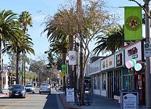
Even though many young people live in Isla Vista, there are not many large stores or businesses. Other nearby areas have worked to attract shoppers and their tax money. Isla Vista remains mostly a place where young people live, with a unique mix of small businesses.
Geography
Isla Vista is generally the area surrounded by El Colegio Road to the north, Ocean Road to the east, the beach to the south, and Camino Majorca to the west. In 2010, about 14,843 people lived in this area.
The name "Isla Vista" actually comes from the first part of the community that was developed in 1925. There are two other older sections, Ocean Terrace and Orilla del Mar, which were developed in 1926. These three areas together make up what is now called Isla Vista. Some streets in Isla Vista have small "jogs" or turns where these older sections meet. This is because they were planned separately.
When the nearby city of Goleta became a city in 2001, Isla Vista was not included. This was a big discussion, but officials decided that Isla Vista had its own unique identity.
Isla Vista is located at 34°24'53" North and 119°51'38" West. The total area is about 1.9 square miles (4.8 square kilometers). Most of this area is land, with a small part being water.
Demographics
| Historical population | |||
|---|---|---|---|
| Census | Pop. | %± | |
| 1970 | 13,441 | — | |
| 1990 | 20,395 | — | |
| 2000 | 18,344 | −10.1% | |
| 2010 | 23,096 | 25.9% | |
| 2020 | 15,500 | −32.9% | |
| source: | |||
In 2010, the population of Isla Vista was 23,096 people. The area is very densely populated, meaning many people live in a small space. Most of the people living in Isla Vista are young adults, especially those aged 18 to 24. This is because many are college students.
Arts and Culture
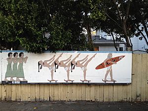
Isla Vista is known for its student and beach culture, since many UCSB and Santa Barbara City College students live there. Some major events include the Earth Day festival and bike races.
Halloween in Isla Vista
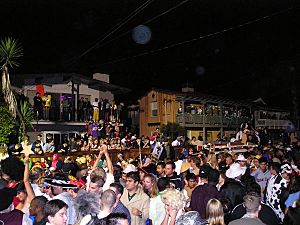
Halloween became a very big event in Isla Vista starting in the late 1970s. Students from UCSB and other schools began to visit Isla Vista for Halloween. The crowds grew very large, sometimes reaching 20,000 to 40,000 people. This led to a lot of noise and trash.
Because of the large crowds and rowdiness, officials started taking steps to control the event. Since about 2014, Halloween in Isla Vista has become much quieter. There are noise curfews, more police officers, and many streets are blocked off for visitors.
The Santa Barbara County Sheriff's Office and the University of California Police Department work together to keep the peace. They even started using body cameras for officers in 2015. In 2014, about 300 police officers were on duty for Halloween weekend.
Media
Isla Vista is served by two main newspapers:
- The daily Santa Barbara News-Press
- The weekly Santa Barbara Independent
Other local news sources include online magazines and the student newspapers from UCSB, The Daily Nexus and The Bottom Line.
Television
Local TV stations include:
- KEYT 3 (ABC affiliate)
- KPMR 38 (Univision affiliate)
- Santa Barbara Channels 17 and 21 (community and educational channels)
Radio
Several radio stations can be heard in Isla Vista:
- KJEE (92.9 MHz)
- KSBL (101.7 MHz)
- KTYD (99.9 MHz)
- The Vibe: Hip Hop y Mas 103.3
There are also NPR stations like KCRW (106.9 MHz) and KCBX (89.5 MHz, 90.9 MHz). KCLU (102.3 FM, 1340 AM) is an NPR station with a news team in Santa Barbara. The only non-commercial radio station in Santa Barbara is KCSB-FM (91.9 MHz), which is run by students at UCSB.
Notable people
- Urijah Faber, a mixed martial artist
- Jay Freeman, creator of Cydia, a software for iPhones
See also
 In Spanish: Isla Vista (California) para niños
 | Dorothy Vaughan |
 | Charles Henry Turner |
 | Hildrus Poindexter |
 | Henry Cecil McBay |


