Jacks Creek, Tennessee facts for kids
Quick facts for kids
Jacks Creek, Tennessee
|
|
|---|---|

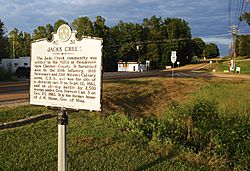
Historical marker along SR 100
|
|
| Country | United States |
| State | Tennessee |
| County | Chester |
| Area | |
| • Total | 0.99 sq mi (2.56 km2) |
| • Land | 0.99 sq mi (2.56 km2) |
| • Water | 0.00 sq mi (0.00 km2) |
| Elevation | 463 ft (141 m) |
| Population
(2020)
|
|
| • Total | 81 |
| • Density | 81.82/sq mi (31.60/km2) |
| Time zone | UTC-6 (Central (CST)) |
| • Summer (DST) | UTC-5 (CDT) |
| ZIP code |
38347
|
| Area code(s) | 731 |
| GNIS feature ID | 1289172 |
Jacks Creek (or Jack's Creek) is a small, unincorporated community in Chester County, Tennessee, United States. An unincorporated community means it's not an official city or town with its own local government.
Contents
History of Jacks Creek
The area around Jacks Creek was first settled in the 1820s. The community and the creek that runs through it share the same name. There are several old stories about how "Jacks Creek" got its name. All the stories agree that the "Jack" in the name refers to a young African-American boy.
Legends of the Name
One legend says that the boy named Jack drowned in the creek. Another story suggests he discovered how fresh and good the creek's water was. A third tale tells of him being found by Native Americans near the creek's banks. No matter which story is true, the name "Jacks Creek" has stuck for a long time.
Civil War Incidents
During the American Civil War, two small events happened near Jacks Creek in 1863.
- On September 12, a minor fight, called a skirmish, took place about a mile north of the community.
- Later, on December 23, a one-day battle occurred a mile south of town. This battle involved a unit from the Confederate Army led by Nathan Bedford Forrest and United States Army troops from Corinth, Mississippi.
Jacks Creek Airfield
In 1937, Jacks Creek became home to the Jack's Creek Intermediate Landing Field. This was an airport designed as an emergency landing spot for planes flying between Nashville and Memphis. At one point, it was considered the second-largest landing field in the United States. It had two runways, a beacon light to guide planes, and a radio control tower. During World War II, the U.S. Army Air Force used this airfield for practice flights.
Jacks Creek Today
Today, Jacks Creek is a quiet community. It has its own Post Office, the Jacks Creek Church of Christ, and Jacks Creek Elementary School. There's also a local spot called Jacks Creek Barbecue Restaurant.
Geography of Jacks Creek
Jacks Creek is mainly located where Tennessee State Route 100 and Tennessee State Route 22A cross paths. This is east of Henderson and south of Lexington. The community sits at an elevation of about 515 feet (157 meters) above sea level. The ZIP code for Jacks Creek is 38347.
Population and Demographics
Demographics is the study of a population, like how many people live in an area. According to the 2020 United States Census, the population of Jacks Creek was 81 people.
| Historical population | |||
|---|---|---|---|
| Census | Pop. | %± | |
| 2020 | 81 | — | |
| U.S. Decennial Census | |||
Notable People from Jacks Creek
Some people who became well-known lived in Jacks Creek at some point in their lives.
- Stephen L. Ross: He was a farmer who served in the Tennessee General Assembly, which is the state's government body that makes laws.
- John Marshall Stone: He lived in Jacks Creek before moving to Mississippi in 1855. He later became the governor of Mississippi, which means he was the leader of that state's government.
 | Jessica Watkins |
 | Robert Henry Lawrence Jr. |
 | Mae Jemison |
 | Sian Proctor |
 | Guion Bluford |


