Jacumba Mountains facts for kids
Quick facts for kids Jacumba Mountains |
|
|---|---|
 |
|
| Highest point | |
| Peak | Jacumba Peak |
| Elevation | 1,375 m (4,511 ft) |
| Geography | |
| Country | United States |
| State | California |
| District | San Diego County |
| Range coordinates | 32°43′11.212″N 116°10′21.060″W / 32.71978111°N 116.17251667°W |
| Parent range | Peninsular Ranges |
| Topo map | USGS Jacumba |
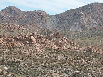
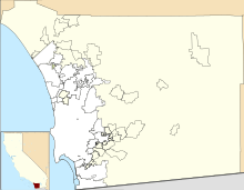
The Jacumba Mountains are a cool mountain range found in eastern San Diego County, in Southern California. They are part of a bigger group of mountains called the Peninsular Ranges. These mountains are located very close to the border between the U.S. and Mexico.
Contents
Discovering the Jacumba Mountains
The Jacumba Mountains stretch out in a long line from the northwest to the southeast. They are located to the east of the In-Ko-Pah Mountains. You can find them just north of Interstate 8, which is a major highway.
How Big Are They?
This mountain range is about 11.5 miles (18.5 kilometers) long. At its southeastern end, there's a spot called Table Mountain. This spot is about 3 miles (4.8 kilometers) northeast of the small town of Jacumba.
Reaching for the Sky: Jacumba Peak
The highest point in the Jacumba Mountains is called Jacumba Peak. It stands tall at about 4,512 feet (1,375 meters) above sea level. You can find this peak near the southern part of the mountain chain.
Neighbors of the Jacumba Mountains
The Jacumba Mountains have several interesting neighbors. To their northwest, you'll find the Tierra Blanca Mountains and the Sawtooth Mountains. Just north of the Jacumba Mountains is the huge Anza-Borrego Desert State Park, a popular place for outdoor adventures. To the northeast, you'll see the Coyote Mountains. Also, the Volcanic Hills area is located on the northeast side of the range.
 | William L. Dawson |
 | W. E. B. Du Bois |
 | Harry Belafonte |


