
Jamesburg, New Jersey facts for kids
Quick facts for kids
Jamesburg, New Jersey
|
||
|---|---|---|
|
Borough
|
||

Jamesburg as seen across Lake Manalapan from Thompson County Park
|
||
|
||

Location of Jamesburg in Middlesex County highlighted in red (left). Inset map: Location of Middlesex County in New Jersey highlighted in orange (right).
|
||

Jamesburg, New Jersey
Location in Middlesex County, New Jersey

Jamesburg, New Jersey
Location in New Jersey

Jamesburg, New Jersey
Location in the United States
|
||
| Country | ||
| State | ||
| County | Middlesex | |
| Incorporated | March 19, 1887 | |
| Named for | James Buckelew | |
| Government | ||
| • Type | Borough | |
| • Body | Borough Council | |
| Area | ||
| • Total | 0.89 sq mi (2.31 km2) | |
| • Land | 0.88 sq mi (2.29 km2) | |
| • Water | 0.01 sq mi (0.02 km2) 0.90% | |
| Area rank | 517th of 565 in state 24th of 25 in county |
|
| Elevation | 85 ft (26 m) | |
| Population
(2020)
|
||
| • Total | 5,783 | |
| • Estimate
(2024)
|
5,869 | |
| • Rank | 358th of 565 in state 23rd of 25 in county |
|
| • Density | 6,556.7/sq mi (2,531.6/km2) | |
| • Density rank | 80th of 565 in state 5th of 25 in county |
|
| Time zone | UTC−05:00 (Eastern (EST)) | |
| • Summer (DST) | UTC−04:00 (Eastern (EDT)) | |
| ZIP Code |
08831
|
|
| Area code(s) | 732 exchanges 521,605 and 656 | |
| FIPS code | 3402334890 | |
| GNIS feature ID | 0885263 | |
| Website | ||

Jamesburg is a small town, also known as a borough, located in Middlesex County, in the state of New Jersey. In 2020, about 5,783 people lived there.
Contents
History of Jamesburg
Jamesburg became an official town (borough) on March 19, 1887. It was created from parts of Monroe Township. The people living there voted to make it a separate town.
How Jamesburg Got Its Name
The town is named after James Buckelew. He started a mill here, which helped the town grow. James Buckelew was also a kind person. When officials in Monroe Township would not let an African-American student attend one of their schools, he stepped in. He paid for a new school to be built that would welcome all children. This school was located on Church Street and Gatzmer Avenue. The town was named in his honor because of his important contributions.
Past Flooding Event
On July 17, 2005, Jamesburg experienced heavy rainfall. About 7 to 8 inches (18 to 20 cm) of rain fell, causing floods in several areas. Many families, between 75 and 100, had to leave their homes. They found shelter at the John F. Kennedy Elementary School.
Geography of Jamesburg
Jamesburg covers a total area of about 0.89 square miles (2.31 square kilometers). Most of this area is land, with a small part being water.
A Town Within a Town
Jamesburg is unique because it is completely surrounded by Monroe Township. This means Jamesburg is like an older, more city-like area right in the middle of Monroe Township. It's one of 21 such "doughnut towns" in New Jersey.
Population Information
The population of Jamesburg has changed over the years.
- In 1880, there were 681 people.
- By 1970, the population grew to 4,584.
- In 2000, it reached 6,025.
- The 2010 census counted 5,915 people.
- In 2020, the population was 5,783.
Parks and Recreation


Thompson Park
Thompson Park is a large park that covers about 675 acres (2.73 square kilometers). It is located on the edge of Jamesburg and also extends into Monroe Township.
Activities at Thompson Park
The park has a 30-acre (120,000 square meter) lake called Manalapan Lake. Visitors can enjoy many activities, including:
- Four tennis courts
- Four basketball courts
- Two handball courts
- Three baseball fields and one softball field
- Many soccer fields
- Picnic areas with grills
- Three hiking and biking trails
- Fishing
- An animal haven
- A gazebo
The park has three entrances, two on Perrineville Road and one on Forsgate Drive. The Monroe Township Soccer Club holds a tournament there every year.
Local Government
Jamesburg is run by a local government system called the "borough" form. This is a common type of government in New Jersey.
How Jamesburg's Government Works
The government is made up of a mayor and a borough council. Both the mayor and council members are chosen by voters in elections held in November.
- The Mayor is elected for a four-year term.
- The borough council has six members. They serve three-year terms, with two seats up for election each year.
In Jamesburg, the council has more power than the mayor. The mayor leads meetings and only votes if there is a tie. The mayor can also stop new laws (veto them), but the council can overrule this with a two-thirds vote. The mayor also helps assign council members to different committees.
Current Leaders
As of 2024, the mayor of Jamesburg is Shannon Spillane, who is a Republican. Her term ends on December 31, 2027.
The members of the Borough Council are:
- Thomas Emens (Democrat, term ends 2025) - Council President
- Tom Goletz (Democrat, term ends 2026)
- Bertin Lefkovic (Democrat, term ends 2026)
- Samantha Rampacek (Democrat, term ends 2025)
- Shannon Spillane (Republican, term ends 2024)
- Brian Taylor (Republican, term ends 2024)
In December 2022, Thomas Goletz was appointed to fill a council seat after a previous member passed away.
Education in Jamesburg
Jamesburg has its own school district, the Jamesburg Public Schools. This district serves students from pre-kindergarten up to eighth grade.
Schools in Jamesburg
As of the 2020–21 school year, the district had two schools:
- John F. Kennedy Elementary School: For students in Pre-K through 5th grade.
- Grace M. Breckwedel Middle School: For students in 6th through 8th grade.
High School Education
Jamesburg used to have its own high school, Jamesburg High School, which opened in 1905. However, it closed in June 1979. Since 1980, high school students from Jamesburg attend Monroe Township High School in Monroe Township. This is part of a special agreement between the two school districts.
Students in eighth grade from all over Middlesex County can also apply to attend the Middlesex County Magnet Schools. These schools offer special career and technical education programs. They are located in different towns like East Brunswick, Edison, Perth Amboy, Piscataway, and Woodbridge Township. Students do not have to pay tuition to attend these magnet schools.
Transportation
Roads and Highways
_just_west_of_Middlesex_County_Route_698_(Dayton_Road)_in_Jamesburg,_Middlesex_County,_New_Jersey.jpg)
As of 2015, Jamesburg had about 16.53 miles (26.60 km) of roads. Most of these roads are maintained by the town itself, while some are managed by Middlesex County.
No major interstate highways or state highways go directly through Jamesburg. However, several county roads pass through, including:
- County Route 522
- County Route 612
- County Route 615
- County Route 625 (Perrineville Road)
The closest major highway is the New Jersey Turnpike (Interstate 95). You can access it at Exit 8A in nearby Monroe Township. County Route 612 connects Jamesburg to the Turnpike.
Public Transportation
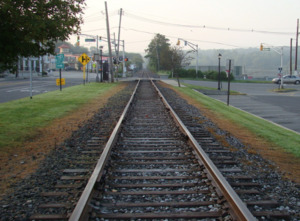
In the past, a railway called the Freehold and Jamesburg Agricultural Railroad was very important for transportation in the Jamesburg area. This railway started operating in 1853. It helped make the region a busy place for travel and trade. The railway stopped being used for regular passenger service by the early 1930s.
Today, Middlesex County offers RIDE shuttles. The M1 route connects Jamesburg to the New Brunswick train station.
Notable People from Jamesburg
Many interesting people have connections to Jamesburg:
- Harrison Woodhull Crosby (1814–1892): In 1847, he was the first person to successfully can tomatoes.
- Harold J. Davall (1879–1931): A college football player and coach, and an engineer.
- Reed Gusciora (born 1960): He became the mayor of Trenton, New Jersey in 2018. Before that, he served in the New Jersey General Assembly.
- Frankie Hayes (1914–1955): A professional baseball catcher who played in Major League Baseball for many years, mostly for the Philadelphia Athletics.
- George Edward Pendray (1901–1987): A strong supporter of space travel.
See also
 In Spanish: Jamesburg (Nueva Jersey) para niños
