Joondalup facts for kids
Quick facts for kids JoondalupPerth, Western Australia |
|||||||||||||||
|---|---|---|---|---|---|---|---|---|---|---|---|---|---|---|---|
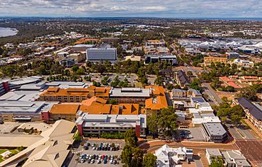
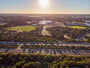
Aerial view of Joondalup
|
|||||||||||||||
| Established | 1980s | ||||||||||||||
| Postcode(s) | 6027 | ||||||||||||||
| Area | 11.8 km2 (4.6 sq mi) | ||||||||||||||
| Location | 26 km (16 mi) from Perth | ||||||||||||||
| LGA(s) | City of Joondalup | ||||||||||||||
| State electorate(s) | Joondalup | ||||||||||||||
| Federal Division(s) | Moore | ||||||||||||||
|
|||||||||||||||
Joondalup is a lively suburb in Perth, Western Australia. It's about 26 kilometers (16 miles) north of Perth's city center. Joondalup is like the main hub for Perth's northern suburbs. It has a busy city center of its own!
Contents
History of Joondalup
In the 1960s, a plan called the Corridor Plan for Perth was created. This plan aimed to build five new shopping and business centers. Joondalup was chosen as one of these important centers. The idea was to spread out the shopping and business from Perth's main city center.
Most of the land in Joondalup was empty until the 1960s. But by the late 1980s and early 1990s, Joondalup started to grow fast. Many houses and businesses were built. It quickly became known as the "city of the north." Today, the government still sees Joondalup as a key center for the Perth area.
The city gets its name from Lake Joondalup. The name "Joondalup" comes from the Noongar language. It might mean "place of whiteness or glistening" or "place of a creature that can only move backwards."
Joondalup's Location and Features
Joondalup is surrounded by different areas. To the north is Burns Beach Road. The Mitchell Freeway is to the west. Eddystone and Lakeside Drive are to the south. And to the east, you'll find Lake Joondalup.
Two main roads, Grand Boulevard and Joondalup Drive, run through the middle of the suburb. Most of Joondalup has shops, offices, and homes. There are also some natural areas. These include parts of the Yellagonga Regional Park and a small bushland area.
People of Joondalup
In 2016, about 9,090 people lived in Joondalup. Many people were born in Australia (46.4%). Other common birthplaces include England (15.3%), New Zealand (3.8%), and South Africa (3.3%). Most people (73.5%) speak only English at home. Other languages like Mandarin and Arabic are also spoken. The average age of people in Joondalup was 34.
How Joondalup is Governed
Joondalup is part of the City of Joondalup local government. This means local decisions are made here. The main offices for the City of Joondalup are in the city center. The Joondalup Library is also here. It's a big library for the whole area.
The Western Australia Police Force has a police station in Joondalup. There's also a court here. This court handles different legal cases for the community.
Culture and Fun in Joondalup
Shopping and Retail
Joondalup's city center is a busy place for shopping. It has many shops and restaurants. Lakeside Joondalup is a large shopping center. It's right next to the Joondalup train station.
Events and Festivals
Joondalup hosts the Joondalup Festival every year. This is a big event in the city center. It has markets, music, fashion shows, and street performers. There are also fun fairground rides and parades. The festival is free and brings many people to Joondalup.
Since 2016, the Kaleidoscope Festival has also been held here. This festival shows off amazing art and light displays. It's a very popular event!
Parks and Beaches
Joondalup has several lovely parks. These include Central Park and Neil Hawkins Park. Neil Hawkins Park is part of the Yellagonga Regional Park. You can see many birds like parrots and cockatoos there. Kangaroos also live in the park.
The park is next to Lake Joondalup and its wetlands. These wetlands are important for birds that travel long distances. Joondalup also has beautiful beaches nearby. These include Burns Beach in the north and Beaumaris Beach.
Sports in Joondalup
Joondalup is home to several soccer clubs. These include ECU Joondalup SC, Joondalup United FC, and Sorrento FC. They play in a top league in Australia. Games between Sorrento FC and ECU Joondalup are always exciting!
Arena Joondalup, also known as HBF Arena, is a big sports venue. It's the home ground for the West Perth Football Club (Australian Rules Football). It's also where the Wanneroo Basketball Association plays. The Arena also hosts music events and other shows.
Education in Joondalup
Joondalup is a major place for learning in the northern suburbs. It's even called the Joondalup Learning Precinct.
The North Metropolitan TAFE has a campus here. TAFE colleges offer practical skills for jobs. Edith Cowan University also has a large campus in Joondalup. Students can study for university degrees here. The campus has libraries, shops, sports facilities, and student housing.
The West Australian Police Academy is also located in Joondalup. This is where new police officers are trained. Joondalup also has local schools like Joondalup Primary School and Lake Joondalup Baptist College.
Joondalup's Infrastructure
Water Supply
Joondalup gets its drinking water from the nearby Gnangara Mound. The water is cleaned at a special plant. The Water Corporation manages the water supply for the area.
Roads and Driving
Joondalup has good road connections. You can get onto the Mitchell Freeway from three different points. Joondalup Drive is another major road. It connects to other highways like the Tonkin Highway.
Public Transport
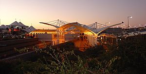
The Joondalup train station and bus interchange is very important. It's connected to Lakeside Joondalup Shopping City. Trains run south to Perth's city center. This journey takes about 25 minutes. Trains also run north to Yanchep railway station.
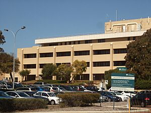
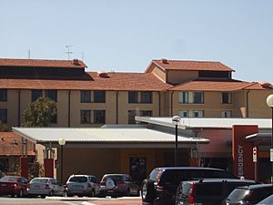
There are also special free bus services in Joondalup. These are called the Central Area Transit (CAT) buses. They travel in a circle around the city center. They stop at places like the Joondalup Health Campus, Edith Cowan University, and the TAFE. Other regular buses also serve the rest of the suburb.
 | Precious Adams |
 | Lauren Anderson |
 | Janet Collins |


