Jugiong facts for kids
Quick facts for kids JugiongNew South Wales |
|||||||||||||||
|---|---|---|---|---|---|---|---|---|---|---|---|---|---|---|---|

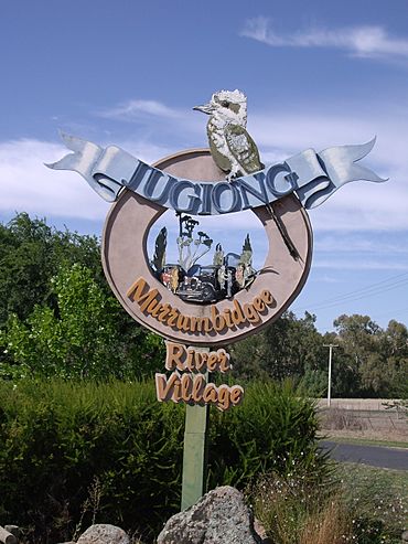
Entering Jugiong at the old Hume Highway
|
|||||||||||||||
| Postcode(s) | 2726 | ||||||||||||||
| Elevation | 303 m (994 ft) | ||||||||||||||
| Location | |||||||||||||||
| LGA(s) | Hilltops Council | ||||||||||||||
| Region | South West Slopes | ||||||||||||||
| County | Harden | ||||||||||||||
| Parish | Jugiong | ||||||||||||||
| State electorate(s) | Cootamundra | ||||||||||||||
| Federal Division(s) | Hume | ||||||||||||||
|
|||||||||||||||
Jugiong is a small town in New South Wales, Australia. It is located right next to the Murrumbidgee River. The town is part of the Hilltops Council area. You can find it just off the Hume Highway. Jugiong is about 30 kilometres southwest of Bookham. It is also about 40 kilometres northeast of Gundagai.
Contents
About Jugiong: A River Town
Jugiong is a quiet and pleasant place to visit. It sits on a large bend of the Murrumbidgee River. The Jugiong Creek also flows into the river nearby. The town is known for its peaceful atmosphere. It's a great spot for travellers to stop and rest.
Early History of Jugiong
The land where Jugiong is located first belonged to the Wiradjuri people. This is an Aboriginal Australian group. The name "Jugiong" likely comes from a Wiradjuri word. Some early settlers thought it meant "the valley of the crows."
European settlers arrived in the 1820s. Henry O'Brien started grazing sheep here. By 1844, there was already a public house, which is like an inn or hotel. A town site was officially set aside in 1853. The Jugiong Post Office opened in 1856. A bridge was built over Jugiong Creek in 1859. Jugiong has had a public school since 1883.
Important Buildings and People
John Sheehan was an important person in Jugiong's early days. He owned the public house. He also gave land and money for the town's Catholic Church. This church, St John the Evangelist, was built between 1858 and 1860. There was also an Anglican Church built in 1895. This building is now privately owned.
A famous Australian cricketer, Richie Benaud, spent some of his childhood in Jugiong. There is also a memorial in the area. It remembers Sergeant Edmund Parry. He was a police officer. He was shot by a bushranger named John Gilbert in 1864.
Jugiong's Geography and Floods
Jugiong is located on a big loop of the Murrumbidgee River. The river splits into two streams downstream, forming Jugiong Island. The areas near the river and the lower parts of town can flood. There were big floods in 1852, 1870, 1891, and other years.
During the 1852 flood, John Sheehan saved 33 people. The government gave him a special silver tankard for his bravery. Later, the Burrinjuck Dam was made bigger in 1957. This helped protect Jugiong from floods coming from the upper Murrumbidgee River. However, Jugiong Creek can still have flash floods. A storm, like a hurricane, also badly damaged the town in 1898.
Because of the flood risk and not being on a main railway line, Jugiong became more of a village. Many buildings moved to higher ground. In 1872, only about 150 people lived there.
Water Supply and Local Industries
Since 1933, water has been pumped from the Murrumbidgee River at Jugiong. This water goes to two dams in the Cowang Hills. From there, it supplies water to towns like Cootamundra, Young, and Temora.
South of Jugiong, there is a large quarry. This is where river gravel is dug up. North of town, another quarry is now used as a regional landfill site.
Jugiong Today
Jugiong was once on the main road between Yass and Gundagai. Now, the Hume Highway goes around the town. This makes Jugiong a peaceful place.
At the 2016 census, Jugiong had 222 people living there. By the 2021 census, the population had grown to 255.
 | Leon Lynch |
 | Milton P. Webster |
 | Ferdinand Smith |


