Kécarpoui River facts for kids
Quick facts for kids Kécarpoui River |
|
|---|---|

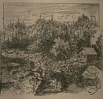
La baie de Kécarpoui, 1897
|
|
| Other name(s) | Rivière Kécarpoui |
| Country | Canada |
| Province | Quebec |
| Region | Côte-Nord |
| RCM | Le Golfe-du-Saint-Laurent |
| Physical characteristics | |
| River mouth | Gulf of Saint Lawrence 0 metres (0 ft) 51°03′43″N 58°50′02″W / 51.0619444°N 58.8338889°W |
| Length | 27 kilometres (17 mi) |
| Basin features | |
| Basin size | 696 square kilometres (269 sq mi) |
The Kécarpoui River (also called French: Rivière Kécarpoui in French) is a special river in the Côte-Nord area of Quebec, Canada. It flows south and empties into the big Gulf of Saint Lawrence. This river is well-known for its salmon.
Contents
Where is the Kécarpoui River?
The Kécarpoui River is a narrow river, about 27 kilometres (17 mi) long. It starts in the mountains and flows towards the sea.
River Mouth and Islands
The end of the river, called its mouth, is in a place called Gros-Mécatina. This area is part of the Le Golfe-du-Saint-Laurent Regional County Municipality. Right across from the river's mouth, in the Gulf, there's a group of islands called the Kécarpoui Archipelago.
What does Kécarpoui mean?
The name Kécarpoui comes from the Innu language. It means "porcupine river." This suggests that porcupines might have been common in the area long ago!
What is the Kécarpoui River like?
Back in 1914, a book called Dictionnaire des rivières et lacs de la province de Québec described the Kécarpoui River. It said the river flows through the Laurentides mountains. It also mentioned that the river is not easy to travel on, even for small boats like canoes.
Nature around the River
The land around the river isn't very good for farming. Instead, you'll find lots of fir and spruce trees, though they aren't very tall. The river is a great spot for fishing, with both salmon and trout living in its waters. People also used to visit the area to hunt for animals and their furs.
The River's Basin
The Kécarpoui River basin is the entire area of land where water flows into the river. It covers a large space of about 696 square kilometres (269 sq mi).
Neighboring Rivers
This basin is located between two other river basins: the Véco River basin to the west and the Saint-Augustin River basin to the east.
Local Areas
The Kécarpoui basin is partly in the wild, unorganized territory of Petit-Mécatina. It also stretches into the towns of Gros-Mécatina and Saint-Augustin.
Power Station in the Basin
Interestingly, the Lac-Robertson Generating Station is found within the Kécarpoui basin. This power station gets its energy from a dam on the Véco River, even though it's located in the Kécarpoui area.
Wildlife and Environment
The Kécarpoui River area is mostly covered by evergreen trees, like pines and spruces. This type of forest is called a conifer forest.
Animals You Might See
Many different mammals live in this area. Some of them include:
- Black bears
- Moose
- Boreal woodland caribou (a type of deer)
- Wolf
- Fox
- Lynx (a wild cat)
- Muskrat
- Mink
- Otter
- Porcupine
Near the river's mouth, on the many small islands, you can also find large groups of seabirds.
Fishing in the Kécarpoui River
The Kécarpoui River is famous for its Atlantic salmon. It's known as a great place for salmon fishing.
Salmon Journey
The bottom of the river is made up of medium-sized rocks. Salmon swim up the river for about 19 kilometres (12 mi) from the Gulf. These salmon usually weigh between 2.2 to 4.8 kilograms (4.9 to 10.6 lb).
Fishing Success
From 2013 to 2017, people reported catching an average of 7 salmon each year in the Kécarpoui River.
Fishing Services
There's a company called Pourvoirie Kecarpoui/Kecarpoui Outpost that offers special fishing trips. They provide guided expeditions that visit not only the Kécarpoui River but also other nearby rivers like the Véco, Saint-Augustin, Coxipi, Chécatica, and Napetipi. They also visit a place called Baie des roches.
 | Mary Eliza Mahoney |
 | Susie King Taylor |
 | Ida Gray |
 | Eliza Ann Grier |


