Kebler Pass facts for kids
Quick facts for kids Kebler Pass |
|
|---|---|

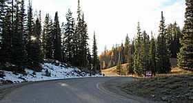
A view of the top of the pass.
|
|
| Elevation | 10,007 ft (3,050 m) |
| Traversed by | Gunnison County Road 12 |
| Location | Gunnison County, Colorado, United States |
| Range | West Elk Mountains |
| Coordinates | 38°50′59″N 107°06′01″W / 38.84972°N 107.10028°W |
| Topo map | USGS Mount Axtell |
Kebler Pass is a beautiful mountain pass located high up in the West Elk Mountains of Colorado, United States. A mountain pass is like a natural path or road that goes through a mountain range, making it easier to travel from one side to the other. Kebler Pass sits at a very high elevation of 10,007 feet (about 3,050 meters) above sea level!
The Road Through Kebler Pass
The road that crosses Kebler Pass is called Gunnison County Road (GCR) 12. It's a scenic route that connects different parts of Colorado. On the eastern side, GCR 12 starts near the town of Crested Butte. On the western side, it meets State Highway 133 close to Paonia State Park.
Most of GCR 12 is a gravel road. This means it's not paved with asphalt like many highways. However, some parts near the very top of the pass have been paved, which makes the drive a bit smoother.
When Can You Visit?
Kebler Pass is a popular spot, especially during the warmer months. In the summer, most regular cars can easily drive on the road. It's a great place to explore the mountains and enjoy nature.
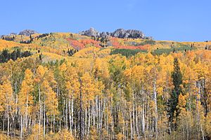
However, because it's so high up, Kebler Pass gets a lot of snow in winter. This means the road is completely closed during the winter months. It usually reopens in late spring or early summer, once all the snow has melted and the road is safe to use again. Many people visit in the fall to see the amazing colors of the changing leaves.
 | Frances Mary Albrier |
 | Whitney Young |
 | Muhammad Ali |


