West Elk Mountains facts for kids
Quick facts for kids West Elk Mountains |
|
|---|---|

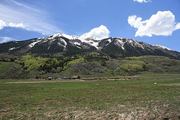
Whetstone Mountain in the West Elk Mountains
|
|
| Highest point | |
| Peak | West Elk Peak |
| Elevation | 13,042 ft (3,975 m) |
| Geography | |
| Country | United States |
| Parent range | Rocky Mountains |
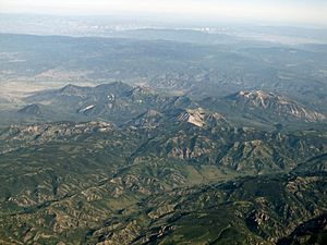
The West Elk Mountains are a tall mountain range in the western part of Colorado, a state in the United States. Most of these mountains are found within the Gunnison National Forest. A special part of the range is protected as the West Elk Wilderness, which means it's kept wild and natural. The mountains are mainly in Gunnison County, with smaller parts reaching into Delta and Montrose counties.
The West Elks are surrounded by rivers that flow into the Gunnison River. To the north, you'll find the North Fork of the Gunnison River. To the east, there's the East River, which also feeds into the Gunnison. To the south and west, the mountains connect to Black Mesa and Fruitland Mesa. These areas are part of the same uplift that created the amazing Black Canyon of the Gunnison. To the northeast, the West Elks meet the Elk Mountains, separated by Anthracite Creek and Coal Creek. Nearby towns include Gunnison, Paonia, and the ski resort of Crested Butte.
Contents
How the West Elk Mountains Were Formed
The northern and southern parts of the West Elk Mountains have different stories about how they were made and what they look like today.
Mountains in the North: Laccoliths
In the northern West Elks, many of the big peaks are called laccoliths. Imagine hot, melted rock (called magma) pushing up from deep underground. About 30 million years ago, this magma pushed into layers of soft rock, like the Mancos Shale, but it didn't break through to the surface. Instead, it formed big, dome-shaped bubbles under the ground.
Over millions of years, the softer rock layers on top slowly wore away due to erosion (like wind and water). This left the harder laccoliths exposed, creating the tall, distinct mountains we see today. Some examples of these laccolith mountains in the West Elks include Marcellina Mountain, Mount Gunnison, East Beckwith Mountain, the Anthracite Range, Mount Axtell, Carbon Peak, and Whetstone Mountain.
Mountains in the South: Volcanoes
In contrast, the southern part of the range was shaped by volcanic rocks. Not long after the laccoliths formed in the north, volcanoes started erupting to the south. A huge stratovolcano (a cone-shaped volcano like Mount Fuji) and other openings spewed out a lot of material. This material piled up to form what is now the southern West Elk Mountains.
Much of this volcanic material is part of something called the West Elk Breccia Formation. This is a mix of different volcanic bits, including thick layers of mudflows (like fast-moving rivers of mud and rock). In some places, this West Elk Breccia is over 3,500 feet (1,067 meters) thick!
On top of the West Elk Breccia, volcanic ash was laid down by more eruptions from the San Juan volcanic field to the south. Most of this ash fell about 26 to 27 million years ago. The rock formed from this ash is called tuff, which is usually quite soft. However, some of the ash that landed closer to the southern edge of the volcanic area was so hot that it fused together into a harder rock called welded tuff.
These harder welded tuffs are tougher than the breccia below them. Today, they form caps on many flat-topped mountains (mesas) in the southern West Elk Mountains.
Shaping the Landscape: Erosion
Over long periods, erosion has carved out the valleys and shaped the mesas and peaks we see today. The highest point in the West Elk Mountains is West Elk Peak. This peak is located near the center of where the huge volcano once stood.
You can see these different rock layers clearly at the southern edge of the West Elk Mountains, where the Gunnison River has cut through the volcanic rocks. A great example is at the Dillon Pinnacles in Curecanti National Recreation Area. The tough welded tuff forms the cap of Dillon Mesa, sitting on top of the West Elk Breccia, which has eroded into tall, pointed pinnacles. Below the breccia, you can see even older sedimentary rocks, including the Mancos, Dakota, and Morrison Formations.
Tallest Peaks of the West Elk Mountains
Here are the nine tallest peaks in the West Elk Mountains that stand out significantly from the land around them:
| Rank | Mountain Peak | Elevation | Prominence | Isolation |
|---|---|---|---|---|
| 1 | West Elk Peak NGS PB | 13,042 feet 3975 m |
3,095 feet 943 m |
13.8 miles 22.2 km |
| 2 | Mount Gunnison NGS PB | 12,725 feet 3879 m |
3,549 feet 1082 m |
11.8 miles 19.1 km |
| 3 | Whetstone Mountain NGS PB | 12,527 feet 3818 m |
2,456 feet 749 m |
9.4 miles 15.1 km |
| 4 | East Beckwith Mountain NGS PB | 12,441 feet 3792 m |
2,492 feet 760 m |
6.8 miles 11.0 km |
| 5 | Anthracite Range High Point NGS PB | 12,394 feet 3778 m |
2,125 feet 648 m |
4.8 miles 7.7 km |
| 6 | Carbon Peak NGS PB | 12,088 feet 3684 m |
2,179 feet 664 m |
3.9 miles 6.3 km |
| 7 | Mount Guero NGS PB | 12,058 feet 3675 m |
2,432 feet 741 m |
6.4 miles 10.3 km |
| 8 | Coal Mountain PB | 11,710 feet 3570 m |
1,715 feet 523 m |
4.8 miles 7.8 km |
| 9 | Marcellina Mountain PB | 11,353 feet 3461 m |
2,728 feet 831 m |
5.1 miles 8.2 km |
 | Georgia Louise Harris Brown |
 | Julian Abele |
 | Norma Merrick Sklarek |
 | William Sidney Pittman |


