West Elk Peak facts for kids
Quick facts for kids West Elk Peak |
|
|---|---|

West Elk Peak
|
|
| Highest point | |
| Elevation | 13,042 ft (3,975 m) |
| Prominence | 3,095 ft (943 m) |
| Isolation | 13.78 mi (22.18 km) |
| Listing | Colorado prominent summits Colorado range high points |
| Geography | |
| Location | Gunnison County, Colorado, U.S. |
| Parent range | Highest summit of the West Elk Mountains |
| Topo map | USGS 7.5' topographic map West Elk Peak, Colorado |
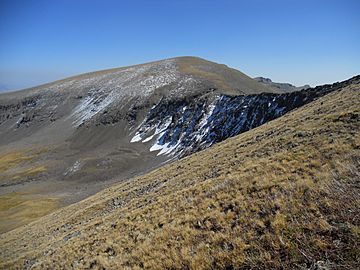
West Elk Peak is a tall mountain in Colorado. It stands at about 13,042 feet (3,975 meters) high. This makes it the highest point in the West Elk Mountains. You can find it in Gunnison County, Colorado, in a wild area called the West Elk Wilderness. The mountain is made mostly of volcanic rock. This rock is called West Elk Breccia and is very old, about 30 to 35 million years old!
Contents
How West Elk Peak Was Formed
West Elk Peak has a long and interesting history. It started forming a very long time ago, in the late Paleozoic Era. Back then, it was part of a high land area called the Uncompahgre highland.
Layers of Rock and Volcanoes
Over millions of years, during the Mesozoic and early Cenozoic eras, many layers of sand and mud piled up. These layers covered the old highland surface. They were about 10,000 to 15,000 feet thick!
Later, about 30 million years ago, something big happened. Hot, melted rock from deep inside the Earth started to push up. This melted rock formed huge underground areas called "batholiths." One of these batholiths pushed close enough to the surface to feed volcanoes. These volcanoes were in the West Elk Mountains and the nearby San Juan Mountains.
Shaped by Nature
The mountain area you see today was created by these volcanoes. Over time, the land has been pushed up slowly by forces inside the Earth. Water and ice have also played a big role. They have carved and shaped the mountain, giving it the look it has today.
Minerals and Coal
You might think such a big mountain would have lots of valuable minerals. But around West Elk Peak, there aren't many mineral deposits. However, a type of coal called bituminous coal has been found and mined on the northern and eastern sides of the mountain.
Other Names for the Peak
Over the years, West Elk Peak has been known by a couple of names.
- West Elk Mountain
- West Elk Peak (This is its official name today!)
 | Sharif Bey |
 | Hale Woodruff |
 | Richmond Barthé |
 | Purvis Young |


