Kensett, Arkansas facts for kids
Quick facts for kids
Kensett, Arkansas
|
|
|---|---|

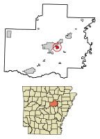
Location of Kensett in White County, Arkansas.
|
|
| Country | United States |
| State | Arkansas |
| County | White |
| Area | |
| • Total | 1.88 sq mi (4.87 km2) |
| • Land | 1.87 sq mi (4.83 km2) |
| • Water | 0.01 sq mi (0.03 km2) |
| Elevation | 226 ft (69 m) |
| Population
(2020)
|
|
| • Total | 1,400 |
| • Density | 750.27/sq mi (289.75/km2) |
| Time zone | UTC-6 (Central (CST)) |
| • Summer (DST) | UTC-5 (CDT) |
| ZIP code |
72082
|
| Area code(s) | 501 |
| FIPS code | 05-36430 |
| GNIS feature ID | 2404822 |
Kensett is a city located in White County, Arkansas, in the United States. It is right next to the city of Searcy. Kensett is known as the hometown of Wilbur D. Mills. He was an important politician in the United States House of Representatives during the 1960s and 1970s.
The current mayor of Kensett is Allen Edge. In 2010, about 1,648 people lived there. Many businesses have moved to Kensett to support the natural gas industry. The city is also a hub for landscaping and plant nurseries. For example, Double Springs sod farm is located nearby. Kensett has several restaurants and the lowest sales tax rate in White County.
Contents
Kensett's Location and Land
According to the United States Census Bureau, Kensett covers about 1.8 square miles (4.8 square kilometers). Most of this area is land. A very small part, about 0.56%, is water. Black Creek forms the eastern border of the city. This creek flows into the Little Red River, which is further northeast.
How Many People Live in Kensett?
| Historical population | |||
|---|---|---|---|
| Census | Pop. | %± | |
| 1880 | 86 | — | |
| 1920 | 480 | — | |
| 1930 | 889 | 85.2% | |
| 1940 | 827 | −7.0% | |
| 1950 | 829 | 0.2% | |
| 1960 | 905 | 9.2% | |
| 1970 | 1,444 | 59.6% | |
| 1980 | 1,751 | 21.3% | |
| 1990 | 1,741 | −0.6% | |
| 2000 | 1,791 | 2.9% | |
| 2010 | 1,648 | −8.0% | |
| 2020 | 1,400 | −15.0% | |
| U.S. Decennial Census | |||
Kensett's Population in 2020
The 2020 United States census counted 1,400 people living in Kensett. There were 717 households and 407 families in the city. The table below shows the different groups of people living in Kensett in 2020.
| Race | Number | Percentage |
|---|---|---|
| White (non-Hispanic) | 828 | 59.14% |
| Black or African American (non-Hispanic) | 219 | 15.64% |
| Native American | 6 | 0.43% |
| Asian | 4 | 0.29% |
| Other/Mixed | 95 | 6.79% |
| Hispanic or Latino | 248 | 17.71% |
Schools in Kensett
Students living in Kensett attend schools in the Riverview School District. This district includes Kensett Elementary School. Older students go to Riverview Junior High School and Riverview High School, both located in Searcy.
The Riverview School District was formed on July 1, 1991. It combined the school districts of Judsonia, Kensett, and Griffithville.
Getting Around Kensett
Kensett is served by three state highways. Arkansas Highway 36 (also called Wilbur D. Mills Avenue or Northeast 4th Street) crosses White County. It goes west into Faulkner County and southeast to the White River. Arkansas Highway 87 (Usery Road) runs next to the Union Pacific rail line. It connects southwest to Higginson. Arkansas Highway 385 (Southeast 1st Street or Depot Street) leads south to Griffithville. Other important roads include Searcy Street, which goes northeast into Searcy, and Old Railroad Road, which connects southeast to West Point.
Famous People from Kensett
- George Dickey – He was a catcher for two professional baseball teams, the Boston Red Sox and the Chicago White Sox.
- Georgia Holt – She was a singer, songwriter, actress, and model. She is also the mother of the famous singer and actress Cher.
See also
 In Spanish: Kensett (Arkansas) para niños
 | Shirley Ann Jackson |
 | Garett Morgan |
 | J. Ernest Wilkins Jr. |
 | Elijah McCoy |

