
Searcy, Arkansas facts for kids
Quick facts for kids
Searcy, Arkansas
|
||
|---|---|---|

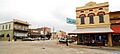
Part of historic downtown Searcy
|
||
|
||
| Motto(s):
Pride – Progress – Potential "The city where thousands live as millions wish they could."[1]
|
||

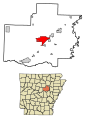
Location of Searcy in White County, Arkansas.
|
||
| Country | United States | |
| State | Arkansas | |
| County | White | |
| Founded | 1838 | |
| Incorporated | 1851 | |
| Area | ||
| • Total | 18.41 sq mi (47.69 km2) | |
| • Land | 18.32 sq mi (47.44 km2) | |
| • Water | 0.10 sq mi (0.25 km2) | |
| Elevation | 245 ft (75 m) | |
| Population
(2020)
|
||
| • Total | 22,937 | |
| • Density | 1,252.22/sq mi (483.50/km2) | |
| Time zone | UTC-6 (CST) | |
| • Summer (DST) | UTC-5 (CDT) | |
| ZIP codes |
72143, 72145, 72149
|
|
| Area code(s) | 501 | |
| FIPS code | 05-63020 | |
| GNIS feature ID | 2405437 | |
Searcy (pronounced SUR-see) is the biggest city in White County, Arkansas, USA. It's also the county seat, which means it's where the county government is located. In 2019, about 23,767 people lived there.
Searcy is the main city in the Searcy Micropolitan Area, which covers all of White County. The city is named after Richard Searcy, who was a judge for the Superior Court of the Arkansas Territory. Searcy is known as a college town because it's home to Harding University and ASU-Searcy.
Contents
History of Searcy
Searcy was first called White Sulphur Springs. Its name changed in 1837, two years after White County was created. The state renamed the county seat to honor Richard Searcy (1794-1832), an important Arkansas lawmaker.

The town had a health spa from its beginning until 1820. The special springs that made the spa famous then dried up.
Israel Moore, who came from Philadelphia, planned Searcy's first streets. He named the main streets after those in Old Philadelphia, near Independence Hall. These names include Race, Arch, Market, Vine, Spring, Cherry, Spruce, Locust, and Pine. In 1957, Searcy named Moore Street after him.
Spring Street and downtown Searcy's Spring Park are named for the town's early history. The community was once known as White Sulphur Springs. As early as 1834, local springs were thought to have healing powers. This drew visitors, much like the popular Hot Springs.
During the American Civil War, a battle called the Battle of Whitney's Lane happened near Searcy. The exact spot is still debated. Searcy Landing, on the Little Red River, is where some Union Army soldiers are buried.
Searcy officially became a city on August 6, 1851.

The Smyrna Methodist Church, just west of Searcy, is the oldest church building still standing in Arkansas. It was built in 1856.
Searcy also has the oldest working courthouse in the state, the White County Courthouse. It was finished in 1837. The current courthouse was built in 1871. It has a clocktower with a model of the Liberty Bell from 1855.
Searcy was a stop on the Missouri and North Arkansas Railroad. This train line carried people and goods from 1906 to 1946. It ran from Joplin, Missouri, to Helena in eastern Arkansas.
On August 9, 1965, a fire happened at a Titan II missile silo north of Searcy. This event led to the loss of 53 civilian workers. It was a very large industrial accident in American history.
In 2019, Searcy won the "Small Business Revolution on Main Street" award. This gave the city $500,000 to improve six small businesses. These renovations were shown on the Hulu TV show hosted by Amanda Brinkman.
Geography and Climate
Searcy covers about 14.8 square miles (38.3 square kilometers). Most of this area is land, with a small part being water.
Climate in Searcy
The weather in Searcy has hot, humid summers. Winters are usually mild to cool. Searcy has a humid subtropical climate. This means it gets plenty of rain all year, and temperatures are generally warm.
| Climate data for Searcy, Arkansas (1991–2020 normals, extremes 1892–1895, 1915–present) | |||||||||||||
|---|---|---|---|---|---|---|---|---|---|---|---|---|---|
| Month | Jan | Feb | Mar | Apr | May | Jun | Jul | Aug | Sep | Oct | Nov | Dec | Year |
| Record high °F (°C) | 87 (31) |
86 (30) |
91 (33) |
97 (36) |
99 (37) |
109 (43) |
112 (44) |
115 (46) |
111 (44) |
100 (38) |
87 (31) |
81 (27) |
115 (46) |
| Mean maximum °F (°C) | 68.8 (20.4) |
74.1 (23.4) |
80.8 (27.1) |
86.3 (30.2) |
91.8 (33.2) |
97.1 (36.2) |
100.8 (38.2) |
100.9 (38.3) |
96.0 (35.6) |
88.0 (31.1) |
77.7 (25.4) |
69.9 (21.1) |
102.4 (39.1) |
| Mean daily maximum °F (°C) | 49.1 (9.5) |
54.1 (12.3) |
63.0 (17.2) |
73.0 (22.8) |
81.6 (27.6) |
89.6 (32.0) |
93.0 (33.9) |
92.1 (33.4) |
85.4 (29.7) |
73.8 (23.2) |
61.3 (16.3) |
51.6 (10.9) |
72.3 (22.4) |
| Daily mean °F (°C) | 39.6 (4.2) |
43.6 (6.4) |
52.3 (11.3) |
61.7 (16.5) |
71.1 (21.7) |
79.4 (26.3) |
82.8 (28.2) |
81.5 (27.5) |
74.2 (23.4) |
62.2 (16.8) |
50.8 (10.4) |
42.3 (5.7) |
61.8 (16.6) |
| Mean daily minimum °F (°C) | 30.0 (−1.1) |
33.2 (0.7) |
41.5 (5.3) |
50.4 (10.2) |
60.6 (15.9) |
69.3 (20.7) |
72.6 (22.6) |
70.9 (21.6) |
63.0 (17.2) |
50.7 (10.4) |
40.3 (4.6) |
33.0 (0.6) |
51.3 (10.7) |
| Mean minimum °F (°C) | 13.3 (−10.4) |
17.3 (−8.2) |
22.9 (−5.1) |
33.2 (0.7) |
44.6 (7.0) |
57.3 (14.1) |
63.1 (17.3) |
60.1 (15.6) |
46.9 (8.3) |
33.7 (0.9) |
23.1 (−4.9) |
17.8 (−7.9) |
10.8 (−11.8) |
| Record low °F (°C) | −20 (−29) |
−10 (−23) |
9 (−13) |
24 (−4) |
34 (1) |
44 (7) |
51 (11) |
46 (8) |
31 (−1) |
22 (−6) |
11 (−12) |
−4 (−20) |
−20 (−29) |
| Average precipitation inches (mm) | 3.58 (91) |
3.90 (99) |
5.07 (129) |
5.42 (138) |
5.93 (151) |
3.02 (77) |
3.87 (98) |
3.41 (87) |
3.83 (97) |
4.13 (105) |
4.77 (121) |
4.91 (125) |
51.84 (1,317) |
| Average snowfall inches (cm) | 0.7 (1.8) |
0.6 (1.5) |
0.4 (1.0) |
0.0 (0.0) |
0.0 (0.0) |
0.0 (0.0) |
0.0 (0.0) |
0.0 (0.0) |
0.0 (0.0) |
0.0 (0.0) |
0.0 (0.0) |
0.1 (0.25) |
1.8 (4.6) |
| Average precipitation days (≥ 0.01 in) | 9.1 | 7.9 | 10.1 | 9.5 | 9.6 | 7.1 | 7.9 | 6.9 | 6.3 | 7.8 | 8.5 | 9.3 | 100.0 |
| Average snowy days (≥ 0.1 in) | 0.4 | 0.4 | 0.3 | 0.0 | 0.0 | 0.0 | 0.0 | 0.0 | 0.0 | 0.0 | 0.1 | 0.2 | 1.4 |
| Source: NOAA | |||||||||||||
Population and People
| Historical population | |||
|---|---|---|---|
| Census | Pop. | %± | |
| 1860 | 621 | — | |
| 1870 | 874 | 40.7% | |
| 1880 | 840 | −3.9% | |
| 1890 | 1,203 | 43.2% | |
| 1900 | 1,995 | 65.8% | |
| 1910 | 2,331 | 16.8% | |
| 1920 | 2,836 | 21.7% | |
| 1930 | 3,387 | 19.4% | |
| 1940 | 3,670 | 8.4% | |
| 1950 | 6,024 | 64.1% | |
| 1960 | 7,272 | 20.7% | |
| 1970 | 9,040 | 24.3% | |
| 1980 | 13,612 | 50.6% | |
| 1990 | 15,180 | 11.5% | |
| 2000 | 18,928 | 24.7% | |
| 2010 | 22,858 | 20.8% | |
| 2020 | 22,937 | 0.3% | |
| U.S. Decennial Census | |||
Searcy's Population in 2020
| Race | Number | Percentage |
|---|---|---|
| White (non-Hispanic) | 17,461 | 76.13% |
| Black or African American (non-Hispanic) | 2,439 | 10.63% |
| Native American | 77 | 0.34% |
| Asian | 401 | 1.75% |
| Pacific Islander | 12 | 0.05% |
| Other/Mixed | 1,300 | 5.67% |
| Hispanic or Latino | 1,247 | 5.44% |
In 2020, there were 22,937 people living in Searcy. There were 8,205 households and 4,810 families.
Population in 2014
In 2014, Searcy had 23,768 people. The city had 8,140 households. About 27.4% of households had children under 18. Many households (51.8%) were married couples.
The average household had 2.28 people. The average family had 2.86 people. About 20.5% of the population was under 18. About 14.7% were 65 or older. The average age in Searcy was 30 years old.
Economy and Businesses
First Security Bank, one of Arkansas's largest banks, started in downtown Searcy in 1932. It was first called Security Bank.
In 1978, Walmart opened its first distribution center outside of Bentonville in eastern Searcy. This building is still used as a Sam's Club distribution center. A larger Walmart distribution center has since opened in southern Searcy. Walmart has also had retail stores in Searcy since the 1970s.
The sales tax for purchases in Searcy is 9.5%, which is higher than the state average.
Education in Searcy
Searcy has both public and private schools, as well as colleges.
Public Schools
Most of Searcy is served by the Searcy Public Schools district. This district includes:
- Searcy High School
- Ahlf Junior High School
- Southwest Middle School
- McRae Elementary
- Sidney Deener Elementary
- Westside Elementary
A small part of eastern Searcy is in the Riverview School District. This district operates Riverview High School and Riverview Junior High School in Searcy.
Private Schools
- Harding Academy is a school for students from kindergarten through 12th grade. It prepares students for college. It is overseen by Harding University and is next to the university campus.
- Liberty Christian School (PK – 6)
- CrossPointe Preparatory opened in 2009. It is part of the National Association of University-Model Schools.
- Sunshine School
Colleges and Universities
- Harding University is a private Christian university. It was founded in 1924 and moved to Searcy in 1934. It has grown to include 49 buildings on over 350 acres. With more than 6,100 students, Harding University is the biggest private university in Arkansas.
- A campus of Arkansas State University is also in Searcy. It used to be Foothills Technical Institute. It is a technical campus of nearby Arkansas State University Beebe. It offers several two-year programs.
Notable People from Searcy
- Mike Beebe, a former governor of Arkansas
- Ed Bethune, a former U.S. representative
- Stephen Mark Brown, an opera singer
- John Paul Capps, a politician
- Weston Dacus, an NFL linebacker
- Beth Ditto, lead singer for the band Gossip (band)
- Les Eaves, a state representative for White County
- James Hannah, former chief justice of the Arkansas Supreme Court
- Eugene Lambert, a basketball and football coach
- Bryce Mitchell, a mixed martial artist in the UFC
Images for kids
-
Part of historic downtown Searcy
-
Location of Searcy in White County, Arkansas.
-

City of Searcy Logo
See also
 In Spanish: Searcy (Arkansas) para niños
