Kent Peak (Boulder Mountains, Idaho) facts for kids
Quick facts for kids Kent Peak |
|
|---|---|

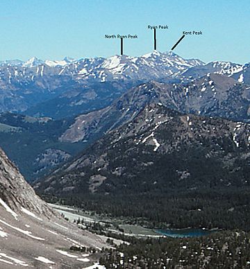
Kent Peak viewed from below Castle Peak
|
|
| Highest point | |
| Elevation | 11,664 ft (3,555 m) |
| Prominence | 584 ft (178 m) |
| Geography | |
| Parent range | Boulder Mountains |
| Topo map | USGS Ryan Peak |
| Climbing | |
| Easiest route | Scramble, class 3 |
Kent Peak is a tall mountain in Idaho, standing at 11,664 feet (3,555 m) above sea level. It's the second highest peak in the Boulder Mountains. This mountain is special because it sits right on the border of two counties, Blaine and Custer. It's also very close to the highest point in the range, Ryan Peak, which is only about 0.75 miles (1,210 m) away.
Kent Peak is part of some important natural areas. It's on the edge of the Sawtooth National Recreation Area and the Salmon-Challis National Forest. A part of it is even inside the Hemingway–Boulders Wilderness, which is a protected wild area. Overall, Kent Peak is the 34th tallest mountain in all of Idaho!
Discovering Kent Peak: A Majestic Idaho Mountain
Kent Peak is a truly impressive mountain in Idaho. It's known for its height, reaching over 11,600 feet into the sky! This makes it one of the tallest mountains you can find in the state. It's part of the beautiful Boulder Mountains, which are famous for their rugged beauty and amazing views.
Where is Kent Peak Located?
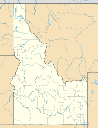
You can find Kent Peak right on the line between Blaine County and Custer County in central Idaho. It's not far from another big mountain called Ryan Peak. In fact, Kent Peak is just a short distance south of Ryan Peak, which is the very highest point in the Boulder Mountains.
The mountain is also part of some important natural areas. It touches the Sawtooth National Recreation Area, which is a huge area set aside for outdoor fun. It's also next to the Salmon-Challis National Forest, a large forest managed for wildlife and recreation. Part of Kent Peak is even within the Hemingway–Boulders Wilderness, a special area where nature is kept wild and untouched.
How Can You Reach Kent Peak?
If you're an experienced hiker and want to explore Kent Peak, there's a main way to get there. The journey usually starts north of Ketchum, a town in Idaho. You'll need to follow Idaho State Highway 75 to the Sawtooth National Recreation Area headquarters.
From the headquarters, you take national forest road 146. You follow this road until it ends, where you'll find the trailhead. There's a trail, number 115, that goes up a ridge to the west of Kent Peak. However, the most common way to climb the mountain is by following the south ridge. This route is considered a "class 3" climb, which means it involves some basic scrambling over rocks, but it's not technical rock climbing.
 | Leon Lynch |
 | Milton P. Webster |
 | Ferdinand Smith |


