Kiowa, Kansas facts for kids
Quick facts for kids
Kiowa, Kansas
|
|
|---|---|

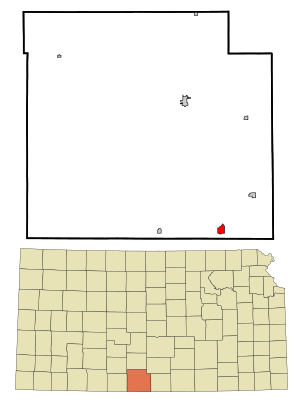
Location within Barber County and Kansas
|
|

|
|
| Country | United States |
| State | Kansas |
| County | Barber |
| Founded | 1872 |
| Incorporated | 1885 |
| Named for | Kiowa people |
| Government | |
| • Type | Mayor–Council |
| Area | |
| • Total | 1.11 sq mi (2.87 km2) |
| • Land | 1.11 sq mi (2.87 km2) |
| • Water | 0.00 sq mi (0.00 km2) |
| Elevation | 1,332 ft (406 m) |
| Population
(2020)
|
|
| • Total | 902 |
| • Density | 813/sq mi (314.3/km2) |
| Time zone | UTC-6 (CST) |
| • Summer (DST) | UTC-5 (CDT) |
| ZIP code |
67070
|
| Area code | 620 |
| FIPS code | 20-37125 |
| GNIS ID | 2395545 |
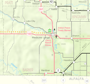
Kiowa is a city located in Barber County, Kansas, in the United States. In 2020, about 902 people lived there. It's found just one mile north of the border between Kansas and Oklahoma.
Contents
Kiowa's History and Important Events
Kiowa's Early Days: The 1800s
Kiowa started as a town in 1872. It was named after the Kiowa people, a Native American tribe.
Kiowa in the 1900s
On June 7, 1900, a famous activist named Carrie Nation visited Kiowa. She was known for protesting against places that sold alcohol. She caused a stir by damaging her first saloon here.
In 1905, a railroad line was built connecting Kiowa to Enid, Oklahoma. This line was later sold to a larger company, the Atchison, Topeka and Santa Fe Railway, in 1907. Part of this railway line was no longer used after 1996.
Kiowa's Location and Area
According to the United States Census Bureau, Kiowa covers about 1.07 square miles (2.77 square kilometers). All of this area is land, with no large bodies of water inside the city limits.
Who Lives in Kiowa? Population Facts
| Historical population | |||
|---|---|---|---|
| Census | Pop. | %± | |
| 1880 | 42 | — | |
| 1890 | 893 | 2,026.2% | |
| 1900 | 765 | −14.3% | |
| 1910 | 1,520 | 98.7% | |
| 1920 | 1,539 | 1.3% | |
| 1930 | 1,501 | −2.5% | |
| 1940 | 1,379 | −8.1% | |
| 1950 | 1,561 | 13.2% | |
| 1960 | 1,674 | 7.2% | |
| 1970 | 1,414 | −15.5% | |
| 1980 | 1,409 | −0.4% | |
| 1990 | 1,160 | −17.7% | |
| 2000 | 1,055 | −9.1% | |
| 2010 | 1,026 | −2.7% | |
| 2020 | 902 | −12.1% | |
| U.S. Decennial Census | |||
Kiowa's Population in 2020
The 2020 United States census showed that 902 people lived in Kiowa. There were 404 households and 230 families. Most residents, about 90.8%, identified as white.
About 22.5% of the people were under 18 years old. The average age in Kiowa was 43.9 years.
Kiowa's Population in 2010
In 2010, the census counted 1,026 people living in Kiowa. There were 466 households. The city's population density was about 958.9 people per square mile.
Most of the people, 95.3%, were White. About 24.5% of households had children under 18. The average age in the city was 46.9 years.
Education in Kiowa
Kiowa is part of the South Barber USD 255 public school district. This district serves the community's students.
The Kiowa Chieftains, a high school track and field team, won a state championship in 1940. This was a big achievement for the school!
Local News in Kiowa
Kiowa has its own weekly newspaper. It's called The Kiowa News. This paper shares local stories and updates with the community.
Transportation and Infrastructure
Two main highways, K-2 and K-8, pass through Kiowa. The Southern Transcon railway line, operated by BNSF Railway, also runs through the city. These routes help people and goods travel to and from Kiowa.
Famous People From Kiowa
- Marcellus Boss: He was the fifth Civilian Governor of Guam. Before that, he worked as Kiowa's city attorney.
- Charles E. Brown, Jr.: He became the Chief of Chaplains for the U.S. Army.
- Bill Tidwell: He was a great athlete who won four national championships in middle-distance running. He later became a coach and athletic director.
- James Wilson: He served as a State Representative in Colorado.
See also
 In Spanish: Kiowa (Kansas) para niños
 | Toni Morrison |
 | Barack Obama |
 | Martin Luther King Jr. |
 | Ralph Bunche |

