Knife River (Lake Superior) facts for kids
Quick facts for kids Knife River (Lake Superior) |
|
|---|---|

Knife River
|
|
|
Mouth of the Knife River
|
|
| Country | United States |
| State | Minnesota |
| County | St. Louis, Lake County |
| Physical characteristics | |
| Main source | King Lake 47°09′12″N 91°45′17″W / 47.1532623°N 91.7546197°W |
| River mouth | Knife River, Minnesota, Lake Superior 46°56′59″N 91°46′44″W / 46.9496578°N 91.7787897°W |
| Length | 23.9-mile-long (38.5 km) |
The Knife River is a cool river in northern Minnesota. It's about 23.9 miles (38.5 km) long. This river flows through parts of Lake and Saint Louis counties. It eventually empties into Lake Superior, one of the Great Lakes! You can find it between the cities of Duluth and Two Harbors.
Contents
What's in a Name?
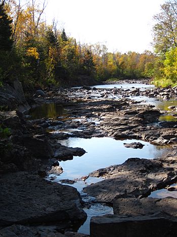
The name Knife River comes from the Ojibwe language. Their name for it was Mokomani Zibi. People think the river got this name because of the long, sharp stones. These stones are found near where the river meets Lake Superior.
River's Journey
The main part of the Knife River flows for about 23.9 miles. It starts at King Lake and flows towards Lake Superior. The river runs mostly parallel to the shoreline. It also has about four or five smaller streams that flow into it. These smaller streams are called tributaries.
River's Area
The entire area that drains water into the Knife River is called its watershed. This watershed covers about 84.3 square miles (218.3 km²). Inside this area, there are many streams. If you added up the length of all these streams, it would be about 181.1 miles (291.4 km)!
Water Flow
Scientists have been measuring the Knife River's water flow since 1974. On average, it carries about 90.3 cubic feet (2.56 m³) of water every second. That's a lot of water moving by!
River Health
People are keeping a close eye on the Knife River's water quality. There's a concern about too much sediment in the water. Sediment is like tiny bits of dirt or sand floating around. Because of this, the river was put on a special list in 1998. This list is for waters that need help to become cleaner.
A study in 2008 looked into where all this sediment was coming from. They found that most of it, about 60%, came from the riverbanks eroding. Another 30% came from the river's bluffs, which are like steep cliffs along the river.
Land Around the River
Most of the land around the Knife River is natural and undeveloped. About 72% of the watershed is covered by forests. Another 16% is wetland, which is land that is often wet or covered with water. About 6% is open grassland.
Only a small part of the land is used for farming, about 5%. The last 1% is where the small community of Knife River, Minnesota is located. This community sits right at the mouth of the river.
 | Aaron Henry |
 | T. R. M. Howard |
 | Jesse Jackson |


