Kollumerland en Nieuwkruisland facts for kids
Quick facts for kids
Kollumerland en Nieuwkruisland
Kollumerlân en Nijkrúslân
Kollumerland c.a.
|
|||
|---|---|---|---|

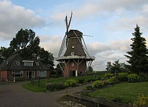
Windmill Rust Roest
|
|||
|
|||

Location in Friesland
|
|||
| Country | Netherlands | ||
| Province | |||
| Merged | 2019 | ||
| Area | |||
| • Total | 116.35 km2 (44.92 sq mi) | ||
| • Land | 109.75 km2 (42.37 sq mi) | ||
| • Water | 6.60 km2 (2.55 sq mi) | ||
| Elevation | 0.9 m (3.0 ft) | ||
| Highest elevation | 1.6 m (5.2 ft) | ||
| Lowest elevation | 0 m (0 ft) | ||
| Population
(May 2014)
|
|||
| • Total | 12,905 | ||
| • Density | 118/km2 (310/sq mi) | ||
| Time zone | UTC+1 (CET) | ||
| • Summer (DST) | UTC+2 (CEST) | ||
| Postcode |
9291–9299, 9851–9853
|
||
| Area code | 0511, 0594 | ||
Kollumerland en Nieuwkruisland was a special area in the northern Netherlands. It was a type of local government area called a municipality. You could find it in the province of Friesland.
In 2019, Kollumerland en Nieuwkruisland joined with two other municipalities. These were Dongeradeel and Ferwerderadiel. Together, they formed a brand new municipality called Noardeast-Fryslân. So, Kollumerland en Nieuwkruisland no longer exists as a separate municipality.
Towns and Villages
This area was home to several towns and villages. Each had its own unique character. These places were part of the daily life for the people living there.
Here are the main places that were part of Kollumerland en Nieuwkruisland:
- Augsbuurt
- Burum
- Kollum
- Kollumerpomp
- Kollumerzwaag
- Munnekezijl
- Oudwoude
- Triemen
- Veenklooster
- Warfstermolen
- Westergeest
- Zwagerbosch
Population Numbers
As of April 1, 2016, Kollumerland en Nieuwkruisland had a population of 12,775 people. This number came from the CBS, which is the Dutch statistics office.
Understanding the Landscape
The land in Kollumerland en Nieuwkruisland was mostly flat. It was typical of the Dutch landscape. You could see canals, fields, and small towns.
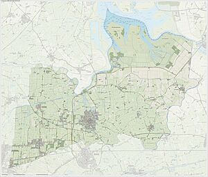
This map shows the layout of the municipality. It helps you see where the different villages were located. It also shows the waterways and roads.
See also
 You can also read about Kollumerland en Nieuwkruisland in Spanish: Kollumerland en Nieuwkruisland para niños
 | James B. Knighten |
 | Azellia White |
 | Willa Brown |


