
Koolunga, South Australia facts for kids
Quick facts for kids KoolungaSouth Australia |
|||||||||||||||
|---|---|---|---|---|---|---|---|---|---|---|---|---|---|---|---|

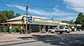
Sixth Street, Koolunga
|
|||||||||||||||

Koolunga
Location in South Australia
|
|||||||||||||||
| Population | 195 (2016 census) | ||||||||||||||
| Postcode(s) | 5464 | ||||||||||||||
| Location |
|
||||||||||||||
| LGA(s) | Port Pirie Regional Council | ||||||||||||||
| Region | Mid North | ||||||||||||||
| State electorate(s) | Frome | ||||||||||||||
| Federal Division(s) | Grey | ||||||||||||||
|
|||||||||||||||
Koolunga is a small town in the Mid North area of South Australia. Its postcode is 5464. In 2016, about 200 people lived in the town and its surrounding areas.
Contents
History of Koolunga
The land where Koolunga now stands was first looked at for settlement in 1846 by John Hope. The town of Koolunga started in the 1880s. It was built next to the Broughton River. This spot was special because it had a shallow place to cross the river, known as "Hope's Crossing."
The government officially planned the town on August 30, 1875. The first pieces of land were sold on October 7, 1875. The name Koolunga comes from the Ngadjuri people, who are Aboriginal Australians. It means "red banks," which describes the red riverbanks of the Broughton River nearby.
In the early 1900s, Koolunga was a busy place. It had a general store, a hotel, a post office, a butcher shop, a town hall, a church, and a garage. Over time, some of these businesses closed down. The general store, post office, and butcher shop became homes.
There was once a railway station called Koolunga. It was later renamed Boucaut station. This station was about 11 kilometres (7 miles) southeast of the town. The railway line did not go directly through Koolunga itself.
What Koolunga Does: Economy
The main ways people make a living in Koolunga and the nearby areas are through farming. Farmers mostly grow cereals like wheat and barley, and also canola. Some people also raise sheep, but this is less common.
Services in Koolunga
Koolunga is a small town, so it offers basic services for its residents. These services also support the local farming industry. For bigger shopping trips or public services, people usually travel to larger towns. These towns include Port Pirie, Crystal Brook, or Clare.
Koolunga has a small primary school for younger students. There is also a bowling green for playing lawn bowls. These are located on the edges of the town.
Bunyip Park and Trail
Bunyip Park is on the southeast side of Koolunga. It has a gate that leads to the Bunyip River Trail. This trail is a short loop that follows both sides of the Broughton River. Bunyip Park has simple barbecue facilities. You can also use it as a campsite.
The park is named after the bunyip. This is a large creature from Aboriginal mythology. People believed a bunyip was seen in a nearby waterhole in 1883.
How Koolunga is Governed
Koolunga is part of the Port Pirie Regional Council. This is the local government group that makes decisions for the area. For state government, Koolunga is in the South Australian House of Assembly's electoral district of Frome. This means people in Koolunga vote for a representative in the state parliament from the Frome area. For the national government, Koolunga is in the Australian House of Representatives's Division of Grey. This means they vote for a representative in the national parliament from the Grey area.
Images for kids
-
The Koolunga Hotel was established in 1876

