
Kurnool district facts for kids
Kurnool District is a special area, or district, located in the state of Andhra Pradesh, India. It's in the west-central part of the state. This district shares its borders with several other districts. To the north, it touches Mahabubnagar district in Telangana. To the west, it's next to Raichur district and Bellary district in Karnataka. To the south, you'll find Anantapur district, and to the southeast, YSR Kadapa district. Finally, Prakasham district is to its east.
The main city and headquarters of Kurnool District is Kurnool city. In 2011, the district had a population of about 4,053,463 people. About 28% of these people lived in cities. Kurnool District is quite large! It's the 10th largest district in all of India by area and the 2nd largest in Andhra Pradesh. It covers about 17,658 square kilometers (6,818 square miles). In terms of population, it ranks 53rd among all districts in India.
Contents
People and Population in Kurnool District
Let's learn about the people who live in Kurnool District! According to a survey in 2011, the district had a population of about 4,046,601 people. This number is similar to the population of a country like Liberia or the US state of Oregon.
Population Density and Growth
Kurnool District is home to many people. On average, there are about 229 people living in every square kilometer (590 people per square mile). Between 2001 and 2011, the population grew by about 14.65%.
Gender Balance and Education
In Kurnool District, for every 1000 males, there are about 984 females. This is called the sex ratio. The district also has a good number of people who can read and write. About 61.13% of the people in Kurnool District are literate.
| Religions in Kurnool | ||||
|---|---|---|---|---|
| Religion | Percent | |||
| Hindus | 82.11% | |||
| Muslims | 16.55% | |||
| Christian | 0.82% | |||
| Others† | 0.52% | |||
| Distribution of religions | ||||
Images for kids
-
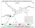
Pre Historic Sites of Krishna-Tungabhadra valley, scattered at different places in Kurnool district
-
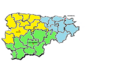
Kurnool District Revenue Divisions
-
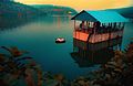
Back Waters of Srisailam Dam
-
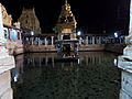
Maha Nandi Temple
-
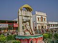
Mantralayam
-
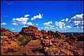
Orvakal Rock Gardens
-
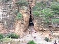
Yaganti Temple Cave
-
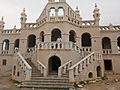
Nawab Bungalow, Banaganapalli
-
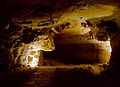
Belum Caves
-
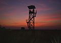
Watch Tower in Rollapadu Wild Life Sanctuary


.jpg)


See also
 In Spanish: Distrito de Kurnool para niños
