La Palma, El Salvador facts for kids
Quick facts for kids
La Palma
|
|
|---|---|
|
Municipality
|
|

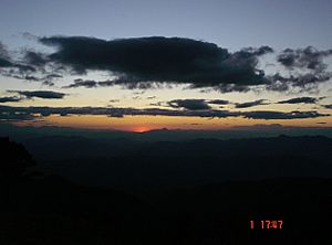
Panorama of the municipality of La Palma from the mountains
|
|

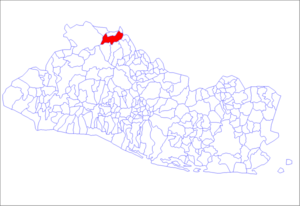
Location of the municipality of La Palma in El Salvador
|
|
| Country | |
| Department | Chalatenango Department |
| Area | |
| • Total | 135.60 km2 (52.36 sq mi) |
| Elevation | 1,059 m (3,474 ft) |
| Population
(2006)
|
|
| • Total | 24,000 |
La Palma is a cool town (called a municipality) in El Salvador. It's located in the Chalatenango area, which is in the mountains. This municipality covers about 135.60 square kilometers. In 2006, around 24,000 people lived there.
La Palma is important in history because it played a big role in ending the Civil War of El Salvador. It was a place where peace talks happened between different groups.
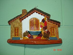
Today, La Palma is known for its beautiful mountains and a lively community of artists. It's one of the best places in El Salvador for handmade crafts. Selling these crafts to tourists and other countries helps the local economy a lot.
Contents
History of La Palma
La Palma got its name from a small village called Palmita during the time of the Spanish colonies. This village was near the Nonuapa River. In 1882, a flood from the river made the villagers move. They settled in the current spot and started the town of La Palma.
In 1959, a special law made La Palma an official town and municipality. It included several smaller areas called cantons, like Los Horcones and San José Sacaré.
La Palma's Role in the Civil War
La Palma was very important during the Civil War of El Salvador. From 1980, it became a key spot for the FMLN (a group of rebels). Later, it was a place where battles happened between the rebels and the government army.
A major event took place on October 15, 1984. The president, Jose Napoleón Duarte, met with the leaders of the FMLN in La Palma. This meeting was the first step towards peace. It led to the Peace Accords of Chapultepec, which finally ended the war.
Geography and Climate
La Palma covers about 131.89 square kilometers. It shares borders with other towns like San Ignacio and Agua Caliente. To the east, it borders Honduras and other Salvadoran towns. To the west, it borders Metapan and Citalá, with the Lempa River forming part of the border.
La Palma is in the mountainous part of El Salvador, so it has a cool climate. The municipality is divided into 8 main areas called cantons and 87 smaller villages in the countryside. The main town area has 6 districts. In 1956, La Palma had about 5,337 people. By 2006, the population had grown to about 24,000 people.
Weather in La Palma
| Climate data for La Palma, El Salvador (1991–2020) | |||||||||||||
|---|---|---|---|---|---|---|---|---|---|---|---|---|---|
| Month | Jan | Feb | Mar | Apr | May | Jun | Jul | Aug | Sep | Oct | Nov | Dec | Year |
| Mean daily maximum °C (°F) | 26.7 (80.1) |
28.6 (83.5) |
30.1 (86.2) |
30.5 (86.9) |
28.9 (84.0) |
27.5 (81.5) |
28.0 (82.4) |
27.9 (82.2) |
27.1 (80.8) |
26.5 (79.7) |
26.0 (78.8) |
26.2 (79.2) |
27.8 (82.0) |
| Daily mean °C (°F) | 19.7 (67.5) |
20.8 (69.4) |
22.0 (71.6) |
23.1 (73.6) |
22.7 (72.9) |
22.0 (71.6) |
21.9 (71.4) |
21.8 (71.2) |
21.5 (70.7) |
21.2 (70.2) |
20.3 (68.5) |
19.8 (67.6) |
21.4 (70.5) |
| Mean daily minimum °C (°F) | 14.8 (58.6) |
15.0 (59.0) |
15.8 (60.4) |
17.2 (63.0) |
18.0 (64.4) |
17.9 (64.2) |
17.6 (63.7) |
17.7 (63.9) |
17.7 (63.9) |
17.5 (63.5) |
16.4 (61.5) |
15.4 (59.7) |
16.8 (62.2) |
| Average precipitation mm (inches) | 1.7 (0.07) |
15.1 (0.59) |
19.4 (0.76) |
81.4 (3.20) |
278.7 (10.97) |
446.6 (17.58) |
317.3 (12.49) |
397.8 (15.66) |
475.8 (18.73) |
289.0 (11.38) |
50.6 (1.99) |
5.7 (0.22) |
2,379 (93.66) |
| Average relative humidity (%) | 78 | 76 | 74 | 76 | 83 | 88 | 86 | 87 | 90 | 87 | 82 | 80 | 82.3 |
| Source: Ministerio de Medio Ambiente y Recursos Naturales | |||||||||||||
Economy and Crafts
The economy of La Palma mostly depends on arts and crafts. About 75% of the people earn their living from making and selling these items. Tourism also brings in a lot of money. The other 25% of the population works in agriculture. They grow crops like vegetables, corn, beans, and coffee.
The Art of La Palma
In the 1970s, an artist named Fernando Llort helped develop the unique art style in La Palma. He started an artisan industry that became the main source of jobs.
Today, there are about 100 craft workshops in La Palma. Half of these workshops make items to sell to other countries. This growth in craft exports is special for La Palma, as it's not common in other parts of the country.
Farming in La Palma
Coffee growing is the second most important industry in La Palma. However, it has been decreasing because of strong competition from other countries. In 1988, coffee sales made up more than half of El Salvador's money from exports. But by 2004, this had dropped a lot, to only 7%.
Fun Places to Visit
La Palma has many cool places to explore, especially if you love nature and adventure!
- Miramundo: About 13 kilometers from La Palma town, you'll find Miramundo. It's in a hill forest, very high up at 2400 meters. It's known for its super cool climate, with an average temperature of just 12°C. It's a great place to escape the heat!
- San Ignacio: Just 3 kilometers away is San Ignacio, a small town at 1010 meters. You can find hotels here and lots of fun tourist activities. The town of Citalá and the Lempa River are also very close by.
- Las Pilas: This spot is in the mountain forest of La Palma. It has an even colder climate than Miramundo! Farmers here grow special crops like blackberries, strawberries, peaches, lettuce, and cabbages because of the cool weather.
- Cayahuanca Stone: This amazing rock is about 4 kilometers north of San Ignacio. It's located right on the border between Honduras and El Salvador, about 1550 meters above sea level. From the top, you get an incredible view of both countries! During Easter, local people and visitors often camp overnight at the Cayahuanca Stone.
- El Pital: This is the highest point in El Salvador, standing tall at 2730 meters! It's about 12 kilometers from La Palma town. El Pital is a mountain covered in a cloudy forest, with an average temperature of only 10°C. On April 13, 2004, it got so cold that parts of the mountain were covered in frost and ice, which was a big surprise for everyone!
See also
 In Spanish: La Palma (El Salvador) para niños


