Lempa River facts for kids
Quick facts for kids Lempa River |
|
|---|---|

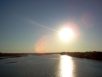
Sunset over the Lempa river
|
|

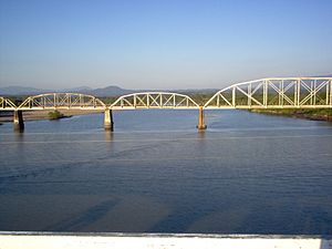
Railroad Bridge (FENADESAL) over the Lempa river, as seen from the Carretera del Litoral highway bridge (El Salvador)
|
|
| Countries | |
| Physical characteristics | |
| Main source | Sierra Madre Olopa, Chiquimula, Guatemala 1,200 m (3,900 ft) 14°41′33″N 89°18′18″W / 14.69250°N 89.30500°W |
| River mouth | Pacific Ocean El Playón, Tecoluca, San Vicente, El Salvador 0 m (0 ft) 13°15′17″N 88°49′38″W / 13.25472°N 88.82722°W |
| Length | 422 km (262 mi) |
| Basin features | |
| Basin size | 18,246 km2 (7,045 sq mi) |
The Lempa River (called Río Lempa in Spanish) is a very important river in Central America. It stretches for about 422 kilometers (262 miles).
Contents
River's Journey: Where the Lempa River Flows
The Lempa River starts its journey in the mountains of southern Guatemala. It begins between two mountain ranges, the Sierra Madre and the Sierra del Merendón. Near the town of Olopa, the river is first known as the Río Olopa.
It flows south for about 30 kilometers (19 miles) in Guatemala. Then, it enters Honduras and officially becomes the Lempa River. It travels through Honduras for about 31 kilometers (19 miles).
The river then crosses into El Salvador near the town of Citalá. It continues for another 360 kilometers (224 miles) through El Salvador. The Lempa River generally flows south until it reaches the Pacific Ocean in the San Vicente area. A small part of the river also forms the border between El Salvador and Honduras.
River Basin: How Much Land Does the Lempa River Cover?
A river's watershed (or basin) is all the land where water drains into that river. The Lempa River's watershed is huge, covering about 18,246 square kilometers (7,045 square miles).
Most of this basin, about 10,255 square kilometers (3,959 square miles), is in El Salvador. This means that nearly half of El Salvador's land is part of the Lempa River basin. Many people in El Salvador, about 77.5 percent of the population, live in cities and towns within this basin. This includes the capital city, San Salvador. The rest of the basin is in Honduras (5,696 square kilometers or 2,200 square miles) and Guatemala (2,295 square kilometers or 886 square miles).
Hydroelectricity: Power from the River
Hydroelectricity is a way to make electricity using the power of flowing water. Along the Lempa River, there are several large dams built for this purpose. These dams help to control the river's flow and generate electricity for the surrounding areas.
In El Salvador, some of the important hydroelectric dams on the Lempa River include:
- The Guayojo dam
- The Cerrón Grande Hydroelectric Dam
- The 5 de Noviembre dam
- The 15 de Septiembre dam, which you can easily see from the Pan-American highway.
These dams are very important for providing power to homes and businesses in the region.
See also
 In Spanish: Río Lempa para niños
- List of rivers of Guatemala
- List of rivers of Honduras
- List of rivers of El Salvador
- List of rivers of the Americas by coastline
 | Madam C. J. Walker |
 | Janet Emerson Bashen |
 | Annie Turnbo Malone |
 | Maggie L. Walker |


