La Perla, San Juan, Puerto Rico facts for kids
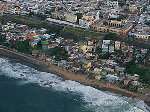
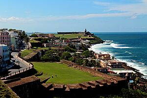
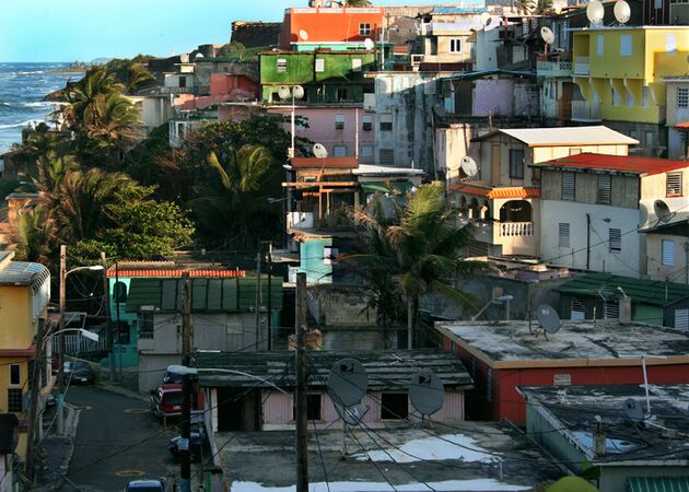
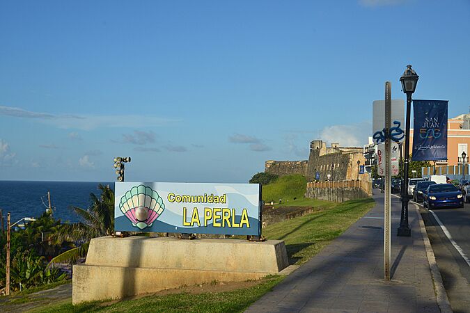
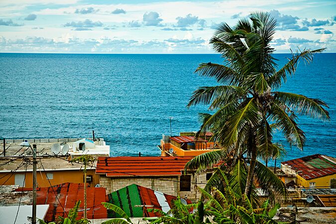
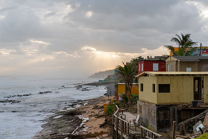
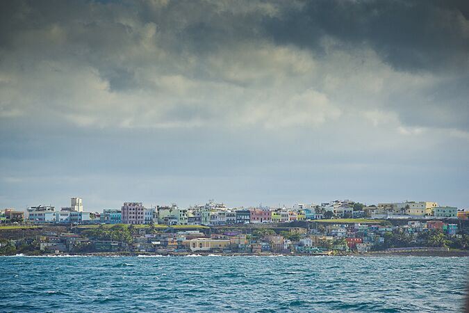
La Perla is a historic neighborhood located right next to the old city wall of Old San Juan, Puerto Rico. It stretches for about 600 meters (650 yards) along the rocky Atlantic coast. You can find it just east of the Santa Maria Magdalena de Pazzis Cemetery and down the hill from Calle Norzagaray.
La Perla was first settled in the 1700s. Back then, it was where the city's slaughterhouse was located. Laws at the time said that homes for enslaved people and homeless workers, as well as cemeteries, had to be built outside the main city center. So, La Perla was outside the city walls. Over time, farmers and workers started building their homes around the slaughterhouse, and that's how the community began.
Contents
Exploring La Perla's History and Location
La Perla, which means "The Pearl" in Spanish (La Perla), is found within the Old San Juan Historic District. It was originally known as El Matadero, meaning "The Slaughterhouse." Enslaved people built homes here in the 18th century because they were required to live outside the city walls. Later, jíbaros (Puerto Rican farmers) who moved to San Juan also settled in this area.
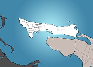
La Perla is part of two smaller areas called Mercado subbarrio (on the west side) and San Cristóbal subbarrio (on the east side). These are both in the San Juan Antiguo barrio. San Juan Antiguo is on an island called Isleta de San Juan, which is connected to the main part of Puerto Rico by bridges. The US National Park Service helps manage the Old San Juan Historic District, where La Perla is located.
Some people have called La Perla a "shantytown" because many of its homes were built without official permits. For a long time, tourists usually didn't visit La Perla. However, some local business owners have worked hard to improve its image. They've opened art galleries, cafés, and restaurants. A local community group called La Perla Impacto Comunitario even organizes tours for visitors.
Getting Around La Perla
There are only four main ways to enter La Perla. One way is through the Santa María Magdalena de Pazzis Cemetery. The other entrances are from Calle Norzagaray, a street named after a Spanish governor.
Here are the main streets in La Perla:
- Calle Tiburcio Reyes (this is on the western edge, next to the old city wall)
- Calle San Miguel (mostly in the western part, along the north side)
- Calle Bajada Matadero (mostly in the western part, along the south side)
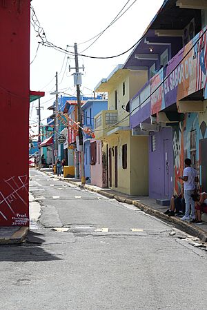
- Calle Lucila Silva (mostly in the western part, running east-west through the middle; it's too narrow for cars)
- Calle Augustín O Aponte (in the eastern part)
Even though many homes in La Perla were built without official permits, the residents do have important services like electricity, water, and regular garbage pickup. In 1973, there were about 900 houses and 3,300 people living in the neighborhood.
Community Life and Fun in La Perla
La Perla has a special music recording studio called El Estudio D' Oro. It offers free music production workshops for people of all ages in the community. This studio is also home to a live urban radio show called Hip Hop 787 La Verdadera Escuela, which is broadcast on WVOZ Mix 107.7 FM.
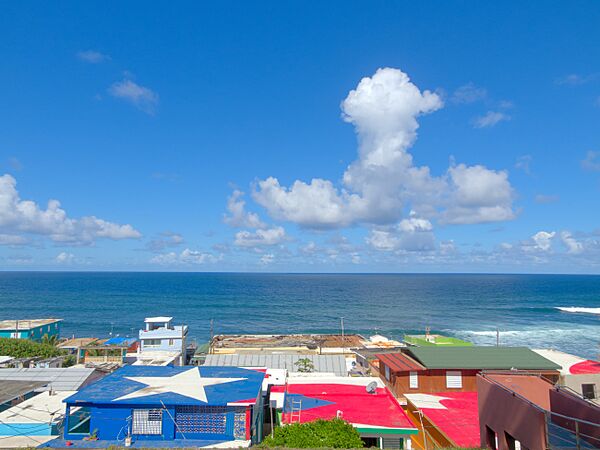
In 2010, famous basketball player Carmelo Anthony helped fix up the basketball court on the eastern side of La Perla. He gave it a new surface and a cool design with the Air Jordan logo. This court became known by his name and is now considered one of "the most breathtaking locations for a basketball court in the world" because it's right by the ocean, overlooking the Atlantic!
La Perla also has a colorful, bowl-shaped concrete area called El Bowl. During the week, kids use it for skateboarding. But on weekends, it's filled with water and becomes a community swimming pool! In 2016, architecture students from Puerto Rican universities even asked children for their ideas on how to make their favorite spots in La Perla even better.
La Perla in the Spotlight
In 2017, the super popular music video for the song "Despacito" was filmed in La Perla. This made the neighborhood famous around the world and many tourists became curious to visit the place they saw in the video.
However, on September 20, 2017, Hurricane Maria hit Puerto Rico very hard. La Perla was severely damaged, looking "like it was hit by a bomb." The name "Despacito" (which means "slowly") was even used to talk about how slow the help from the United States was after Hurricanes Irma and Maria caused so much destruction in places like La Perla. Soon after the hurricane, the National Park Service helped the residents of La Perla by providing tarps for their damaged homes.
Quick Facts About La Perla
According to the United States 2000 Census, La Perla had a population of 338 people. There were 198 housing units, with 169 of them being homes where people lived. The area of La Perla is about 66,914 square meters (80,028 square yards).
La Perla is located in the northernmost parts of the Mercado and San Cristóbal areas within the San Juan Antiguo neighborhood.
Images for kids
-
Youth playing basketball at a court in La Perla
See also
 In Spanish: La Perla (San Juan, Puerto Rico) para niños
 | Anna J. Cooper |
 | Mary McLeod Bethune |
 | Lillie Mae Bradford |


