
Isleta de San Juan facts for kids
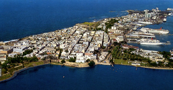
Aerial view of Isleta de San Juan in Old San Juan
|
|
 |
|

Isleta de San Juan
Location in Puerto Rico

Isleta de San Juan
Location in Lesser Antilles

Isleta de San Juan
Location in Caribbean
|
|
| Geography | |
|---|---|
| Location | Caribbean Sea |
| Coordinates | 18°28′0.43″N 66°6′26.47″W / 18.4667861°N 66.1073528°W |
| Archipelago | Puerto Rico Archipielago, Greater Antilles |
| Area | 7.8 km2 (3.0 sq mi) |
| Territory | Puerto Rico |
| Demographics | |
| Population | ~7000 (2010) |
| Additional information | |
| Time zone | |
The Isleta de San Juan (which means Islet of San Juan in Spanish) is a small island. It is about 3 square miles (7.8 km2) in size. You can find it in the San Juan Bay on the Atlantic coast of northern Puerto Rico.
This island is home to Old San Juan. It holds the record for the oldest lasting European settlement in Puerto Rico, started in 1521. It's also the second oldest European settlement in the West Indies, after Santo Domingo. Because of its important location in the Caribbean during the time Spain explored and settled the Americas, it has a city wall. It also has many old military buildings, like El Morro Castle. Today, many of Puerto Rico's government buildings are here, including the territory's capitol building (El Capitolio).
Contents
History of Isleta de San Juan
People lived on Isleta de San Juan long before the Spanish arrived in the Caribbean in 1492. In 1937, an archaeologist named Irving Rouse from Yale University found old remains. These included a shell shed and a fishing spot near where the Puerto Rico National Guard Museum is today.
The island was first mapped in 1519. This was done to find good places for a new home for settlers from Caparra. A road connecting the island to the main part of Puerto Rico was finished in 1519. The town of Puerto Rico de San Juan Bautista was officially started on July 20, 1521.
Building projects began that same year. These included La Fortaleza, the Casa de Contratación (a trading house), and Juan Ponce de León's home, Casa Blanca. With a new port and military buildings, the original town of San Juan grew. It kept growing until the 1700s. Then, the town of El Roble (now Río Piedras) became the biggest city in the area.
Geography of Isleta de San Juan
Isleta de San Juan is a small island, covering about 3 square miles (7.8 km2). It is separated from the main island of Puerto Rico. This separation is made by El Boquerón and the San Antonio Channel (Caño de San Antonio). The island has many hills and rocks. Most of the island, except for its west end and south coast, is surrounded by cliffs. There are also high points like El Morro on its northwestern side.
Neighborhoods of Isleta de San Juan
The areas where people live on Isleta de San Juan are split into a western and an eastern part. The western part includes neighborhoods called subbarrios. These are Ballajá, Catedral, Mercado, San Cristóbal, San Francisco, and Marina. Together, these make up Old San Juan.
The eastern part of the island is the neighborhood of Puerta de Tierra. This is where many of the Puerto Rico's government buildings are located. This includes the capitol building.
Culture of Isleta de San Juan
The famous Normandie Hotel is located on Isleta de San Juan. It is a historic building.
Population of Isleta de San Juan
In 2010, about 7,000 people lived on Isleta de San Juan.
Transportation on Isleta de San Juan
Isleta de San Juan is connected to the main island of Puerto Rico. It has three bridges and a raised road called a causeway. The Dos Hermanos Bridge links it to El Condado. The San Antonio Bridges connect it with Isla Grande.
The San Antonio Railroad Bridge is no longer used for trains, but it is still kept today. It used to connect Old San Juan's Covadonga Terminal to the rest of Puerto Rico by railway. Traffic to the island is usually stopped during the San Sebastián Street Festival.
Images for kids
-
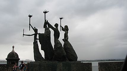
Silhouette of Statues in Isleta de San Juan
-
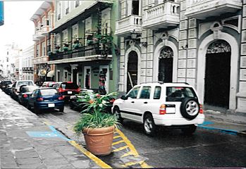
Traffic in Isleta de San Juan
-
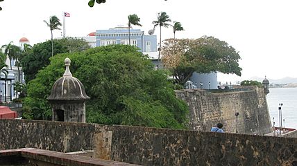
Fort and building in Isleta de San Juan
-
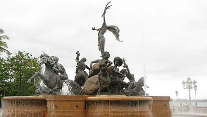
Street art, statues in Isleta de San Juan
-
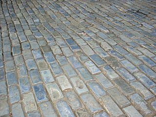
Blue cobblestone streets of Old San Juan


See also
 In Spanish: Isleta de San Juan para niños
