La Prairie, Minnesota facts for kids
Quick facts for kids
La Prairie
|
|
|---|---|

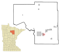
Location of the city of La Prairie
within Itasca County, Minnesota |
|
| Country | United States |
| State | Minnesota |
| County | Itasca |
| Area | |
| • Total | 1.70 sq mi (4.41 km2) |
| • Land | 1.65 sq mi (4.28 km2) |
| • Water | 0.05 sq mi (0.13 km2) |
| Elevation | 1,283 ft (391 m) |
| Population
(2020)
|
|
| • Total | 653 |
| • Density | 395.28/sq mi (152.61/km2) |
| Time zone | UTC-6 (Central (CST)) |
| • Summer (DST) | UTC-5 (CDT) |
| ZIP code |
55744
|
| Area code(s) | 218 |
| FIPS code | 27-35648 |
| GNIS feature ID | 0656924 |
La Prairie is a small city in Itasca County, Minnesota, United States. It's located in the northern part of the state. In 2020, about 653 people lived there.
Two important roads, U.S. Highway 2 and U.S. Highway 169, pass through La Prairie. These highways help connect the city to other places.
Contents
History of La Prairie
La Prairie had a post office for many years, from 1890 to 1917. The community got its name from the nearby Prairie River.
Geography and Location
According to the United States Census Bureau, the city covers a total area of about 1.69 square miles (4.4 square kilometers). Most of this area, about 1.64 square miles (4.2 square kilometers), is land. A small part, about 0.05 square miles (0.13 square kilometers), is water.
La Prairie is right next to the city of Grand Rapids.
People of La Prairie
| Historical population | |||
|---|---|---|---|
| Census | Pop. | %± | |
| 1900 | 88 | — | |
| 1910 | 48 | −45.5% | |
| 1920 | 63 | 31.3% | |
| 1930 | 43 | −31.7% | |
| 1940 | 69 | 60.5% | |
| 1950 | 88 | 27.5% | |
| 1960 | 243 | 176.1% | |
| 1970 | 413 | 70.0% | |
| 1980 | 536 | 29.8% | |
| 1990 | 438 | −18.3% | |
| 2000 | 605 | 38.1% | |
| 2010 | 665 | 9.9% | |
| 2020 | 653 | −1.8% | |
| U.S. Decennial Census | |||
Population in 2010
In 2010, the city had 665 people living in 270 households. About 184 of these were families. The city had about 405 people per square mile (156 per square kilometer). There were 287 housing units, which means homes or apartments.
Most of the people in La Prairie were White (91.6%). There were also small numbers of African American (0.6%), Native American (2.9%), and other races. About 4.8% of the people were from two or more races. About 0.9% of the population was Hispanic or Latino.
Households and Families
Out of the 270 households, 30.4% had children under 18 living with them. More than half (54.1%) were married couples living together. About 10.7% had a female head of the household with no husband present. Only 3.3% had a male head of the household with no wife present. About 31.9% of households were not families.
Almost 27.4% of all households were made up of individuals living alone. About 12.6% of these individuals were 65 years old or older. The average household had 2.39 people, and the average family had 2.86 people.
Age and Gender
The average age of people in La Prairie in 2010 was 41.8 years.
- 24.5% of residents were under 18 years old.
- 7.2% were between 18 and 24 years old.
- 21.5% were between 25 and 44 years old.
- 28.2% were between 45 and 64 years old.
- 18.8% were 65 years old or older.
The city's population was almost evenly split between genders: 49.3% male and 50.7% female.
See also
 In Spanish: La Prairie (Minnesota) para niños
 | Audre Lorde |
 | John Berry Meachum |
 | Ferdinand Lee Barnett |

