La Trêve Lake facts for kids
Quick facts for kids La Trêve Lake |
|
|---|---|

Watershed of Nottaway River
|
|
| Location | Baie-James |
| Coordinates | 49°55′49″N 75°32′19″W / 49.93028°N 75.53861°W |
| Type | Natural |
| Primary inflows | Mildred River, Dempster creek, Daladier creek. |
| Primary outflows | La Trêve River |
| Basin countries | Canada |
| Max. length | 32 kilometres (20 mi) |
| Max. width | 10 kilometres (6.2 mi) |
| Surface area | 61 kilometres (38 mi) |
| Surface elevation | 337 metres (1,106 ft) |
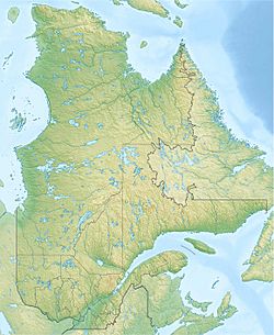
La Trêve Lake is a freshwater lake in Quebec, Canada. It is located in the southern part of the Eeyou Istchee James Bay area, which is in the Nord-du-Québec region.
The lake stretches across areas called Daine and Guettard. A part of it, Rita Bay, reaches into La Ribourde. The main activity around the lake is forestry, which means cutting down trees for wood. After forestry, people enjoy recreational tourism activities like fishing or boating.
You can reach the lake by a forest road from the south. This road connects to Highway 113, which links the towns of Lebel-sur-Quévillon and Chibougamau. The surface of La Trêve Lake is usually frozen from early November until mid-May. However, it's generally safe to walk or drive on the ice from mid-November to mid-April.
Contents
About La Trêve Lake
This lake is about 32.0 kilometres (19.9 mi) long and up to 10 kilometres (6.2 mi) wide. It sits at an elevation of 337 metres (1,106 ft) above sea level. The lake has a very unusual shape with many bays and peninsulas.
Here are some of its main parts:
- East side: You'll find Dussault Bay and Pichamobi Bay here. Pichamobi Bay receives water from Dempster Creek, which flows from the east.
- Northwest side: Gilbert Bay is located here. This is where the lake's water flows out into the La Trêve River.
- West side: This side features Geneviève Bay.
- South side: Here you'll find Rita Bay.
Two long pieces of land, called peninsulas, separate some of these bays. One peninsula stretches 8.6 kilometres (5.3 mi) northeast, separating Geneviève and Rita bays. Another peninsula stretches 7.5 kilometres (4.7 mi) northeast, separating Gilbert and Geneviève bays. This second peninsula also encloses a smaller lake called Lake Gisèle. On the east side, a peninsula extends 4.4 kilometres (2.7 mi) westward, separating Pichamobi Bay and Dussault Bay.
Where the Lake's Water Flows
The water from La Trêve Lake flows out from Gilbert Bay on the northwest side. This outflow leads to the La Trêve River.
Here's how far the lake's mouth is from other important places:
- 20.0 kilometres (12.4 mi) east of where the La Trêve River joins the Maicasagi River.
- 66.2 kilometres (41.1 mi) north of where the Maicasagi River flows into Maicasagi Lake.
- 92.8 kilometres (57.7 mi) northeast of the mouth of Goéland Lake.
- 112.4 kilometres (69.8 mi) northeast of the mouth of Olga Lake.
- 34.8 kilometres (21.6 mi) northeast of the village of Waswanipi.
- 144.9 kilometres (90.0 mi) northeast of the center of Matagami.
- 134.6 kilometres (83.6 mi) northeast of the mouth of Lake Matagami.
Rivers and Streams Near the Lake
The main rivers and streams that are close to La Trêve Lake include:
- North side: The Mildred River, Caupichigau River, and Caupichigau Lake.
- East side: Dempster Creek and the Brock River, which flows into the Chibougamau River.
- South side: The Chibougamau River and Alouettes Creek.
- West side: Inconnue Lake and the La Trêve River.
Name of the Lake
The name "La Trêve" for this lake was first seen on a map from 1928. However, the exact meaning or reason for this name is not known.
The official name "Lac La Trêve" was formally recognized on December 5, 1968, by the Commission de toponymie du Québec. This commission is responsible for naming places in Quebec.
 | Ernest Everett Just |
 | Mary Jackson |
 | Emmett Chappelle |
 | Marie Maynard Daly |


