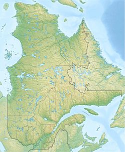
Lac aux Écorces facts for kids
Quick facts for kids Lac aux Écorces |
|
|---|---|
| Location | Lac-Jacques-Cartier (TNO), La Côte-de-Beaupré Regional County Municipality, Capitale-Nationale |
| Coordinates | 47°54′32″N 71°44′19″W / 47.90889°N 71.73861°W |
| Lake type | Natural |
| Primary inflows | (clockwise from the mouth) rivière aux Écorces, des ruisseaux riverains, la décharge du lac Labelle, par la décharge des lacs à la Culotte et Bina, le ruisseau Salvail et la décharge du lac Tréteau |
| Primary outflows | rivière aux Écorces |
| Basin countries | Canada |
| Max. length | 7.1 km (4.4 mi) |
| Max. width | 0.6 km (0.37 mi) |
| Surface elevation | 398 m (1,306 ft) |
Lac aux Écorces is a beautiful freshwater lake in Quebec, Canada. Its name means "bark lake" in English. This lake is an important part of the Rivière aux Écorces river system. It is located in the Lac-Jacques-Cartier area, within the Laurentides Wildlife Reserve.
The area around the lake is a mix of nature and human activity. Roads like Route 169 and Route 155 help people get to the region. These roads connect bigger cities like Quebec City and Alma.
The main activities here are forestry, which means managing forests for wood, and recreational tourism. People come here to enjoy nature. The lake usually freezes over from early December to late March. It's generally safe to walk or play on the ice from mid-December to mid-March.
About Lac aux Écorces
Lac aux Écorces is like a wider part of the Rivière aux Écorces. It is about 7.1 kilometres (4.4 mi) long and 0.6 kilometres (0.37 mi) wide. The lake sits at an elevation of 398 metres (1,306 ft) above sea level.
Many smaller streams and lakes feed into Lac aux Écorces. The main river that flows through it is the Pikauba River. Other water sources include Labelle lake, lakes to Culotte and Bina, Salvail stream, and Tréteau lake.
Water Flow from the Lake
The water from Lac aux Écorces flows out from its northern end. From there, the water travels a long way:
- First, it flows along the Rivière aux Écorces for about 60.8 kilometres (37.8 mi).
- Then, it joins the Pikauba River and flows for another 35.0 kilometres (21.7 mi).
- Next, the water enters Kenogami Lake and travels 17.6 kilometres (10.9 mi) to the Portage-des-Roches dam.
- After that, it flows into the Chicoutimi River for 26.2 kilometres (16.3 mi).
- Finally, the water reaches the Saguenay River and flows 114.6 kilometres (71.2 mi) eastward to Tadoussac. Here, it merges with the huge Saint Lawrence estuary.
Lake Name History
The name "Lac aux Écorces" was officially recognized on December 5, 1968. This was done by the Commission de toponymie du Québec, which is the official body responsible for naming places in Quebec.
 | Sharif Bey |
 | Hale Woodruff |
 | Richmond Barthé |
 | Purvis Young |


