Lac de la Belle Rivière facts for kids
Quick facts for kids Lac de la Belle Rivière |
|
|---|---|
| Location | Belle-Rivière |
| Coordinates | 48°14′11″N 71°43′11″W / 48.23639°N 71.71972°W |
| Lake type | Natural |
| Primary inflows | (clockwise from the mouth) Discharge of lac des Scarabées, discharge of lac Bélair, discharge of lac des Vases, rivière du Milieu, discharge of Grand lac des Cèdres and an unidentified stream. |
| Primary outflows | La Belle Rivière |
| Basin countries | Canada |
| Max. length | 10.1 km (6.3 mi) |
| Max. width | 1.4 km (0.87 mi) |
| Surface elevation | 142 m (466 ft) |
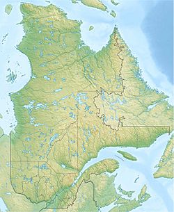
The Lac de la Belle Rivière is a beautiful freshwater lake in Quebec, Canada. It's located in a wild area called Belle-Rivière. This lake is the starting point for the Belle Rivière river.
The lake is part of the larger Lac Saint-Jean watershed. This means all the water from the lake eventually flows into Lac Saint-Jean. You can find the lake in the Laurentides Wildlife Reserve, a protected natural area.
Getting to the lake is easy thanks to Route 169. Another road, the route des Laurentides, runs right along the lake's northeast side. These roads help people visit for fun activities or for forestry work.
Forestry, which is cutting down trees for wood, is the main business here. Tourism, like fishing or camping, is also very popular.
The lake usually freezes over in early December. It stays frozen until the end of March. It's generally safe to walk or play on the ice from mid-December to mid-March.
Contents
Exploring the Lake's Geography
Lac de la Belle Rivière is surrounded by many other lakes and rivers. These are called its "watersheds" because they either flow into it or are nearby.
- North side: You'll find Bélair lake, Beauséjour lake, Curés lake, Belle Rivière, and Vert Lake.
- East side: There are Thom stream, Sauce stream, Pikauba River, Bras des Angers, and rivière aux Écorces.
- South side: Look for Carpe lake, Paul stream, rivière du Milieu, Grand lac des Cèdres, and Thom stream. The Métabetchouane River is also nearby.
- West side: You'll see the Métabetchouane River, Belle Rivière stream, Grignon River, Ouiatchouan River, and the big Lac Saint-Jean.
Size and Shape of the Lake
Lac de la Belle Rivière is about 10.1 km (6.3 mi) long. It is 1.4 km (0.87 mi) wide. The lake sits at an elevation of 346 m (1,135 ft) above sea level. It has a unique shape with three main sections, separated by two narrow spots.
How the Lake Gets Its Water
The lake gets most of its water from the rivière du Milieu, which flows in from the south. It also gets water from the outlet of the Grand lac des Cèdres, another large lake.
The water then flows out of Lac de la Belle Rivière from its western side. This is where the Laurentian Highway bridge is located.
Where is the Lake Located?
The lake's outlet is:
- 6.6 km (4.1 mi) southeast of Route 169.
- 16.6 km (10.3 mi) east of the village of Saint-André-du-Lac-Saint-Jean.
- 19.5 km (12.1 mi) southeast of Lac Saint-Jean.
- 21.3 km (13.2 mi) southeast of where the Belle Rivière meets Lac Saint-Jean.
- 32.0 km (19.9 mi) south of downtown Alma.
The Journey of the Water
From Lac de la Belle Rivière, the water travels a long way!
- First, it flows northwest along the Belle Rivière for 33.8 km (21.0 mi) until it reaches Lac Saint-Jean.
- Then, it crosses Lac Saint-Jean, going north for 15.4 km (9.6 mi).
- After that, the water enters the Saguenay River through a channel called La Petite Décharge. It travels 172.3 km (107.1 mi) along the Saguenay River.
- Finally, the water reaches Tadoussac and joins the huge Saint Lawrence estuary, which leads to the Atlantic Ocean!
The Name: Belle Rivière
The name "Belle Rivière" means "Beautiful River" in French. This name is used for the lake, the river that flows from it, and even the local municipality. It's a very common and fitting name for this lovely area.
The official name "Lac de la Belle Rivière" was made official on December 5, 1968. This was done by the Commission de toponymie du Québec, which is a group that names places in Quebec.
Related Places and Topics
- Lac-Saint-Jean-Est Regional County Municipality
- Belle-Rivière, a special type of territory
- Saguenay River
- Lac Saint-Jean
- La Belle Rivière
- Rivière du Milieu Middle River
- List of lakes in Canada
 | Stephanie Wilson |
 | Charles Bolden |
 | Ronald McNair |
 | Frederick D. Gregory |


