Lake Bathurst (New South Wales) facts for kids
Quick facts for kids Lake Bathurst |
|
|---|---|
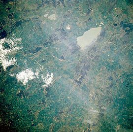
Lake Bathurst at the top of the image, pictured in 1985, viewed from a Space Shuttle. The larger lake is Lake George.
|
|
| Location | Southern Tablelands, New South Wales |
| Coordinates | 35°03′S 149°44′E / 35.050°S 149.733°E |
| Native name | Bundong |
| Etymology | Earl Bathurst |
| Basin countries | Australia |
| Surface area | 2 to 10 km2 (0.77 to 3.86 sq mi) |
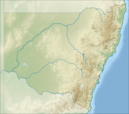
Lake Bathurst is a shallow lake in New South Wales, Australia. It is located about 27 kilometers south-east of Goulburn. The local Aboriginal name for the lake is Bundong.
The name Lake Bathurst also refers to a small town nearby. This town is part of the Goulburn Mulwaree Council area.
Contents
About Lake Bathurst
The size of Lake Bathurst can change a lot. Its surface area can be as small as 2 square kilometers or as large as 10 square kilometers. This depends on how much water flows into the lake and how much evaporates.
The lake was named by a surveyor called James Meehan. He named it after Earl Bathurst, who was an important British official. The nearby town was then named after the lake.
Amazing Birds of Lake Bathurst
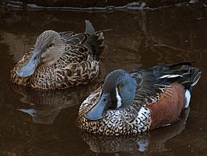
Lake Bathurst is a very important place for many types of birds. An area of 19 square kilometers around the lake is known as an Important Bird Area (IBA). This means it's a special spot for birds, identified by BirdLife International.
The lake is especially important for Australasian shovellers. More than 1% of all Australasian shovellers in the world visit this lake regularly! It also helps blue-billed ducks, which are a type of duck that is almost threatened.
When there is a drought, Lake Bathurst becomes a safe place for birds. It sometimes provides a home for over 1% of the world's freckled ducks, black swans, chestnut teals, and sharp-tailed sandpipers.
Lake Bathurst Town
| Lake Bathurst New South Wales |
|||||||||||||||
|---|---|---|---|---|---|---|---|---|---|---|---|---|---|---|---|
 |
|||||||||||||||
| Population | 228 (2016 census) | ||||||||||||||
| Postcode(s) | 2580 | ||||||||||||||
| Location | |||||||||||||||
| LGA(s) | Goulburn Mulwaree Council | ||||||||||||||
| Region | Southern Tablelands | ||||||||||||||
| County | Argyle | ||||||||||||||
| Parish | Covan | ||||||||||||||
| State electorate(s) | Goulburn | ||||||||||||||
| Federal Division(s) | Hume | ||||||||||||||
|
|||||||||||||||
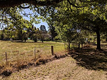
The town of Lake Bathurst is a very small village. It is located about 3 kilometers west of the lake itself, along the Goulburn-Braidwood Road. In 2016, about 228 people lived in the Lake Bathurst area.
Railway History
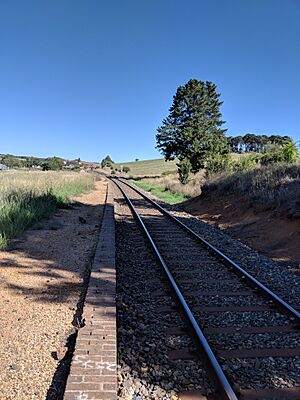
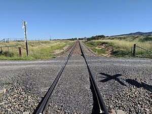
The town of Lake Bathurst once had its own railway station. This station was part of the Bombala railway line. It operated from 1884 until 1975, helping people travel to and from the area.
Another railway station, called Inveralochy, was built nearby in 1890. It was located in the northern part of the Lake Bathurst area. This station closed in 1974.
World War II Role
During World War II, Lake Bathurst played a small but important role. It was home to a special fuel storage site for aircraft. This site was called RAAF No.16 Inland Aircraft Fuel Depot (IAFD).
It was built in 1942 to store fuel for the RAAF (Royal Australian Air Force) and the US Army Air Forces. This depot closed on August 29, 1944. Many such depots were built across Australia to make sure planes had enough fuel during the war.
 | Victor J. Glover |
 | Yvonne Cagle |
 | Jeanette Epps |
 | Bernard A. Harris Jr. |


