Argyle County facts for kids
Quick facts for kids ArgyleNew South Wales |
|||||||||||||||
|---|---|---|---|---|---|---|---|---|---|---|---|---|---|---|---|

Location of Argyle
|
|||||||||||||||
|
|||||||||||||||
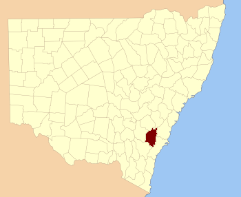
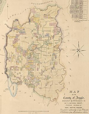
Argyle County was an important historical area in New South Wales, Australia. It was one of the first 19 areas officially set up by the government. Today, it is known as one of the 141 cadastral divisions. These divisions help define land ownership and boundaries. The county included the area around the city of Goulburn.
Its natural borders were Lake George to the southwest. The Shoalhaven River was to the east, and the Wollondilly River to the northeast.
Contents
Discovering Argyle County
How Argyle County Got Its Name
Argyle County was named by Governor Macquarie. He was the Governor of New South Wales at the time. He chose the name after his home county in Scotland. This naming happened in 1820 when he was visiting the area.
Early Days and Growth
In 1829, new laws were made to set up courts in New South Wales. Courts were created in Argyle County at places like Cookbundoon, Goulburn Plains, and Inverary. This helped keep law and order in the growing region.
By 1832, James Byrne worked as an Assistant Surveyor for the county. Surveyors measure and map land. By 1835, Argyle County had its own magistrate and police force. This meant it had its own local justice system.
In 1852, Argyle County was quite large. It covered about 1,248,600 acres (5,053 square kilometres). It also had a population of 5,565 people. The land was known for being very good for farming. It also had plenty of water.
Changes Over Time
In 1857, a major landowner in the area was Charles Cowper. He owned a large amount of land, about 19,720 acres (80 square kilometres). The area also had its own voting district. This was called the Electoral district of Argyle. It existed from 1856 to 1904.
Even a famous book, the Encyclopædia Britannica Eleventh Edition, mentioned Goulburn. It noted that Goulburn was located within Argyle County.
In 2004, a new local government area was proposed. It was called the Greater Argyle Council. This council was meant to focus on the Argyle County area. It combined the former City of Goulburn and parts of Mulwaree Shire. However, it was soon renamed. In October 2004, it became the Goulburn Mulwaree Council.
 | May Edward Chinn |
 | Rebecca Cole |
 | Alexa Canady |
 | Dorothy Lavinia Brown |


