Wollondilly River facts for kids
Quick facts for kids Wollondilly |
|
|---|---|

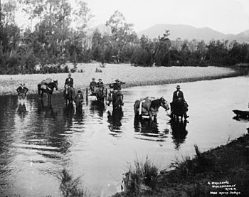
A trek crossing the river, circa 1900. Picture from the Powerhouse Museum.
|
|
| Other name(s) | Deerabublin River (1819–1968) |
| Country | Australia |
| State | New South Wales |
| Region | South Eastern Highlands (IBRA), Southern Tablelands, Southern Highlands |
| Local government areas | Goulburn Mulwaree, Wollondilly Shire |
| Physical characteristics | |
| Main source | Great Dividing Range McAlister, near Crookwell 993 m (3,258 ft) 34°27′0″S 149°34′0″E / 34.45000°S 149.56667°E |
| River mouth | Lake Burragorang 115 m (377 ft) 33°57′0″S 150°26′0″E / 33.95000°S 150.43333°E |
| Length | 156 km (97 mi) |
| Basin features | |
| River system | Hawkesbury–Nepean catchment |
| Basin size | 2,699 km2 (1,042 sq mi) |
| Tributaries |
|
| Reservoirs | Pejar Dam, Lake Burragorang |
The Wollondilly River is an important perennial river in New South Wales, Australia. A perennial river means it flows all year round. It is part of the larger Hawkesbury–Nepean water system. The river flows through the beautiful Southern Tablelands and Southern Highlands regions.
The river starts on the western slopes near Crookwell. It then winds its way south-east through the city of Goulburn. After Goulburn, it turns north-east towards Bullio. From there, it flows north-west to Barrallier, before finally heading north-easterly into Lake Burragorang.
Contents
River's Journey and Features
The Wollondilly River used to flow into the Warragamba River. This meant it was part of the big Hawkesbury-Nepean water system.
Sydney's Water Supply
Today, things are a bit different. After the huge Warragamba Dam was built, the Wollondilly River now flows into Lake Burragorang. This lake is super important because it provides most of the drinking water for the big city of Sydney. It's like a giant natural reservoir!
Where the River Begins
The Wollondilly River starts about 7 kilometres (4.3 mi) east of Crookwell. At first, it flows south and is held back by the Pejar Dam. This dam helps manage the water flow.
Flowing Through Towns
The river then continues south-east and east, passing through Goulburn. In Goulburn, another river, the Mulwaree River, joins the Wollondilly. Near a place called Towrang, the river turns north-east. It then meets the Wingecarribee River near Bullio.
River's Path and Size
From Bullio, the Wollondilly River takes a wide turn to the north-west towards Barrallier. After Barrallier, it turns east before finally heading north-easterly into Lake Burragorang.
The Wollondilly River is quite long, stretching for about 156 kilometres (97 mi). The area of land that drains water into the river, called its "subcatchment area," is about 2,699 square kilometres (1,042 sq mi). This makes it the largest subcatchment area in the entire Hawkesbury-Nepean system.
What's in a Name?
The Wollondilly Shire is a local government area that is named after this very river. The name "Wollondilly" is thought to come from an Aboriginal word, wallandillii. This word is said to mean 'water trickling over rocks'. However, there isn't clear proof of this meaning in the Tharawal language.
 | DeHart Hubbard |
 | Wilma Rudolph |
 | Jesse Owens |
 | Jackie Joyner-Kersee |
 | Major Taylor |

