Lake City, Pennsylvania facts for kids
Quick facts for kids
Lake City, Pennsylvania
|
|
|---|---|
|
Borough
|
|

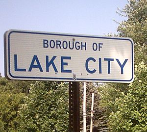
Lake City borough sign
|
|

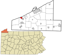
Location in Erie County and the U.S. state of Pennsylvania.
|
|
| Country | United States |
| State | Pennsylvania |
| County | Erie |
| Area | |
| • Total | 1.80 sq mi (4.68 km2) |
| • Land | 1.80 sq mi (4.65 km2) |
| • Water | 0.01 sq mi (0.02 km2) |
| Elevation
(Borough benchmark elevation)
|
721 ft (220 m) |
| Highest elevation
(southern borough boundary)
|
730 ft (220 m) |
| Lowest elevation | 578 ft (176 m) |
| Population
(2020)
|
|
| • Total | 2,935 |
| • Density | 1,633.28/sq mi (630.54/km2) |
| Time zone | UTC-5 (EST) |
| • Summer (DST) | UTC-4 (EDT) |
| ZIP code |
16423
|
| Area code(s) | 814 |
Lake City is a small town, called a borough, located in Erie County, Pennsylvania, United States. In 2020, about 2,936 people lived there. Lake City is part of the larger Erie area.
Contents
History of Lake City
Before Europeans settled in this area, the land where Lake City now stands was home to the Erie people.
Miles Grove: How Lake City Began
Lake City was once known as Miles Grove. It was also called Girard Station because of its location on the Lake Shore Railroad. This village was named after Judge Miles, who helped get a train station built there. Austin H. Seeley gave the land for the station and planned out the first lots for homes.
Miles Grove grew slowly at first. But it got a big boost when the Erie & Pittsburg railroad was finished. This made Miles Grove a regular stop for trains. Another important development was when A. Denio's fork and farm tool factory moved to the area. This factory, later known as Otsego Fork Mills, provided jobs for about 70 people.
In the late 1800s, Miles Grove had many nice homes. It also had two churches, a school with three teachers, an iron factory, a hotel, several stores, and other businesses. The Methodist Episcopal Church was built in 1867.
Geography of Lake City
Lake City is in the western part of Erie County. It is located at 42°1′2″N 80°20′48″W / 42.01722°N 80.34667°W. To the south, it borders the town of Girard. On its east, west, and partly north sides, it is surrounded by Girard Township. Part of its northern border is along Lake Erie.
The borough covers about 1.8 square miles (4.7 square kilometers). Most of this area is land, with a very small amount of water. Elk Creek flows through the western edge of Lake City. It then enters Lake Erie just outside the borough.
Two main roads serve Lake City. Pennsylvania Route 5 runs east and west as West Lake Road. Pennsylvania Route 18 runs north and south as Lake Street and Rice Avenue. PA 5 connects Lake City to Avonia to the northeast and Conneaut, Ohio to the southwest. PA 18 goes south into Girard. The city of Erie is about 15 miles northeast. Most streets in Lake City are for homes, and there are no traffic lights.
Population and People
| Historical population | |||
|---|---|---|---|
| Census | Pop. | %± | |
| 1930 | 1,077 | — | |
| 1940 | 1,108 | 2.9% | |
| 1950 | 1,369 | 23.6% | |
| 1960 | 1,722 | 25.8% | |
| 1970 | 2,117 | 22.9% | |
| 1980 | 2,384 | 12.6% | |
| 1990 | 2,519 | 5.7% | |
| 2000 | 2,811 | 11.6% | |
| 2010 | 3,031 | 7.8% | |
| 2020 | 2,936 | −3.1% | |
| 2021 (est.) | 2,908 | −4.1% | |
| Sources: | |||
In 2010, Lake City had 2,699 people living in 1,025 homes. About 788 of these were families. The population density was about 1,565 people per square mile. Most people living in Lake City were White (99.32%).
Many homes (40.8%) had children under 18 living there. More than half (57.0%) of the homes were married couples. The average household had 2.73 people.
The population was spread out by age. About 30.0% of residents were under 18. The median age was 35 years old. This means half the people were younger than 35, and half were older.
Notable Person
- William Frederick "Bones" Ely was a baseball player from the 1800s who played in Major League Baseball.
See also
 In Spanish: Lake City (Pensilvania) para niños
 | George Robert Carruthers |
 | Patricia Bath |
 | Jan Ernst Matzeliger |
 | Alexander Miles |

