Lake Manchester Dam facts for kids
Quick facts for kids Lake Manchester Dam |
|
|---|---|
|
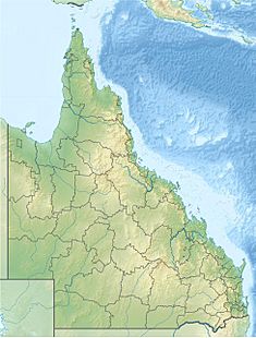
Location of the Lake Manchester Dam
in Queensland |
|
| Country | Australia |
| Location | South East Queensland |
| Coordinates | 27°29′17″S 152°45′5″E / 27.48806°S 152.75139°E |
| Purpose | |
| Status | Operational |
| Construction began | 1912 |
| Opening date |
|
| Operator(s) | SEQ Water |
| Dam and spillways | |
| Type of dam | Gravity dam |
| Impounds | Cabbage Tree Creek |
| Height | 38 m (125 ft) |
| Length | 277 m (909 ft) |
| Dam volume | 45×103 m3 (1.6×10⁶ cu ft) |
| Spillway type | Uncontrolled |
| Spillway capacity | 450 m3/s (16,000 cu ft/s) |
| Reservoir | |
| Creates | Lake Manchester |
| Total capacity | 26,000 ML (5.7×10⁹ imp gal; 6.9×10⁹ US gal) |
| Catchment area | 74 km2 (29 sq mi) |
| Surface area | 318 ha (790 acres) |
The Lake Manchester Dam is a large concrete dam in South East Queensland, Australia. It was built across the Cabbage Tree Creek. The main job of this dam is to provide drinking water for the city of Brisbane. The big lake formed by the dam is called Lake Manchester.
Contents
Where is Lake Manchester Dam?
The dam is located near the area also called Lake Manchester. This is about 15 kilometres (9.3 mi) north of the city of Ipswich. The Cabbage Tree Creek flows into the dam. This creek then joins the Brisbane River nearby.
The dam was first built to help supply water when the Brisbane River's water levels were low. Today, it is part of a bigger system called the South East Queensland Water Grid. This grid connects many dams to make sure there is enough water for everyone.
Dam Structure and Size
The dam wall is made of concrete. It stands 38 metres (125 ft) high and is 227 metres (745 ft) long. When the dam is full, it holds 26,000 megalitres (920×106 cu ft) of water. This water comes from a large area of 74 square kilometres (29 sq mi), which includes parts of the D'Aguilar Range. The lake created by the dam, Lake Manchester, covers an area of 318 hectares (790 acres).
The dam has a special part called an un-gated spillway. This means there are no gates to control the water flow. If the dam gets too full, water flows over this spillway. It can release up to 450 cubic metres per second (16,000 cu ft/s) of water.
The dam was first managed by the Metropolitan Water Supply and Sewerage Board. Later, the Brisbane City Council took over. Since July 2008, Seqwater has been in charge of managing the dam.
A Look Back: Dam History
Before Lake Manchester Dam, other dams like the Enoggera Dam and Gold Creek Dam supplied water to Brisbane. But as the city grew, more water was needed. So, a new spot was chosen on Cabbage Tree Creek.
An American engineer named Allan Hazen designed the dam. Construction started in 1912. The dam was finished in 1916. It was originally called the Cabbage Tree Creek Dam. In 1916, it was renamed Lake Manchester Dam. This was to honor E. J. T. Manchester, who was the president of the water supply board at the time. In 1924, the dam's capacity was increased by raising a part of it.
In 2005, during a time of drought, the dam was used again to help with water supply. There were some concerns about leaks and cracks. Because of this, the dam underwent a big upgrade. This project was called the Lake Manchester Dam Flood Security Upgrade. It involved making the dam wall stronger and taller. This was to make sure it met safety rules for large dams, especially during heavy rain. Work began in 2007 and was completed in 2008.
Fun Activities at Lake Manchester
The area around Lake Manchester Dam is a great place for outdoor activities. You can enjoy things like:
- Barbecuing
- Camping
- Horse riding
- Mountain biking
- Picnicking
- Bushwalking (hiking)
 | William L. Dawson |
 | W. E. B. Du Bois |
 | Harry Belafonte |


